Graham · Kintail
Carnan Cruithneachd
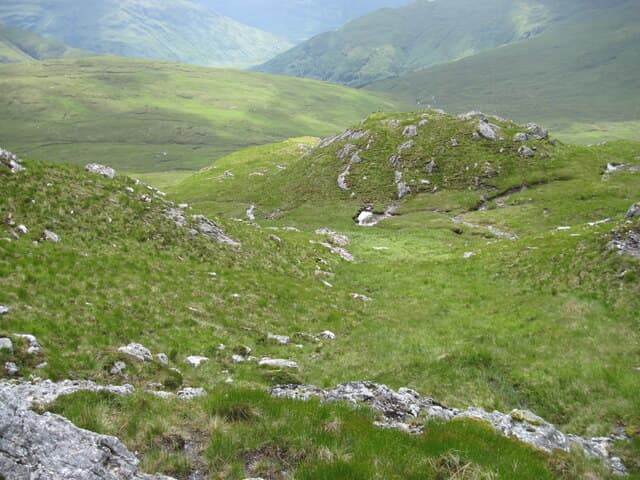
A pointed Graham above Glen Elchaig at the back of Killilan, looking up to Iron Lodge and the remote Mullardoch hills. A rough, lonely peak with no easy line — the kind of hill local stalkers know better than walkers.
Quick facts
- Height
- 727.8m/ 2388ft
- Prominence
- 220 m
- Distance
- ~13 km
- Ascent
- ~596 m
- Time
- 4–6 hrs
- Grid ref
- NG994258
- Parking
- NH005246
- Nearest
- Fort William· Inverness 70km
- Dogs
- Dogs on lead required near livestockDog-friendly guide ↗
Height and prominence cross-checked against the Database of British and Irish Hills (CC BY).
No GPX track yet
Walked this route? Share your track to help other walkers.
Standard route
forest path 25% · heather hillside 40% · grassy ridge 25% · summit area 10%
From the road end at Killilan follow the private track up Glen Elchaig as far as Loch na Leitreach. Strike north onto the steep south-east face, picking a line up rock and heather to the small summit cairn.
Terrain
Estate track for the approach, then trackless heather, broken rock and small craggy steps. The east face has several small outcrops to weave round. Demanding underfoot.
In winter
Snow plasters the east face and the upper crags ice up. The Glen Elchaig approach floods after heavy rain — fords across side burns can become uncrossable. Treat as a winter mountaineering objective in full conditions.
Kit for this: the winter Munro kit list · which boots take crampons
Best time of year
Getting there
- Glasgow3h 17m
- Edinburgh4h 48m
OS maps: OS Landranger 25, OS Landranger 33
Mobile signal: Reception at Killilan; gone past the locked gate
Current conditions
Daylight Today
- Sunrise
- 07:52
- Sunset
- 18:23
- Civil dawn
- 07:13
- Civil dusk
- 19:02
NOAA Solar Calculator · 14 October 2026
Around Carnan Cruithneachd on the SCOT network
Getting there, basing yourself, and what to do off the hill.
Carnan Cruithneachd — common questions
- What difficulty is Carnan Cruithneachd?
- On the OutdoorSCOT scale, Carnan Cruithneachd comes in at 4/5 — challenging. Expect roughly 13km and 596m of ascent on the usual route — 4-6 hours for most parties. Ground conditions: Estate track for the approach, then trackless heather, broken rock and small craggy steps.
- How much drop does Carnan Cruithneachd have?
- The drop is 220m: measured from the summit of Carnan Cruithneachd down to the saddle joining it to higher terrain.
- Where's the parking for Carnan Cruithneachd?
- Park at NH005246 near Fort William. Double-check the grid reference on an OS map first; informal laybys here fill early in high season.
- What's the best month to climb Carnan Cruithneachd?
- Aim for May, June, July, August, September on Carnan Cruithneachd. In the remaining months treat it as a winter hill — full kit, solid navigation, and a look at the relevant SAIS avalanche forecast before you go.
- Can dogs go up Carnan Cruithneachd?
- Dogs are fine on a lead. The route passes livestock or ground-nesting bird habitat, so keep them close throughout.
- Will I get phone signal on Carnan Cruithneachd?
- Reception at Killilan; gone past the locked gate
- Is Carnan Cruithneachd safe in winter?
- Snow plasters the east face and the upper crags ice up. The Glen Elchaig approach floods after heavy rain — fords across side burns can become uncrossable. Treat as a winter mountaineering objective in full conditions.
Get the OutdoorSCOT weekly
One email a week — new route, hill and bothy guides, seasonal conditions and the odd hard-won lesson. No spam, unsubscribe in one click.