Munro · Kintail
Sgurr nan Ceathramhnan (Sgurr nan Ceathreamhnan)
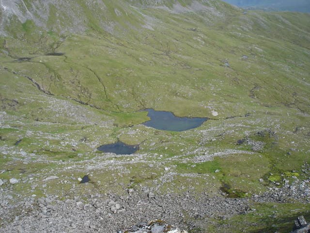
Sgurr nan Ceathreamhnan — "peak of the quarters", a name referring to ancient land divisions — is the 1150m Munro at the western end of Glen Affric, one of the most remote major hills in the country. With 433m of prominence it dominates the watershed between Affric and Kintail. The summit is a striking small cairn on a narrow rocky crest at the head of a great cliffed corrie, the Garbh Choire, that drops north toward Loch Mullardoch. The mountain is famous for genuine wilderness atmosphere — most parties stay overnight at the SYHA Alltbeithe hostel to reach it.
Quick facts
- Height
- 1149.7m/ 3772ft
- Prominence
- 433 m
- Distance
- 19 km
- Ascent
- 1012 m
- Time
- 7–11 hrs
- Grid ref
- NH057228
- Parking
- NH200234
- Nearest city
- Fort William· 49km
- Dogs
- Dogs on lead required near livestockDog-friendly guide ↗
Height and prominence cross-checked against the Database of British and Irish Hills (CC BY).
No GPX track yet
Walked this route? Share your track to help other walkers.
Standard route
Glen Affric track 25% · Open hillside / remote path 35% · Complex ridge 40%
The classic line is the long approach from the Glen Affric road end at Loch Affric, walking 12km west to Alltbeithe hostel then climbing the broad south ridge of Sgurr nan Ceathreamhnan. Around 30km return — a major day, usually broken with an overnight at Alltbeithe. The shorter but equally committing west approach is from Morvich in Kintail via Gleann Lichd and Camban bothy. Often combined with neighbouring Mullach na Dheiragain for a remote two-Munro day.
Terrain
The Glen Affric stalkers paths are well-built; firm gravel as far as Alltbeithe. The climb onto the south ridge mixes turf with occasional rocky pulls. Higher up the crest narrows to a slim crest with steep drops both sides — careful footwork required, no scrambling proper. The connection to Mullach na Dheiragain involves a long pathless ridge with several minor tops.
In winter
A major winter mountaineering objective with full alpine character — cornices on the north corrie rims, avalanche-prone slopes on the south face after westerly storms, and a long approach in deteriorating light. Alltbeithe hostel can be used as a winter base but verify open dates. SAIS Northern Highlands applies. Phone signal absent throughout.
Best time of year
Getting there
- Glasgow3h 12m
- Edinburgh4h 40m
OS maps: OS Landranger 25, OS Landranger 33
Mobile signal: No signal. One of the very remotest Munros in Scotland. Download maps at home — no coverage for the entirety of the approach.
Current conditions
Daylight Today
- Sunrise
- 05:01
- Sunset
- 21:54
- Civil dawn
- 04:04
- Civil dusk
- 22:51
NOAA Solar Calculator · 23 July 2026
Pair with
Curated multi-hill combinations from Sgurr nan Ceathramhnan (Sgurr nan Ceathreamhnan).
On a long-distance route
Sgurr nan Ceathramhnan (Sgurr nan Ceathreamhnan) sits within 5km of these named long-distance walks — useful for trail-pack rest days or section extensions.
Got a photo of Sgurr nan Ceathramhnan (Sgurr nan Ceathreamhnan)?
30 seconds, helps other walkers.
Submit a photoAround Sgurr nan Ceathramhnan (Sgurr nan Ceathreamhnan) on the SCOT network
Getting there, basing yourself, and what to do off the hill.
Sgurr nan Ceathramhnan (Sgurr nan Ceathreamhnan) — common questions
- What difficulty is Sgurr nan Ceathramhnan (Sgurr nan Ceathreamhnan)?
- On the OutdoorSCOT scale, Sgurr nan Ceathramhnan (Sgurr nan Ceathreamhnan) comes in at 3/5 — moderately challenging. Expect roughly 19km and 1012m of ascent on the usual route — 7-11 hours for most parties. Ground conditions: The Glen Affric stalkers paths are well-built; firm gravel as far as Alltbeithe.
- How much drop does Sgurr nan Ceathramhnan (Sgurr nan Ceathreamhnan) have?
- The drop is 433m: measured from the summit of Sgurr nan Ceathramhnan (Sgurr nan Ceathreamhnan) down to the saddle joining it to higher terrain.
- Where's the parking for Sgurr nan Ceathramhnan (Sgurr nan Ceathreamhnan)?
- Park at NH200234. Double-check the grid reference on an OS map first; informal laybys here fill early in high season.
- What's the best month to climb Sgurr nan Ceathramhnan (Sgurr nan Ceathreamhnan)?
- Aim for May, June, July, August, September, October on Sgurr nan Ceathramhnan (Sgurr nan Ceathreamhnan). In the remaining months treat it as a winter hill — full kit, solid navigation, and a look at the relevant SAIS avalanche forecast before you go.
- Can dogs go up Sgurr nan Ceathramhnan (Sgurr nan Ceathreamhnan)?
- Dogs are fine on a lead. The route passes livestock or ground-nesting bird habitat, so keep them close throughout.
- Will I get phone signal on Sgurr nan Ceathramhnan (Sgurr nan Ceathreamhnan)?
- No signal. One of the very remotest Munros in Scotland. Download maps at home — no coverage for the entirety of the approach.
- Is Sgurr nan Ceathramhnan (Sgurr nan Ceathreamhnan) safe in winter?
- A major winter mountaineering objective with full alpine character — cornices on the north corrie rims, avalanche-prone slopes on the south face after westerly storms, and a long approach in deteriorating light. Alltbeithe hostel can be used as a winter base but verify open dates. SAIS Northern Highlands applies. Phone signal absent throughout.
Get the OutdoorSCOT weekly
One email a week — new route, hill and bothy guides, seasonal conditions and the odd hard-won lesson. No spam, unsubscribe in one click.