Munro · Kintail
Beinn Fhada
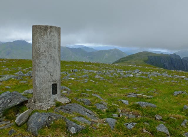
Beinn Fhada (1031m) — anglicised as Ben Attow, "the long mountain" — lives up to its name with a vast summit plateau stretching for 5km east-west above Gleann Lichd. The hill is the immediate eastern neighbour of the Five Sisters of Kintail and is usually paired with A' Ghlas-bheinn to its north. The Plaide Mhòr summit plateau is among the largest in Scotland and a serious navigation challenge in cloud.
Gaelic: “mountain, long” · Pronunciation: bine ah-dah
Quick facts
- Height
- 1031.9m/ 3385ft
- Prominence
- 647 m
- Distance
- 19 km
- Ascent
- 1100 m
- Time
- 6–8 hrs
- Grid ref
- NH018192
- Parking
- NG960210
- Nearest city
- Fort William· 46km
- Dogs
- Dogs on lead required near livestockDog-friendly guide ↗
Height and prominence cross-checked against the Database of British and Irish Hills (CC BY).
No GPX track yet
Walked this route? Share your track to help other walkers.
Standard route
Gleann Lichd path 30% · Open hillside 30% · Summit plateau 40%
The classic route is from Morvich at the head of Loch Duich. Walk up Strath Croe and follow the well-built stalkers' path into the Bealach an Sgairne (the "Gates of Affric"). From the bealach turn south-east and climb the steep west spur of Beinn Fhada onto the Plaide Mhòr plateau, then continue east-south-east across the broad summit to the trig pillar. Return either by reversing or by descending south to Gleann Lichd via the Beinn Bhuidhe shoulder. Around 19km with 1100m of ascent.
Terrain
The Morvich approach into the Bealach an Sgairne is one of the great Highland glen walks — restored stone pitching for most of its length. The climb onto the Plaide Mhòr plateau is steep grass with one short rocky step. The summit plateau is a huge expanse of mossy turf and small lochans — beautiful in clear weather but a serious navigation challenge in cloud. The descent off the south side to Gleann Lichd is steep grass.
In winter
A serious winter Kintail Munro. The Plaide Mhòr plateau drifts heavily and the absence of features makes whiteout navigation a true challenge. Cornicing on the north corries (Coire an Sgairne, Coire Dhruim Reidhe) is consistent. Avalanche risk on the steeper headwalls is significant after south-westerly storms. Phone signal absent above the Bealach. SAIS Northern Highlands applies.
Best time of year
Getting there
- Glasgow3h 9m
- Edinburgh4h 40m
OS maps: OS Landranger 33
Mobile signal: Signal vanishes above 700m in Kintail. Shiel Bridge and Morvich have occasional coverage. Cache maps ahead of leaving Shiel Bridge.
Current conditions
Daylight Today
- Sunrise
- 05:01
- Sunset
- 21:54
- Civil dawn
- 04:05
- Civil dusk
- 22:51
NOAA Solar Calculator · 23 July 2026
Pair with
Curated multi-hill combinations from Beinn Fhada.
On a long-distance route
Beinn Fhada sits within 5km of these named long-distance walks — useful for trail-pack rest days or section extensions.
Around Beinn Fhada on the SCOT network
Getting there, basing yourself, and what to do off the hill.
Beinn Fhada — common questions
- How hard is Beinn Fhada?
- We grade Beinn Fhada at 5/5, which puts it in very challenging territory. The usual route is around 19km with 1100m of climbing; allow 6-8 hours. Underfoot: The Morvich approach into the Bealach an Sgairne is one of the great Highland glen walks — restored stone pitching for most of its length.
- What is Beinn Fhada's prominence?
- 647m of prominence. That's the vertical drop from the summit to the col that links Beinn Fhada to the next higher ground.
- Where do I park for Beinn Fhada?
- Most walkers start from NG960210. Verify the grid reference on an OS map before you set off — space is tight on busy summer weekends.
- When is the best time to climb Beinn Fhada?
- May, June, July, August, September, October give the most reliable conditions on Beinn Fhada. Beyond that window the high ground turns wintry: carry full mountain kit, be confident navigating, and check the SAIS avalanche forecast for the area.
- Is Beinn Fhada dog-friendly?
- Yes, but dogs must be kept on a lead — there is livestock or ground-nesting bird interest on the route.
- Is there mobile signal on Beinn Fhada?
- Signal vanishes above 700m in Kintail. Shiel Bridge and Morvich have occasional coverage. Cache maps ahead of leaving Shiel Bridge.
- Is Beinn Fhada safe in winter?
- A serious winter Kintail Munro. The Plaide Mhòr plateau drifts heavily and the absence of features makes whiteout navigation a true challenge. Cornicing on the north corries (Coire an Sgairne, Coire Dhruim Reidhe) is consistent. Avalanche risk on the steeper headwalls is significant after south-westerly storms. Phone signal absent above the Bealach. SAIS Northern Highlands applies.
Get the OutdoorSCOT weekly
One email a week — new route, hill and bothy guides, seasonal conditions and the odd hard-won lesson. No spam, unsubscribe in one click.