Munro · Fife & Perthshire
Beinn Ghlas
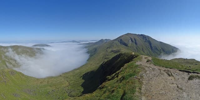
Beinn Ghlas — "the green-grey hill" — is the 1103m Munro that pairs with Ben Lawers on the long Loch Tay ridge, the first Munro encountered on the standard route from the NTS visitor centre. The summit is a cairn on a broad grassy dome with views south down Loch Tay to the Trossachs and north-east along the Lawers ridge. Almost every party combines Beinn Ghlas with Ben Lawers itself on the same day — the high col between them is only 100m down.
Gaelic: “mountain, grey-green” · Pronunciation: bine glass
Quick facts
- Height
- 1103.4m/ 3620ft
- Prominence
- 109 m
- Distance
- 18 km
- Ascent
- 971 m
- Time
- 6–9 hrs
- Grid ref
- NN625404
- Parking
- NN608378
- Nearest city
- Stirling· 50km
- Dogs
- Dogs on lead required near livestockDog-friendly guide ↗
Height and prominence cross-checked against the Database of British and Irish Hills (CC BY).
No GPX track yet
Walked this route? Share your track to help other walkers.
Standard route
NTS path 50% · Open hillside 30% · Summit 20%
Start at the NTS visitor centre below Ben Lawers and take the flagstoned NNR path, which climbs north over the Beinn Ghlas summit on the way to Ben Lawers itself. Around 11km out-and-back with 950m of climbing for both Munros. The 18km/971m figures in the database cover the longer Lawers seven-Munro round. Beinn Ghlas alone is a 7km/700m half-day from the visitor centre.
Terrain
The NTS path is exceptionally well-constructed — gravel and stone-pitched throughout the National Nature Reserve. The summit dome is broad short turf with the cairn on a small platform. The connection to Ben Lawers is short broad ridge walking with no exposure. The reserve protects rare arctic-alpine flora; stay on the path to avoid trampling.
In winter
A relatively benign winter Munro — broad ridge, good path, no avalanche slopes of consequence. The flagstoned path is followable under most snow conditions. Easterly snowfall accumulates on the summit dome. The visitor centre car park is gritted. SAIS Southern Cairngorms gives a regional indicator.
Best time of year
Getting there
- Glasgow2h 47m
- Edinburgh2h 57m
OS maps: OS Landranger 51
Mobile signal: Good signal at the NTS car park below Ben Lawers. Signal reduces above 900m but is generally better than most Highland hills due to the Tay valley transmitters. Download maps as backup.
Current conditions
Daylight Today
- Sunrise
- 05:01
- Sunset
- 21:46
- Civil dawn
- 04:07
- Civil dusk
- 22:40
NOAA Solar Calculator · 23 July 2026
Pair with
Curated multi-hill combinations from Beinn Ghlas.
Around Beinn Ghlas on the SCOT network
Getting there, basing yourself, and what to do off the hill.
Getting there: Rannoch station
Rannoch Moor — remote West Highland Line stop; Schiehallion approach via bus
27km from the hill
tripscot.co.uk
On TripSCOTBase yourself in Aberfeldy
Loch Tay base — Ben Lawers, Tarmachan ridge, Birks of Aberfeldy
25km from the hill
tripscot.co.uk
On TasteSCOTAfter the hill: Aberfeldy
Aberfeldy — heart of Dewar's blends; honey-and-heather Highland style
25km from the hill
tastescot.co.uk
Beinn Ghlas — common questions
- What difficulty is Beinn Ghlas?
- On the OutdoorSCOT scale, Beinn Ghlas comes in at 3/5 — moderately challenging. Expect roughly 18km and 971m of ascent on the usual route — 6-9 hours for most parties. Underfoot: The NTS path is exceptionally well-constructed — gravel and stone-pitched throughout the National Nature Reserve.
- What is Beinn Ghlas's prominence?
- 109m of prominence. That's the vertical drop from the summit to the col that links Beinn Ghlas to the next higher ground.
- Where do I park for Beinn Ghlas?
- Most walkers start from NN608378. Verify the grid reference on an OS map before you set off — space is tight on busy summer weekends.
- When is the best time to climb Beinn Ghlas?
- May, June, July, August, September, October give the most reliable conditions on Beinn Ghlas. Beyond that window the high ground turns wintry: carry full mountain kit, be confident navigating, and check the SAIS avalanche forecast for the area.
- Is Beinn Ghlas dog-friendly?
- Yes, but dogs must be kept on a lead — there is livestock or ground-nesting bird interest on the route.
- Is there mobile signal on Beinn Ghlas?
- Good signal at the NTS car park below Ben Lawers. Signal reduces above 900m but is generally better than most Highland hills due to the Tay valley transmitters. Download maps as backup.
- Is Beinn Ghlas safe in winter?
- A relatively benign winter Munro — broad ridge, good path, no avalanche slopes of consequence. The flagstoned path is followable under most snow conditions. Easterly snowfall accumulates on the summit dome. The visitor centre car park is gritted. SAIS Southern Cairngorms gives a regional indicator.
Get the OutdoorSCOT weekly
One email a week — new route, hill and bothy guides, seasonal conditions and the odd hard-won lesson. No spam, unsubscribe in one click.