Corbett · Fife & Perthshire
Beinn Dearg
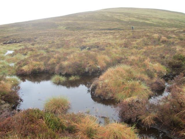
This Beinn Dearg — "red hill", one of more than a dozen so named across Scotland — sits between Glen Lyon and Loch Rannoch in central Perthshire. At 830m it is essentially heather-clad moorland punctuated by small granite outcrops, with the namesake red colouring most evident on the boulder-strewn top. The view north across Loch Rannoch to the Ben Alder hills and south down Glen Lyon to the Lawers range gives it a fine cross-Highland panorama from the watershed between the two great glens.
Gaelic: “mountain, red” · Pronunciation: bine jerr-ak
Quick facts
- Height
- 830m/ 2723ft
- Prominence
- 201 m
- Distance
- 15 km
- Ascent
- 730 m
- Time
- 5–7 hrs
- Grid ref
- NN608497
- Parking
- NN586473
- Nearest
- Fort William· Perth 57km
- Dogs
- Dogs on lead required near livestockDog-friendly guide ↗
Height and prominence cross-checked against the Database of British and Irish Hills (CC BY).
No GPX track yet
Walked this route? Share your track to help other walkers.
Standard route
estate track 30% · rough heather 35% · broad ridge 25% · granite top 10%
Most parties start from Innerwick in mid Glen Lyon and follow the estate track north into Gleann Daimh, then climb pathless heather slopes east onto the broad south ridge of Beinn Dearg. An even-graded climb up the ridge tops out at the cairn. Round trip about 15km with 730m of ascent. The hill is sometimes combined with neighbouring Meall Buidhe or Meall na Aighean if conditions allow, though both are longer outings in their own right.
Terrain
The Gleann Daimh estate track is firm underfoot. Beyond it the surface is rough heather and peat — pathless and slow. The summit ridge is broad short grass with granite outcrops scattered across the top; the highest cairn sits among loose pink granite blocks. No exposure or technical ground. Watch for stalking activity in season; tracks are working estate ground.
In winter
A benign winter Corbett — gentle slopes, no avalanche risk and no cornicing of consequence. The exposed summit catches easterly snowfall. The Glen Lyon road past Innerwick is single-track and rarely gritted in its upper stretches; check conditions before driving in. The hill itself is a straightforward winter walk in stable conditions.
Best time of year
Getting there
- Glasgow2h 48m
- Edinburgh2h 7m
OS maps: OS Landranger 51
Mobile signal: Intermittent in Glen Lyon; no signal on the summit
Current conditions
Daylight Today
- Sunrise
- 04:45
- Sunset
- 22:01
- Civil dawn
- 03:45
- Civil dusk
- 23:00
NOAA Solar Calculator · 13 July 2026
Pair with
Curated multi-hill combinations from Beinn Dearg.
Around Beinn Dearg on the SCOT network
Getting there, basing yourself, and what to do off the hill.
Getting there: Rannoch station
Rannoch Moor — remote West Highland Line stop; Schiehallion approach via bus
21km from the hill
tripscot.co.uk
On TripSCOTBase yourself in Aberfeldy
Loch Tay base — Ben Lawers, Tarmachan ridge, Birks of Aberfeldy
25km from the hill
tripscot.co.uk
On TasteSCOTAfter the hill: Aberfeldy
Aberfeldy — heart of Dewar's blends; honey-and-heather Highland style
25km from the hill
tastescot.co.uk
Beinn Dearg — common questions
- What difficulty is Beinn Dearg?
- On the OutdoorSCOT scale, Beinn Dearg comes in at 3/5 — moderately challenging. Expect roughly 15km and 730m of ascent on the usual route — 5-7 hours for most parties. Underfoot: The Gleann Daimh estate track is firm underfoot.
- What is Beinn Dearg's prominence?
- 201m of prominence. That's the vertical drop from the summit to the col that links Beinn Dearg to the next higher ground.
- Where do I park for Beinn Dearg?
- Most walkers start from NN586473 near Fort William. Verify the grid reference on an OS map before you set off — space is tight on busy summer weekends.
- When is the best time to climb Beinn Dearg?
- April, May, June, July, August, September, October give the most reliable conditions on Beinn Dearg. Beyond that window the high ground turns wintry: carry full mountain kit, be confident navigating, and check the SAIS avalanche forecast for the area.
- Is Beinn Dearg dog-friendly?
- Yes, but dogs must be kept on a lead — there is livestock or ground-nesting bird interest on the route.
- Is there mobile signal on Beinn Dearg?
- Intermittent in Glen Lyon; no signal on the summit
- Is Beinn Dearg safe in winter?
- A benign winter Corbett — gentle slopes, no avalanche risk and no cornicing of consequence. The exposed summit catches easterly snowfall. The Glen Lyon road past Innerwick is single-track and rarely gritted in its upper stretches; check conditions before driving in. The hill itself is a straightforward winter walk in stable conditions.
Get the OutdoorSCOT weekly
One email a week — new route, hill and bothy guides, seasonal conditions and the odd hard-won lesson. No spam, unsubscribe in one click.