Graham · Cairngorms
The Buck
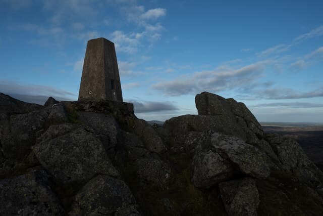
A bold conical Graham of the Cabrach moors between Strathdon and Dufftown, prominent for miles around despite a modest height. The Buck refers to the antler shape of its summit ridge — visible from the Lecht road.
Quick facts
- Height
- 721.7m/ 2368ft
- Prominence
- 257 m
- Distance
- 13 km
- Ascent
- 591 m
- Time
- 4–6 hrs
- Grid ref
- NJ412233
- Parking
- NJ360200
- Nearest city
- Aberdeen· 56km
- Dogs
- Dogs on lead required near livestockDog-friendly guide ↗
Height and prominence cross-checked against the Database of British and Irish Hills (CC BY).
No GPX track yet
Walked this route? Share your track to help other walkers.
Standard route
estate track 35% · heather moorland 45% · grassy plateau 10% · summit area 10%
Park at the high point of the A941 Cabrach road near Suie. Follow the right of way north over the moor, then break east up the heather flank to the trig. A second optional loop continues across to the rocky east top.
Terrain
Heather and grouse moor throughout, with a clear quad track for much of the way. The summit area is rocky with a few small outcrops. Fast and easy walking.
In winter
The Cabrach is one of the colder pockets of mainland Scotland and the A941 frequently closes in winter. The hill itself is benign but the drive can be the crux. Heather and bog can freeze hard, making for surprisingly quick going.
This hill is in the Northern Cairngorms SAIS forecast area. Check SAIS forecasts in winter (December–April).
Best time of year
Getting there
- Glasgow3h 25m
- Edinburgh3h 53m
OS maps: OS Landranger 37
Mobile signal: Patchy across the Cabrach moors; better near Suie
Current conditions
Daylight Today
- Sunrise
- 04:41
- Sunset
- 21:55
- Civil dawn
- 03:41
- Civil dusk
- 22:55
NOAA Solar Calculator · 17 July 2026
Pair with
Curated multi-hill combinations from The Buck.
Around The Buck on the SCOT network
Getting there, basing yourself, and what to do off the hill.
Getting there: Aviemore station
Cairngorm plateau; Lairig Ghru; Speyside Way; Glenmore
52km from the hill
tripscot.co.uk
On TripSCOTBase yourself in Dufftown
Speyside whisky town in the eastern Cairngorms
19km from the hill
tripscot.co.uk
On TasteSCOTAfter the hill: The Glenlivet
Ballindalloch — the first legal distillery under the 1823 Excise Act
15km from the hill
tastescot.co.uk
The Buck — common questions
- How hard is The Buck?
- We grade The Buck at 4/5, which puts it in challenging territory. The usual route is around 13km with 591m of climbing; allow 4-6 hours. Terrain: Heather and grouse moor throughout, with a clear quad track for much of the way.
- How prominent is The Buck?
- The Buck has 257m of topographic prominence — the height of its summit above the highest col connecting it to higher ground.
- Where should I park to climb The Buck?
- Standard parking is at NJ360200. Check the parking grid reference on an OS map before travel; informal laybys can fill on summer weekends.
- When should I climb The Buck?
- The standard good-weather months for The Buck are April, May, June, July, August, September, October. Outside those months, expect winter conditions on the high ground — full mountain kit, navigation skills, and a check of the SAIS avalanche forecast for the relevant region.
- Can I bring my dog up The Buck?
- On a lead only — the route crosses ground with livestock or nesting-bird interest.
- What's mobile reception like on The Buck?
- Patchy across the Cabrach moors; better near Suie
- Is The Buck safe in winter?
- The Cabrach is one of the colder pockets of mainland Scotland and the A941 frequently closes in winter. The hill itself is benign but the drive can be the crux. Heather and bog can freeze hard, making for surprisingly quick going.
Get the OutdoorSCOT weekly
One email a week — new route, hill and bothy guides, seasonal conditions and the odd hard-won lesson. No spam, unsubscribe in one click.