Corbett · Cairngorms
Carn Mor
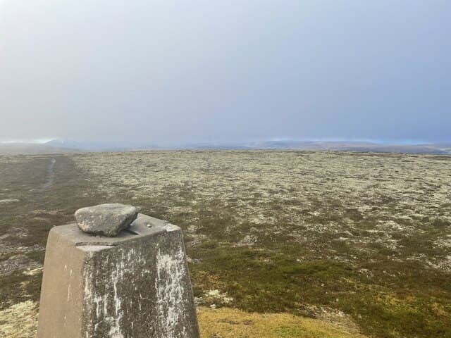
Càrn Mòr — 'the big cairn' — is the heather-clad Corbett of the upper Avon country, rising north-west of Tomintoul on the long ridge running down toward the Cromdale hills. The 804m summit is a small rocky tor on a broad moorland plateau, and the views span from the main Cairngorm plateau in the south to Speyside and the Moray Firth in the north. Drier and friendlier underfoot than the western Highlands, the hill is a good day for parties based at Tomintoul or in lower Speyside.
Gaelic: “cairn-topped hill, big” · Pronunciation: karn more
Quick facts
- Height
- 804m/ 2638ft
- Prominence
- 349 m
- Distance
- 13 km
- Ascent
- 680 m
- Time
- 3–5 hrs
- Grid ref
- NJ265183
- Parking
- NJ128205
- Nearest city
- Inverness· 66km
- Dogs
- Dogs on lead required near livestockDog-friendly guide ↗
Height and prominence cross-checked against the Database of British and Irish Hills (CC BY).
No GPX track yet
Walked this route? Share your track to help other walkers.
Standard route
glen track 25% · heather moorland 35% · plateau grass 30% · summit area 10%
Park at the small layby near Bridge of Brown on the A939 (NJ128205), the road between Grantown-on-Spey and Tomintoul. Walk south-east along a Land Rover track for around 4km, gaining height steadily across moorland. Where the track curves north, leave it and climb south onto Càrn Mòr's broad north ridge. The summit cairn is reached after a short final pull. Allow 5–6 hours.
Terrain
Decent estate Land Rover track on the long approach. Above the track the going is short heather and grass — drier than most Highland hills thanks to the rain-shadow position east of the Cairngorms. The summit is a small rocky tor on a broad plateau; in cloud the descent line needs accurate bearing.
In winter
Cold easterly winds from the Mearns can be brutal on the broad plateau; snow holds well from January through March. No avalanche concerns on the standard line. The Bridge of Brown layby on the A939 is reliably ploughed but the road itself can close in heavy storms over the Lecht.
This hill is in the Northern Cairngorms SAIS forecast area. Check SAIS forecasts in winter (December–April).
Best time of year
Getting there
- Glasgow3h 13m
- Edinburgh3h 4m
OS maps: OS Landranger 37
Mobile signal: No coverage in upper Glen Avon/Loch Avon area
Current conditions
Daylight Today
- Sunrise
- 04:36
- Sunset
- 22:02
- Civil dawn
- 03:34
- Civil dusk
- 23:04
NOAA Solar Calculator · 13 July 2026
Pair with
Curated multi-hill combinations from Carn Mor.
Around Carn Mor on the SCOT network
Getting there, basing yourself, and what to do off the hill.
Getting there: Aviemore station
Cairngorm plateau; Lairig Ghru; Speyside Way; Glenmore
37km from the hill
tripscot.co.uk
On TripSCOTBase yourself in Dufftown
Speyside whisky town in the eastern Cairngorms
22km from the hill
tripscot.co.uk
On TasteSCOTAfter the hill: The Glenlivet
Ballindalloch — the first legal distillery under the 1823 Excise Act
9km from the hill
tastescot.co.uk
Carn Mor — common questions
- Is Carn Mor a hard climb?
- Carn Mor is rated 2/5 (moderate) on the OutdoorSCOT scale. The standard route covers about 13km with 680m of ascent and takes most walkers 3-5 hours. Ground conditions: Decent estate Land Rover track on the long approach.
- How much drop does Carn Mor have?
- The drop is 349m: measured from the summit of Carn Mor down to the saddle joining it to higher terrain.
- Where's the parking for Carn Mor?
- Park at NJ128205. Double-check the grid reference on an OS map first; informal laybys here fill early in high season.
- What's the best month to climb Carn Mor?
- Aim for April, May, June, July, August, September, October on Carn Mor. In the remaining months treat it as a winter hill — full kit, solid navigation, and a look at the relevant SAIS avalanche forecast before you go.
- Can dogs go up Carn Mor?
- Dogs are fine on a lead. The route passes livestock or ground-nesting bird habitat, so keep them close throughout.
- Will I get phone signal on Carn Mor?
- No coverage in upper Glen Avon/Loch Avon area
- Is Carn Mor safe in winter?
- Cold easterly winds from the Mearns can be brutal on the broad plateau; snow holds well from January through March. No avalanche concerns on the standard line. The Bridge of Brown layby on the A939 is reliably ploughed but the road itself can close in heavy storms over the Lecht.
Get the OutdoorSCOT weekly
One email a week — new route, hill and bothy guides, seasonal conditions and the odd hard-won lesson. No spam, unsubscribe in one click.