Corbett · Cairngorms
Carn Ealasaid
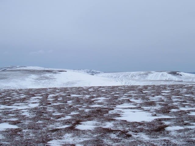
Càrn Ealasaid is the broad heather Corbett sitting directly above the Lecht ski area on the A939, accessible by what is by far the shortest standard ascent of any Corbett. Park at the Lecht and you're already at 645m — you are barely 150m below the 792m summit, and the gentle ups and downs of the clear track and bulldozed access route add up to about 300m of climbing. The summit gives a wide-angle view across the Cromdales to Speyside and east over the open Aberdeenshire moors. A genuine 'tick' rather than a serious day, but useful on a short winter afternoon or for parties new to Corbetts.
Quick facts
- Height
- 792.7m/ 2601ft
- Prominence
- 157 m
- Distance
- 7 km
- Ascent
- 300 m
- Time
- 2–3 hrs
- Grid ref
- NJ227117
- Parking
- NJ246130
- Nearest city
- Inverness· 65km
- Dogs
- Dogs on lead required near livestockDog-friendly guide ↗
Height and prominence cross-checked against the Database of British and Irish Hills (CC BY).
No GPX track yet
Walked this route? Share your track to help other walkers.
Standard route
estate track 30% · heather moorland 45% · grassy upper slopes 15% · summit area 10%
Park at the Lecht ski area car park on the A939 (NJ246130). Walk back south down the road briefly and turn west onto the obvious bulldozed track climbing onto Càrn Ealasaid's broad east shoulder. The track leads almost to the summit; the final 100m is on grass to a small cairn. Descent reverses the line. Allow 2.5–3 hours.
Terrain
The shortest standard ascent of any Corbett — a track from the Lecht car park leads almost to the summit. Bulldozed access road for most of the climb, with a brief grass finale. The summit cairn is small; the broad plateau is featureless in cloud but the descent is back to the obvious track.
In winter
When the Lecht ski road is open, Càrn Ealasaid is among the most accessible winter Corbetts — short, gentle gradient, friendly snow underfoot. The A939 over the Lecht is the most weather-vulnerable A-road in Britain and closes regularly; check Highland Council snow gates before driving up. Once on the hill, no avalanche concerns on the standard line.
This hill is in the Northern Cairngorms SAIS forecast area. Check SAIS forecasts in winter (December–April).
Best time of year
Getting there
- Glasgow3h 4m
- Edinburgh3h 56m
OS maps: OS Landranger 36
Mobile signal: Reasonable signal near Tomintoul; around 2 bars on top
Current conditions
Daylight Today
- Sunrise
- 04:43
- Sunset
- 21:56
- Civil dawn
- 03:43
- Civil dusk
- 22:55
NOAA Solar Calculator · 17 July 2026
Around Carn Ealasaid on the SCOT network
Getting there, basing yourself, and what to do off the hill.
Getting there: Aviemore station
Cairngorm plateau; Lairig Ghru; Speyside Way; Glenmore
33km from the hill
tripscot.co.uk
On TripSCOTBase yourself in Ballater
Eastern Cairngorms / Royal Deeside
21km from the hill
tripscot.co.uk
On TasteSCOTAfter the hill: Tomintoul
Tomintoul village — the gentle Speysider in the eastern Cairngorms
9km from the hill
tastescot.co.uk
Carn Ealasaid — common questions
- Is Carn Ealasaid a hard climb?
- Carn Ealasaid is rated 1/5 (easy) on the OutdoorSCOT scale. The standard route covers about 7km with 300m of ascent and takes most walkers 2-3 hours. Underfoot: The shortest standard ascent of any Corbett — a track from the Lecht car park leads almost to the summit.
- What is Carn Ealasaid's prominence?
- 157m of prominence. That's the vertical drop from the summit to the col that links Carn Ealasaid to the next higher ground.
- Where do I park for Carn Ealasaid?
- Most walkers start from NJ246130. Verify the grid reference on an OS map before you set off — space is tight on busy summer weekends.
- When is the best time to climb Carn Ealasaid?
- April, May, June, July, August, September, October give the most reliable conditions on Carn Ealasaid. Beyond that window the high ground turns wintry: carry full mountain kit, be confident navigating, and check the SAIS avalanche forecast for the area.
- Is Carn Ealasaid dog-friendly?
- Yes, but dogs must be kept on a lead — there is livestock or ground-nesting bird interest on the route.
- Is there mobile signal on Carn Ealasaid?
- Reasonable signal near Tomintoul; around 2 bars on top
- Is Carn Ealasaid safe in winter?
- When the Lecht ski road is open, Càrn Ealasaid is among the most accessible winter Corbetts — short, gentle gradient, friendly snow underfoot. The A939 over the Lecht is the most weather-vulnerable A-road in Britain and closes regularly; check Highland Council snow gates before driving up. Once on the hill, no avalanche concerns on the standard line.
Get the OutdoorSCOT weekly
One email a week — new route, hill and bothy guides, seasonal conditions and the odd hard-won lesson. No spam, unsubscribe in one click.