Graham · Cairngorms
Cook's Cairn
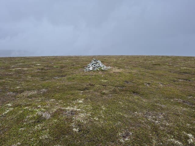
A rolling whaleback summit deep in the Cabrach country between Glenlivet and the upper Deveron, far enough from main roads to feel genuinely lonely. The flanks fold into heather-bag glens carrying small burns north toward Dufftown.
Quick facts
- Height
- 755.9m/ 2480ft
- Prominence
- 213 m
- Distance
- 14 km
- Ascent
- 619 m
- Time
- 4–7 hrs
- Grid ref
- NJ302278
- Parking
- NJ256262
- Nearest city
- Inverness· 66km
- Dogs
- Dogs on lead required near livestockDog-friendly guide ↗
Height and prominence cross-checked against the Database of British and Irish Hills (CC BY).
No GPX track yet
Walked this route? Share your track to help other walkers.
Standard route
estate track 35% · heather moorland 45% · grassy upper area 10% · summit area 10%
Start from the road end at Glenlivet at the bridge over the Suie Burn or from the Cabrach side at the small carpark by Knockfundland. Estate tracks lead a long way south-east onto Carn Liath before a short bog-pull tops out at the cairn.
Terrain
Excellent gravel grouse-shooting tracks for most of the distance, then a final kilometre of trackless heather and peat. Burns can be impassable after rain.
In winter
A modest Speyside summit where the real winter problem is drifting snow filling the shooting tracks rather than alpine conditions on the top. The peat bowls hold concealed soft snow well into spring.
This hill is in the Northern Cairngorms SAIS forecast area. Check SAIS forecasts in winter (December–April).
Best time of year
Getting there
- Glasgow3h 24m
- Edinburgh3h 57m
OS maps: OS Landranger 37
Mobile signal: Reasonable signal near Grantown-on-Spey; 2 bars at the top
Current conditions
Daylight Today
- Sunrise
- 04:35
- Sunset
- 22:02
- Civil dawn
- 03:32
- Civil dusk
- 23:05
NOAA Solar Calculator · 13 July 2026
Pair with
Curated multi-hill combinations from Cook's Cairn.
Around Cook's Cairn on the SCOT network
Getting there, basing yourself, and what to do off the hill.
Getting there: Aviemore station
Cairngorm plateau; Lairig Ghru; Speyside Way; Glenmore
43km from the hill
tripscot.co.uk
On TripSCOTBase yourself in Dufftown
Speyside whisky town in the eastern Cairngorms
12km from the hill
tripscot.co.uk
On TasteSCOTAfter the hill: The Glenlivet
Ballindalloch — the first legal distillery under the 1823 Excise Act
4km from the hill
tastescot.co.uk
Cook's Cairn — common questions
- Is Cook's Cairn a hard climb?
- Cook's Cairn is rated 4/5 (challenging) on the OutdoorSCOT scale. The standard route covers about 14km with 619m of ascent and takes most walkers 4-7 hours. Underfoot: Excellent gravel grouse-shooting tracks for most of the distance, then a final kilometre of trackless heather and peat.
- What is Cook's Cairn's prominence?
- 213m of prominence. That's the vertical drop from the summit to the col that links Cook's Cairn to the next higher ground.
- Where do I park for Cook's Cairn?
- Most walkers start from NJ256262. Verify the grid reference on an OS map before you set off — space is tight on busy summer weekends.
- When is the best time to climb Cook's Cairn?
- April, May, June, July, August, September, October give the most reliable conditions on Cook's Cairn. Beyond that window the high ground turns wintry: carry full mountain kit, be confident navigating, and check the SAIS avalanche forecast for the area.
- Is Cook's Cairn dog-friendly?
- Yes, but dogs must be kept on a lead — there is livestock or ground-nesting bird interest on the route.
- Is there mobile signal on Cook's Cairn?
- Reasonable signal near Grantown-on-Spey; 2 bars at the top
- Is Cook's Cairn safe in winter?
- A modest Speyside summit where the real winter problem is drifting snow filling the shooting tracks rather than alpine conditions on the top. The peat bowls hold concealed soft snow well into spring.
Get the OutdoorSCOT weekly
One email a week — new route, hill and bothy guides, seasonal conditions and the odd hard-won lesson. No spam, unsubscribe in one click.