Graham · Cairngorms
Pressendye
Pressendye (619m) is the great pudding-shaped hill above Tarland in the NJ40 square, on the northern edge of mid-Deeside. A huge wind shelter sits on the summit, big enough to give comfortable cover for several walkers. The view takes in Lochnagar, the Buck of Cabrach and the line of the Deeside hills, with the Moray Firth a silver line on the horizon on the clearest days.
Quick facts
- Height
- 619.1m/ 2031ft
- Prominence
- 254 m
- Distance
- 12 km
- Ascent
- 464 m
- Time
- 3–5 hrs
- Grid ref
- NJ490089
- Parking
- NJ421083
- Nearest city
- Aberdeen· 45km
- Dogs
- Dogs on lead required near livestockDog-friendly guide ↗
Height and prominence cross-checked against the Database of British and Irish Hills (CC BY).
No GPX track yet
Walked this route? Share your track to help other walkers.
Standard route
heather moorland 65% · grass slopes 25% · rocky summit 10%
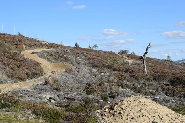
From the parking spot at NJ421083 above Tarland, take the estate track climbing north onto the heather moor. The track gives a steady ascent almost to the summit; the wind shelter and trig point are reached after a final stretch on quad track. About three hours up and back. Return on the ascent track or extend east toward Mona Gowan for a longer round.
Terrain
A well-maintained estate track gives most of the route on firm ground. The upper hill is managed grouse moor with short heather and bilberry around the wind shelter. There are several heather burns to step over but no significant boggy sections.
In winter
Aberdeenshire heather moor catches the east-coast cold snaps and the wind shelter is often the only thing breaking the wind at the top. Snow can drift across the track in shallow ground-blizzards. The hill is a fine choice for a short midwinter day, with the descent track manageable even in poor visibility.
This hill is in the Northern Cairngorms SAIS forecast area. Check SAIS forecasts in winter (December–April).
Best time of year
Getting there
- Glasgow3h 15m
- Edinburgh3h 55m
OS maps: OS Landranger 37
Mobile signal: Strong summit reception; EE holds throughout. Prominent Aberdeenshire viewpoint above Tarland.
Current conditions
Daylight Today
- Sunrise
- 04:35
- Sunset
- 21:59
- Civil dawn
- 03:33
- Civil dusk
- 23:01
NOAA Solar Calculator · 13 July 2026
Around Pressendye on the SCOT network
Getting there, basing yourself, and what to do off the hill.
Getting there: Stonehaven station
Dunnottar Castle; Aberdeenshire coast; Mearns walking country
45km from the hill
tripscot.co.uk
On TripSCOTBase yourself in Ballater
Eastern Cairngorms / Royal Deeside
18km from the hill
tripscot.co.uk
On TasteSCOTAfter the hill: Royal Lochnagar
Balmoral — Queen Victoria's favourite; eastern Cairngorms setting
28km from the hill
tastescot.co.uk
Pressendye — common questions
- How difficult is Pressendye?
- Pressendye carries a 3/5 (moderately challenging) grade on the OutdoorSCOT scale. Count on about 12km, 464m of ascent and a 3-5 hour day on the standard route. Terrain: A well-maintained estate track gives most of the route on firm ground.
- How prominent is Pressendye?
- Pressendye has 254m of topographic prominence — the height of its summit above the highest col connecting it to higher ground.
- Where should I park to climb Pressendye?
- Standard parking is at NJ421083. Check the parking grid reference on an OS map before travel; informal laybys can fill on summer weekends.
- When should I climb Pressendye?
- The standard good-weather months for Pressendye are March, April, May, June, July, August, September, October, November. Outside those months, expect winter conditions on the high ground — full mountain kit, navigation skills, and a check of the SAIS avalanche forecast for the relevant region.
- Can I bring my dog up Pressendye?
- On a lead only — the route crosses ground with livestock or nesting-bird interest.
- What's mobile reception like on Pressendye?
- Strong summit reception; EE holds throughout. Prominent Aberdeenshire viewpoint above Tarland.
- Is Pressendye safe in winter?
- Aberdeenshire heather moor catches the east-coast cold snaps and the wind shelter is often the only thing breaking the wind at the top. Snow can drift across the track in shallow ground-blizzards. The hill is a fine choice for a short midwinter day, with the descent track manageable even in poor visibility.
Get the OutdoorSCOT weekly
One email a week — new route, hill and bothy guides, seasonal conditions and the odd hard-won lesson. No spam, unsubscribe in one click.