Graham · Central Highlands
Meall a' Chrathaich
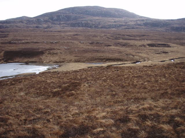
Meall a' Chrathaich (678m) lifts above Glen Urquhart south of the Beauly Firth in NH32-36 country, a broad heather plateau whose Gaelic name speaks of the sieve or strainer — perhaps the way mist drapes the boggy summit. The trig stands on a small outcrop and looks east over Loch Mhor and Loch Ness to the distant Cairngorms.
Quick facts
- Height
- 678.9m/ 2227ft
- Prominence
- 184 m
- Distance
- 13 km
- Ascent
- 556 m
- Time
- 4–6 hrs
- Grid ref
- NH360220
- Parking
- NH348223
- Nearest city
- Inverness· 38km
- Dogs
- Dogs on lead required near livestockDog-friendly guide ↗
Height and prominence cross-checked against the Database of British and Irish Hills (CC BY).
No GPX track yet
Walked this route? Share your track to help other walkers.
Standard route
heather moorland 60% · grass slopes 30% · rocky summit 10%
Park beside the minor road north of Loch Mhor near Errogie and take the forestry track that climbs west into the plantation. Above the trees a peaty argocat rut weaves through bog cotton onto the broad south-east ridge. The trig appears suddenly on its outcrop after a long, flat plod across the summit plateau.
Terrain
Forestry plantation lower down, then bog cotton and peat hag for several kilometres across the broad plateau. The summit outcrop is small and easy to walk past in mist. Argocat ruts help with line but make the going wet.
In winter
East of the Great Glen, snow tends to be patchy but drifts deeply into the peat hags where progress slows to a crawl. The summit plateau is a serious whiteout zone — a featureless mile of bog and outcrop where compass work earns its keep. Wind chill from north-easterlies is brutal.
This hill is in the Creag Meagaidh SAIS forecast area. Check SAIS forecasts in winter (December–April).
Best time of year
Getting there
- Glasgow3h 3m
- Edinburgh3h 20m
OS maps: OS Landranger 26
Mobile signal: Minimal. Remote Loch Monar; signal is marginal here.
Current conditions
Daylight Today
- Sunrise
- 04:48
- Sunset
- 22:02
- Civil dawn
- 03:48
- Civil dusk
- 23:02
NOAA Solar Calculator · 17 July 2026
Around Meall a' Chrathaich on the SCOT network
Getting there, basing yourself, and what to do off the hill.
Meall a' Chrathaich — common questions
- Is Meall a' Chrathaich a hard climb?
- Meall a' Chrathaich is rated 4/5 (challenging) on the OutdoorSCOT scale. The standard route covers about 13km with 556m of ascent and takes most walkers 4-6 hours. Underfoot: Forestry plantation lower down, then bog cotton and peat hag for several kilometres across the broad plateau.
- What is Meall a' Chrathaich's prominence?
- 184m of prominence. That's the vertical drop from the summit to the col that links Meall a' Chrathaich to the next higher ground.
- Where do I park for Meall a' Chrathaich?
- Most walkers start from NH348223. Verify the grid reference on an OS map before you set off — space is tight on busy summer weekends.
- When is the best time to climb Meall a' Chrathaich?
- March, April, May, June, July, August, September, October, November give the most reliable conditions on Meall a' Chrathaich. Beyond that window the high ground turns wintry: carry full mountain kit, be confident navigating, and check the SAIS avalanche forecast for the area.
- Is Meall a' Chrathaich dog-friendly?
- Yes, but dogs must be kept on a lead — there is livestock or ground-nesting bird interest on the route.
- Is there mobile signal on Meall a' Chrathaich?
- Minimal. Remote Loch Monar; signal is marginal here.
- Is Meall a' Chrathaich safe in winter?
- East of the Great Glen, snow tends to be patchy but drifts deeply into the peat hags where progress slows to a crawl. The summit plateau is a serious whiteout zone — a featureless mile of bog and outcrop where compass work earns its keep. Wind chill from north-easterlies is brutal.
Get the OutdoorSCOT weekly
One email a week — new route, hill and bothy guides, seasonal conditions and the odd hard-won lesson. No spam, unsubscribe in one click.