Munro · Kintail
Toll Creagach
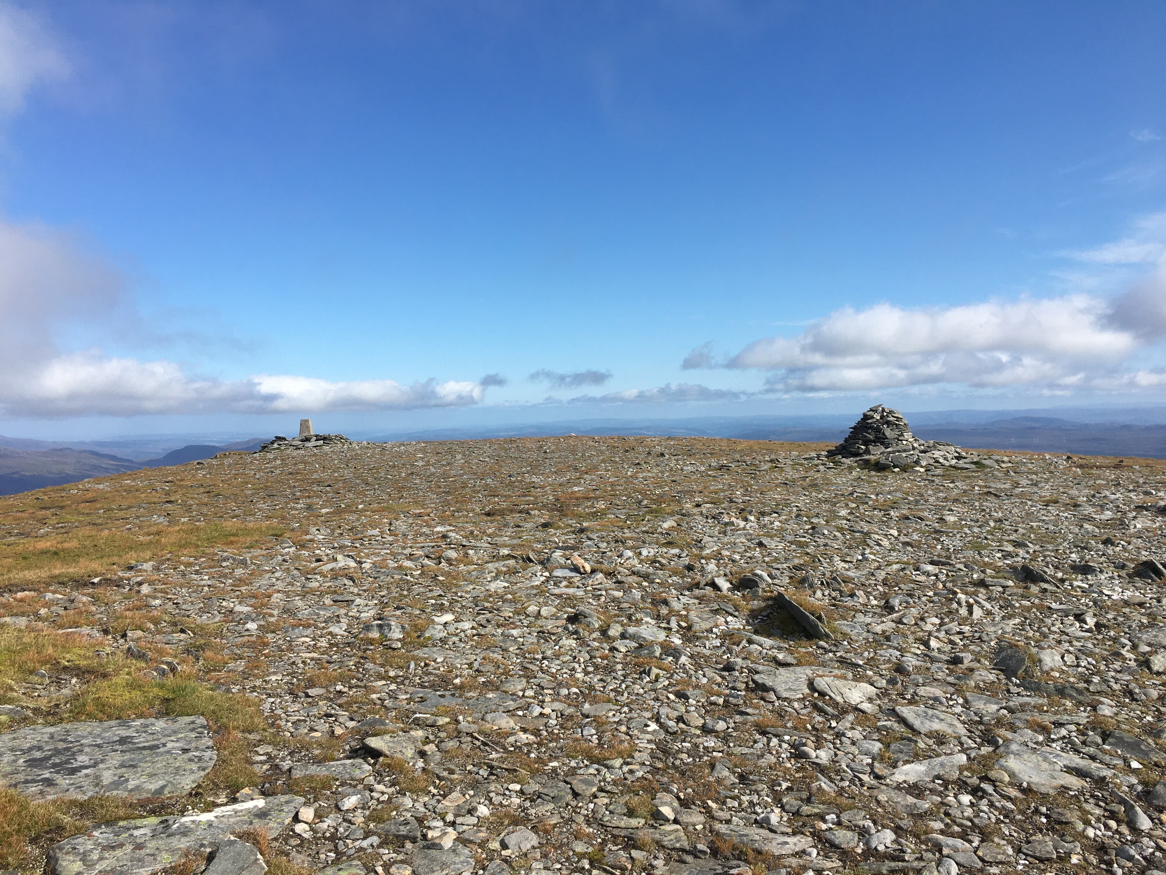
Toll Creagach (1053m) is the easternmost Munro of the long ridge that walls in the south side of upper Glen Affric, sometimes known as the Affric–Cannich south ridge. It is usually paired with Tom a' Choinnich to the west, and on a longer day with the Mam Sodhail / Càrn Eige cluster further along. The summit is a broad mossy dome rather than a sharp peak; its appeal lies in the views west into the heart of Affric and north across Mullardoch.
Quick facts
- Height
- 1053.7m/ 3457ft
- Prominence
- 181 m
- Distance
- 18 km
- Ascent
- 927 m
- Time
- 6–10 hrs
- Grid ref
- NH194282
- Parking
- NH216242
- Nearest city
- Inverness· 50km
- Dogs
- Dogs on lead required near livestockDog-friendly guide ↗
Height and prominence cross-checked against the Database of British and Irish Hills (CC BY).
No GPX track yet
Walked this route? Share your track to help other walkers.
Standard route
Dam road / track 30% · Open hillside 45% · Summit ridge 25%
Start from the small car park at the end of the public road in Glen Affric (Loch Beinn a' Mheadhoin). Take the rough track north up the Allt Toll Easa to the broad bealach between Toll Creagach and Tom a' Choinnich. Climb the easy east ridge of Toll Creagach to the summit. Most parties then return to the bealach and continue west over Tom a' Choinnich. Around 14km with 1100m of ascent for the pair; Toll Creagach alone is 11km with 800m up.
Terrain
The Allt Toll Easa stalkers' path is firm but boggy in the lower section. The east ridge of Toll Creagach is broad short turf — easy walking with no scrambling required. The summit itself is a flat mossy area with a small cairn. The connecting ridge west to Tom a' Choinnich involves a steady drop to the bealach and a steeper climb on the far side. The Glen Affric road access is single-track and slow.
In winter
A relatively benign Munro by winter standards but distance and isolation add up. The east ridge holds wind-blown snow but is unlikely to be avalanche-prone. The north corries (Coire Creagach, Coire nan Tarmachan) develop loaded slopes after southerly storms. Glen Affric is one of the colder valleys in the Highlands and gets little sun in midwinter. Phone signal absent. SAIS Northern Highlands applies.
Best time of year
Getting there
- Glasgow3h 13m
- Edinburgh4h 36m
OS maps: OS Landranger 25
Mobile signal: Dead above 700m in Glen Affric or Mullardoch. The Glen Affric car park at the end of the public road has very patchy coverage. Download maps in Cannich before heading into the glen.
Current conditions
Daylight Today
- Sunrise
- 04:59
- Sunset
- 21:54
- Civil dawn
- 04:03
- Civil dusk
- 22:50
NOAA Solar Calculator · 23 July 2026
Pair with
Curated multi-hill combinations from Toll Creagach.
On a long-distance route
Toll Creagach sits within 5km of these named long-distance walks — useful for trail-pack rest days or section extensions.
Around Toll Creagach on the SCOT network
Getting there, basing yourself, and what to do off the hill.
Toll Creagach — common questions
- How difficult is Toll Creagach?
- Toll Creagach carries a 3/5 (moderately challenging) grade on the OutdoorSCOT scale. Count on about 18km, 927m of ascent and a 6-10 hour day on the standard route. Terrain: The Allt Toll Easa stalkers' path is firm but boggy in the lower section.
- How prominent is Toll Creagach?
- Toll Creagach has 181m of topographic prominence — the height of its summit above the highest col connecting it to higher ground.
- Where should I park to climb Toll Creagach?
- Standard parking is at NH216242. Check the parking grid reference on an OS map before travel; informal laybys can fill on summer weekends.
- When should I climb Toll Creagach?
- The standard good-weather months for Toll Creagach are May, June, July, August, September, October. Outside those months, expect winter conditions on the high ground — full mountain kit, navigation skills, and a check of the SAIS avalanche forecast for the relevant region.
- Can I bring my dog up Toll Creagach?
- On a lead only — the route crosses ground with livestock or nesting-bird interest.
- What's mobile reception like on Toll Creagach?
- Dead above 700m in Glen Affric or Mullardoch. The Glen Affric car park at the end of the public road has very patchy coverage. Download maps in Cannich before heading into the glen.
- Is Toll Creagach safe in winter?
- A relatively benign Munro by winter standards but distance and isolation add up. The east ridge holds wind-blown snow but is unlikely to be avalanche-prone. The north corries (Coire Creagach, Coire nan Tarmachan) develop loaded slopes after southerly storms. Glen Affric is one of the colder valleys in the Highlands and gets little sun in midwinter. Phone signal absent. SAIS Northern Highlands applies.
Get the OutdoorSCOT weekly
One email a week — new route, hill and bothy guides, seasonal conditions and the odd hard-won lesson. No spam, unsubscribe in one click.