Graham · Kintail
Beinn a' Mheadhoin
Beinn a' Mheadhoin (611m), the middle hill, lies above Loch Mullardoch in the NH22 square, the heart of the Affric-Cannich country. A prominent rocky outcrop on the north side of the walker's line crowns the top, set on a long, rolling ridge wedged between Glen Affric and Glen Cannich. Ancient pine and birch on the lower flanks give the approach a particularly atmospheric character.
Quick facts
- Height
- 611.9m/ 2008ft
- Prominence
- 243 m
- Distance
- 12 km
- Ascent
- 458 m
- Time
- 3–5 hrs
- Grid ref
- NH218255
- Parking
- NH207258
- Nearest city
- Inverness· 49km
- Dogs
- Dogs on lead required near livestockDog-friendly guide ↗
Height and prominence cross-checked against the Database of British and Irish Hills (CC BY).
No GPX track yet
Walked this route? Share your track to help other walkers.
Standard route
heather moorland 55% · ancient woodland 25% · rocky summit 20%
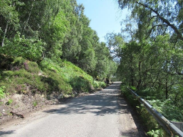
From the road end car park at NH207258 above Cannich, follow the stalkers' path west and then climb onto the south ridge through scattered pines. The line traces the crest over a series of small rises to the summit outcrop. Six hours allows for the walk in plus the climb; the descent retraces the route or extends west to take in the next bump on the ridge.
Terrain
Stalkers' paths through fragments of Caledonian pine give a beautiful start. Above the woodland the ridge is short heather and exposed rock, with bilberry between blocks. The summit outcrop is on the north side of the obvious walker line — easy to miss in cloud.
In winter
Glen Affric and Glen Cannich hold snow well into spring and Beinn a' Mheadhoin's rolling ridge drifts deeply in lee hollows. The ancient pines on the lower hill are stunning under snow but the path beneath disappears. The hill itself is gentle; the long walk in is what makes it a committing winter day.
Best time of year
Getting there
- Glasgow3h 10m
- Edinburgh4h 32m
OS maps: OS Landranger 25
Mobile signal: Poor. Remote Glen Affric/Strathglass area; limited coverage.
Current conditions
Daylight Today
- Sunrise
- 04:42
- Sunset
- 22:09
- Civil dawn
- 03:40
- Civil dusk
- 23:11
NOAA Solar Calculator · 13 July 2026
On a long-distance route
Beinn a' Mheadhoin sits within 5km of these named long-distance walks — useful for trail-pack rest days or section extensions.
Around Beinn a' Mheadhoin on the SCOT network
Getting there, basing yourself, and what to do off the hill.
Beinn a' Mheadhoin — common questions
- What difficulty is Beinn a' Mheadhoin?
- On the OutdoorSCOT scale, Beinn a' Mheadhoin comes in at 3/5 — moderately challenging. Expect roughly 12km and 458m of ascent on the usual route — 3-5 hours for most parties. Terrain: Stalkers' paths through fragments of Caledonian pine give a beautiful start.
- How prominent is Beinn a' Mheadhoin?
- Beinn a' Mheadhoin has 243m of topographic prominence — the height of its summit above the highest col connecting it to higher ground.
- Where should I park to climb Beinn a' Mheadhoin?
- Standard parking is at NH207258. Check the parking grid reference on an OS map before travel; informal laybys can fill on summer weekends.
- When should I climb Beinn a' Mheadhoin?
- The standard good-weather months for Beinn a' Mheadhoin are March, April, May, June, July, August, September, October, November. Outside those months, expect winter conditions on the high ground — full mountain kit, navigation skills, and a check of the SAIS avalanche forecast for the relevant region.
- Can I bring my dog up Beinn a' Mheadhoin?
- On a lead only — the route crosses ground with livestock or nesting-bird interest.
- What's mobile reception like on Beinn a' Mheadhoin?
- Poor. Remote Glen Affric/Strathglass area; limited coverage.
- Is Beinn a' Mheadhoin safe in winter?
- Glen Affric and Glen Cannich hold snow well into spring and Beinn a' Mheadhoin's rolling ridge drifts deeply in lee hollows. The ancient pines on the lower hill are stunning under snow but the path beneath disappears. The hill itself is gentle; the long walk in is what makes it a committing winter day.
Get the OutdoorSCOT weekly
One email a week — new route, hill and bothy guides, seasonal conditions and the odd hard-won lesson. No spam, unsubscribe in one click.