Munro · Kintail
Tom a' Choinnich (Tom a' Choinich)
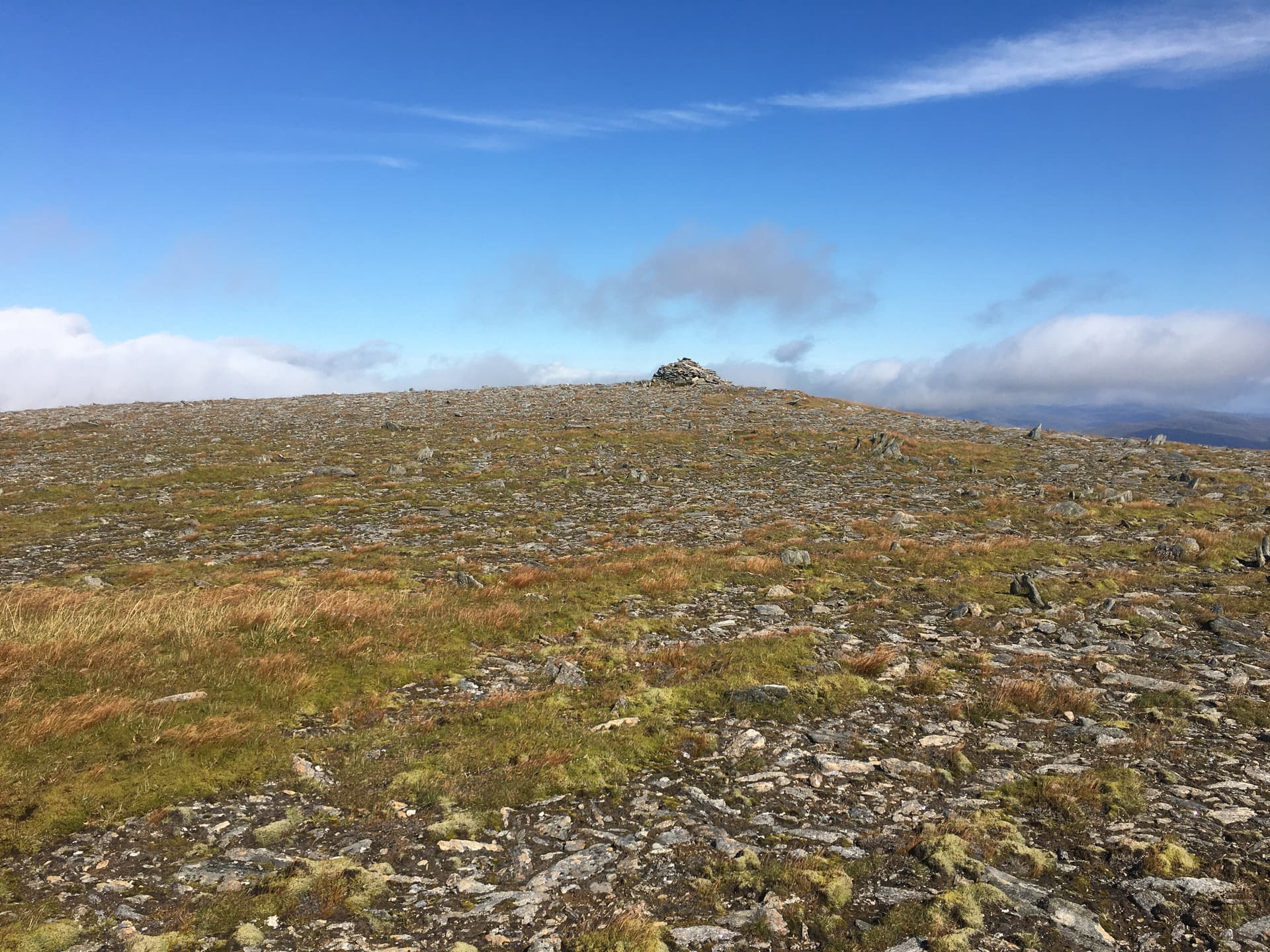
Tom a' Choinich — "hillock of the moss" — is the 1112m Munro at the east end of the Carn Eighe ridge in Glen Affric, paired with the smaller Toll Creagach across a high bealach. The hill commands one of the finest viewpoints in the northern Highlands, looking down on the dramatic basin of Loch Mullardoch to the north and out over the Affric pinewoods to the south. The summit is a large cairn on a wide grassy top.
Quick facts
- Height
- 1112.7m/ 3651ft
- Prominence
- 150 m
- Distance
- 18 km
- Ascent
- 979 m
- Time
- 7–10 hrs
- Grid ref
- NH164273
- Parking
- NH200234
- Nearest city
- Inverness· 53km
- Dogs
- Dogs on lead required near livestockDog-friendly guide ↗
Height and prominence cross-checked against the Database of British and Irish Hills (CC BY).
No GPX track yet
Walked this route? Share your track to help other walkers.
Standard route
Dam road / loch-side path 30% · Steep hillside 35% · Ridge / summit 35%
Approach from the road end at Loch Affric, climbing the path north over the Bealach Toll Easa, then climbing east onto the long ridge of Tom a' Choinich. Around 18km return with 979m of ascent. Most parties combine with Toll Creagach for a two-Munro day; strong walkers extend west to Carn Eighe and Mam Sodhail for a major Affric round.
Terrain
The Glen Affric stalkers paths are firm gravel onto the bealach. The east ridge of Tom a' Choinich is broad grass and small rock outcrops; no path-finding difficulty in clear weather. The summit area is wide cropped turf with the large cairn unmistakable. Watch for the steep north drop to Loch Mullardoch — keep south on the ridge.
In winter
A serious winter day with cornicing on the north side above Loch Mullardoch. The Bealach Toll Easa fills with deep snow. The Glen Affric back-road is narrow, single-lane and seldom gritted beyond the dam. Phone signal absent throughout. SAIS Northern Highlands applies.
Best time of year
Getting there
- Glasgow3h 13m
- Edinburgh4h 37m
OS maps: OS Landranger 25
Mobile signal: No reception above 700m. Cannich is the last town with reliable coverage. Glen Affric is completely out of range — download maps at home.
Current conditions
Daylight Today
- Sunrise
- 05:13
- Sunset
- 21:40
- Civil dawn
- 04:20
- Civil dusk
- 22:33
NOAA Solar Calculator · 30 July 2026
Pair with
Curated multi-hill combinations from Tom a' Choinnich (Tom a' Choinich).
On a long-distance route
Tom a' Choinnich (Tom a' Choinich) sits within 5km of these named long-distance walks — useful for trail-pack rest days or section extensions.
Around Tom a' Choinnich (Tom a' Choinich) on the SCOT network
Getting there, basing yourself, and what to do off the hill.
Tom a' Choinnich (Tom a' Choinich) — common questions
- How hard is Tom a' Choinnich (Tom a' Choinich)?
- We grade Tom a' Choinnich (Tom a' Choinich) at 5/5, which puts it in very challenging territory. The usual route is around 18km with 979m of climbing; allow 7-10 hours. Ground conditions: The Glen Affric stalkers paths are firm gravel onto the bealach.
- How much drop does Tom a' Choinnich (Tom a' Choinich) have?
- The drop is 150m: measured from the summit of Tom a' Choinnich (Tom a' Choinich) down to the saddle joining it to higher terrain.
- Where's the parking for Tom a' Choinnich (Tom a' Choinich)?
- Park at NH200234. Double-check the grid reference on an OS map first; informal laybys here fill early in high season.
- What's the best month to climb Tom a' Choinnich (Tom a' Choinich)?
- Aim for May, June, July, August, September, October on Tom a' Choinnich (Tom a' Choinich). In the remaining months treat it as a winter hill — full kit, solid navigation, and a look at the relevant SAIS avalanche forecast before you go.
- Can dogs go up Tom a' Choinnich (Tom a' Choinich)?
- Dogs are fine on a lead. The route passes livestock or ground-nesting bird habitat, so keep them close throughout.
- Will I get phone signal on Tom a' Choinnich (Tom a' Choinich)?
- No reception above 700m. Cannich is the last town with reliable coverage. Glen Affric is completely out of range — download maps at home.
- Is Tom a' Choinnich (Tom a' Choinich) safe in winter?
- A serious winter day with cornicing on the north side above Loch Mullardoch. The Bealach Toll Easa fills with deep snow. The Glen Affric back-road is narrow, single-lane and seldom gritted beyond the dam. Phone signal absent throughout. SAIS Northern Highlands applies.
Get the OutdoorSCOT weekly
One email a week — new route, hill and bothy guides, seasonal conditions and the odd hard-won lesson. No spam, unsubscribe in one click.