Graham · North-West Highlands
Meall a' Chaorainn
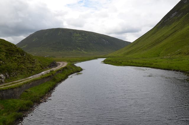
Meall a' Chaorainn (632m), the hill of the rowan, rises north of Strathconon in the NH38 square between Loch Beannacharain and the upper Conon. It is one of the lesser-walked Grahams of Mid-Ross, with a small summit cairn perched on grassy moorland above the broad lower glen. From the top the eye is drawn west to the bigger Strathfarrar hills and east toward the Cromarty Firth.
Quick facts
- Height
- 632m/ 2073ft
- Prominence
- 157 m
- Distance
- 12 km
- Ascent
- 474 m
- Time
- 3–6 hrs
- Grid ref
- NH360827
- Parking
- NH348833
- Nearest
- Ullapool· Inverness 48km
- Dogs
- Dogs on lead required near livestockDog-friendly guide ↗
Height and prominence cross-checked against the Database of British and Irish Hills (CC BY).
No GPX track yet
Walked this route? Share your track to help other walkers.
Standard route
heather moorland 65% · grass slopes 25% · rocky summit 10%
Park at the head of the public road at NH348833 and follow the estate track east before peeling onto open moorland on the south flank. The going is heathery and tussocky low down, easing onto firmer ground above the 500m contour where deer trods can be picked up. The cairn sits in the middle of a wide summit area — gain it on a bearing in mist. Round trip five to six hours.
Terrain
Heather moor and peat hags on the approach with deer trods linking the drier patches. The summit area is broad, featureless grass and lichen-dappled stone — a compass bearing is genuinely needed in cloud. Burns flowing south into Strathconon can swell quickly after rain.
In winter
Strathconon catches snow from northerlies and the broad summit of Meall a' Chaorainn drifts thickly in lee hollows. Ice tends to form on the estate track in shaded sections of the lower walk in. The featureless plateau is dangerous in whiteout — set bearings before you commit and watch for the corniced lip on the north-east edge.
This hill is in the Torridon SAIS forecast area. Check SAIS forecasts in winter (December–April).
Best time of year
Getting there
- Glasgow4h 12m
- Edinburgh4h 22m
OS maps: OS Landranger 20
Mobile signal: Poor. Remote Strathconon/Dirrie More area; limited coverage.
Current conditions
Daylight Today
- Sunrise
- 04:38
- Sunset
- 22:12
- Civil dawn
- 03:33
- Civil dusk
- 23:17
NOAA Solar Calculator · 13 July 2026
Around Meall a' Chaorainn on the SCOT network
Getting there, basing yourself, and what to do off the hill.
Meall a' Chaorainn — common questions
- How difficult is Meall a' Chaorainn?
- Meall a' Chaorainn carries a 4/5 (challenging) grade on the OutdoorSCOT scale. Count on about 12km, 474m of ascent and a 3-6 hour day on the standard route. Terrain: Heather moor and peat hags on the approach with deer trods linking the drier patches.
- How prominent is Meall a' Chaorainn?
- Meall a' Chaorainn has 157m of topographic prominence — the height of its summit above the highest col connecting it to higher ground.
- Where should I park to climb Meall a' Chaorainn?
- Standard parking is at NH348833 near Ullapool. Check the parking grid reference on an OS map before travel; informal laybys can fill on summer weekends.
- When should I climb Meall a' Chaorainn?
- The standard good-weather months for Meall a' Chaorainn are May, June, July, August, September. Outside those months, expect winter conditions on the high ground — full mountain kit, navigation skills, and a check of the SAIS avalanche forecast for the relevant region.
- Can I bring my dog up Meall a' Chaorainn?
- On a lead only — the route crosses ground with livestock or nesting-bird interest.
- What's mobile reception like on Meall a' Chaorainn?
- Poor. Remote Strathconon/Dirrie More area; limited coverage.
- Is Meall a' Chaorainn safe in winter?
- Strathconon catches snow from northerlies and the broad summit of Meall a' Chaorainn drifts thickly in lee hollows. Ice tends to form on the estate track in shaded sections of the lower walk in. The featureless plateau is dangerous in whiteout — set bearings before you commit and watch for the corniced lip on the north-east edge.
Get the OutdoorSCOT weekly
One email a week — new route, hill and bothy guides, seasonal conditions and the odd hard-won lesson. No spam, unsubscribe in one click.