Graham · Central Highlands
Beinn Tharsuinn
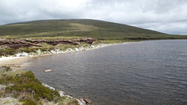
Beinn Tharsuinn (710m) — the transverse hill — at NH41 sits north of the Cromarty Firth between Strath Rusdale and Glen Glass, in the rolling Easter Ross uplands. Several Scottish hills share this name (transverse to a glen line); this is the eastern-Highland example. The small summit cairn looks over Loch Morie and east to the Moray Firth coast, with Ben Wyvis as the dominant skyline to the south-west.
Quick facts
- Height
- 710m/ 2329ft
- Prominence
- 176 m
- Distance
- 13 km
- Ascent
- 582 m
- Time
- 4–6 hrs
- Grid ref
- NH412829
- Nearest
- Ullapool· Inverness 45km
- Dogs
- Dogs on lead required near livestockDog-friendly guide ↗
Height and prominence cross-checked against the Database of British and Irish Hills (CC BY).
No GPX track yet
Walked this route? Share your track to help other walkers.
Standard route
heather moorland 60% · grass and sedge 25% · rocky ridge 15%
From a parking pull-in on the Boath/Strath Rusdale road, take the long estate track north-west across moor and around forestry plantations, then climb the south-east shoulder onto the broad summit. Some 13km return with 582m of cumulative climb. The route is unfrequented and a quad-line gives intermittent help.
Terrain
Forestry edges and quad tracks are useful for the lower half; above the trees the going is on damp heather and peat hags. The transverse summit ridge has several false tops — the true high point carries a small loose cairn. Reseeded sitka plantations on the lower flanks mean access can be diverted year-to-year.
In winter
East-coast snowfall is lighter than the west but Easter Ross hills accumulate windslab in northerlies sweeping in over the Dornoch Firth. The SAIS Northern Highlands zone does not extend this far east but Cairngorm forecasts give a useful proxy. Plantation tracks may be blocked by windthrow — check estate notices.
This hill is in the Creag Meagaidh SAIS forecast area. Check SAIS forecasts in winter (December–April).
Best time of year
Getting there
- Glasgow4h 12m
- Edinburgh4h 20m
OS maps: OS Landranger 20, OS Explorer 437
Mobile signal: Patchy. EE sometimes connects on the upper ridge; otherwise poor in this Easter Ross interior.
Current conditions
Daylight Today
- Sunrise
- 04:37
- Sunset
- 22:12
- Civil dawn
- 03:32
- Civil dusk
- 23:17
NOAA Solar Calculator · 13 July 2026
Around Beinn Tharsuinn on the SCOT network
Getting there, basing yourself, and what to do off the hill.
Getting there: Ardgay station
Kyle of Sutherland; Croick; Far North Line
20km from the hill
tripscot.co.uk
On TripSCOTBase yourself in Ullapool
Main NW Highlands hub; Hebrides ferry; Inverpolly access
30km from the hill
tripscot.co.uk
On TasteSCOTAfter the hill: The Dalmore
Alness — sherried Highland flagship; stately Cromarty Firth setting
28km from the hill
tastescot.co.uk
Beinn Tharsuinn — common questions
- How difficult is Beinn Tharsuinn?
- Beinn Tharsuinn carries a 4/5 (challenging) grade on the OutdoorSCOT scale. Count on about 13km, 582m of ascent and a 4-6 hour day on the standard route. Underfoot: Forestry edges and quad tracks are useful for the lower half; above the trees the going is on damp heather and peat hags.
- What is Beinn Tharsuinn's prominence?
- 176m of prominence. That's the vertical drop from the summit to the col that links Beinn Tharsuinn to the next higher ground.
- When is the best time to climb Beinn Tharsuinn?
- May, June, July, August, September give the most reliable conditions on Beinn Tharsuinn. Beyond that window the high ground turns wintry: carry full mountain kit, be confident navigating, and check the SAIS avalanche forecast for the area.
- Is Beinn Tharsuinn dog-friendly?
- Yes, but dogs must be kept on a lead — there is livestock or ground-nesting bird interest on the route.
- Is there mobile signal on Beinn Tharsuinn?
- Patchy. EE sometimes connects on the upper ridge; otherwise poor in this Easter Ross interior.
- Is Beinn Tharsuinn safe in winter?
- East-coast snowfall is lighter than the west but Easter Ross hills accumulate windslab in northerlies sweeping in over the Dornoch Firth. The SAIS Northern Highlands zone does not extend this far east but Cairngorm forecasts give a useful proxy. Plantation tracks may be blocked by windthrow — check estate notices.
Get the OutdoorSCOT weekly
One email a week — new route, hill and bothy guides, seasonal conditions and the odd hard-won lesson. No spam, unsubscribe in one click.