Graham · Skye & The Small Isles
Marsco
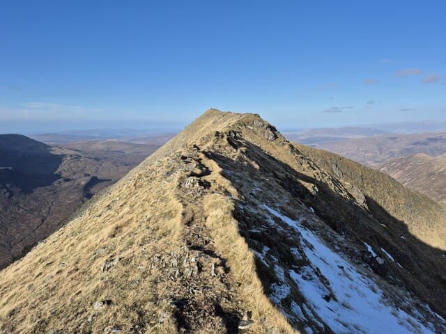
The big rounded pyramid that closes the head of Glen Sligachan, sitting between the Black and Red Cuillin. A brilliant solo Graham day from the Sligachan Hotel. 737 m summit, 14 km out-and-back from Portree, 800 m of ascent. Skye and Small Isles.
Quick facts
- Height
- 737.2m/ 2419ft
- Prominence
- 414 m
- Distance
- ~14 km
- Ascent
- ~800 m
- Time
- 4–6 hrs
- Grid ref
- NG507251
- Parking
- NG486300
- Nearest
- Portree
- Dogs
- Dogs on lead required near livestockDog-friendly guide ↗
Height and prominence cross-checked against the Database of British and Irish Hills (CC BY).
No GPX track yet
Walked this route? Share your track to help other walkers.
Standard route
glen path 20% · rough heather 30% · rocky slope 35% · summit dome 15%
Long path walk from Sligachan into Glen Sligachan, then a steep direct ascent up the west flank. Pathless on the upper slopes but navigation is straightforward in clear weather.
Terrain
Boggy approach on the Glen Sligachan path. Steep, scree-strewn upper slopes. No scrambling.
In winter
Skye winter weather is brutal — Atlantic gales and driving sleet rather than alpine cold.
Kit for this: the winter Munro kit list · which boots take crampons
Best time of year
Getting there
- Glasgow5h 20m
- Edinburgh5h 20m
OS maps: OS Explorer 411
Mobile signal: Brief signal on Skye near Sligachan; 1 bar on the summit
Current conditions
Daylight Today
- Sunrise
- 07:55
- Sunset
- 18:26
- Civil dawn
- 07:16
- Civil dusk
- 19:05
NOAA Solar Calculator · 14 October 2026
Pair with
Curated multi-hill combinations from Marsco.
Around Marsco on the SCOT network
Getting there, basing yourself, and what to do off the hill.
Getting there: Kyle of Lochalsh station
Skye Bridge; Five Sisters of Kintail; Glen Shiel; Plockton
25km from the hill
tripscot.co.uk
On TripSCOTBase yourself in Portree
Main Skye base — Cuillin, Trotternish, Storr
19km from the hill
tripscot.co.uk
On TasteSCOTAfter the hill: Isle of Raasay Distillery
Raasay — new island distillery with rooms; Dun Caan walks from the door
12km from the hill
tastescot.co.uk
Marsco — common questions
- How hard is Marsco?
- We grade Marsco at 3/5, which puts it in moderately challenging territory. The usual route is around 14km with 800m of climbing; allow 4-6 hours. Terrain: Boggy approach on the Glen Sligachan path.
- How prominent is Marsco?
- Marsco has 414m of topographic prominence — the height of its summit above the highest col connecting it to higher ground.
- Where should I park to climb Marsco?
- Standard parking is at NG486300 near Portree. Check the parking grid reference on an OS map before travel; informal laybys can fill on summer weekends.
- When should I climb Marsco?
- The standard good-weather months for Marsco are May, June, July, August, September. Outside those months, expect winter conditions on the high ground — full mountain kit, navigation skills, and a check of the SAIS avalanche forecast for the relevant region.
- Can I bring my dog up Marsco?
- On a lead only — the route crosses ground with livestock or nesting-bird interest.
- What's mobile reception like on Marsco?
- Brief signal on Skye near Sligachan; 1 bar on the summit
- Is Marsco safe in winter?
- Skye winter weather is brutal — Atlantic gales and driving sleet rather than alpine cold.
Get the OutdoorSCOT weekly
One email a week — new route, hill and bothy guides, seasonal conditions and the odd hard-won lesson. No spam, unsubscribe in one click.