Graham · Skye & The Small Isles
Beinn Dearg Mhor
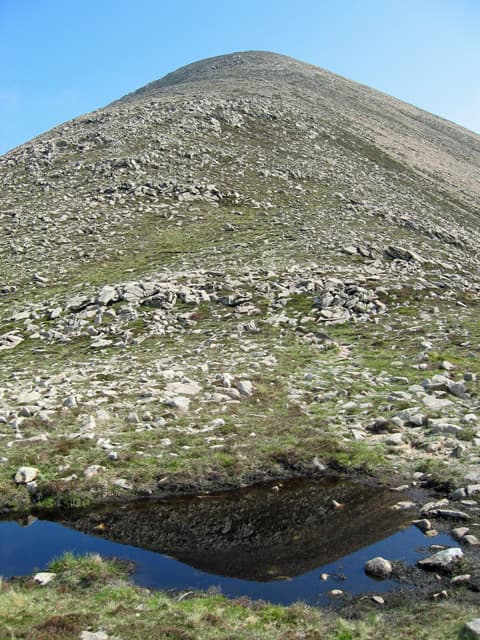
A red-flanked Graham on the western edge of Skye's Minginish peninsula, looking out across Loch Brittle to the Atlantic. Often climbed as a wet-weather alternative when the Cuillin are out of condition.
Gaelic: “mountain, red, big” · Pronunciation: bine jerr-ak vore
Quick facts
- Height
- 733.5m/ 2406ft
- Prominence
- 319 m
- Distance
- 14 km
- Ascent
- 601 m
- Time
- 4–7 hrs
- Grid ref
- NG520284
- Nearest
- Fort William
- Dogs
- Dogs on lead required near livestockDog-friendly guide ↗
Height and prominence cross-checked against the Database of British and Irish Hills (CC BY).
No GPX track yet
Walked this route? Share your track to help other walkers.
Standard route
moorland path 20% · rough heather 40% · rocky slopes 30% · summit area 10%
From the road end at Glen Brittle campsite walk west along the coast track to the Allt Coir' a' Mhadaidh, then climb directly up the south-east flank. The upper slopes broaden onto a rough scree-strewn plateau topped by a small cairn.
Terrain
Coastal grass and bracken at the start, then steep heather and small slabs of Cuillin gabbro. The summit area is bouldery — pick a line round rather than over the larger blocks.
In winter
Skye's maritime climate makes for wet snow rather than ice on this hill. The Cuillin SAIS region rarely applies here as the gradient stays manageable, but cloud can come in off the Atlantic in minutes.
Best time of year
Getting there
- Glasgow4h 45m
- Edinburgh4h 28m
OS maps: OS Landranger 32, OS Explorer 411
Mobile signal: Patchy at Glen Brittle; nothing higher up
Current conditions
Daylight Today
- Sunrise
- 04:53
- Sunset
- 22:08
- Civil dawn
- 03:53
- Civil dusk
- 23:08
NOAA Solar Calculator · 17 July 2026
Around Beinn Dearg Mhor on the SCOT network
Getting there, basing yourself, and what to do off the hill.
Getting there: Kyle of Lochalsh station
Skye Bridge; Five Sisters of Kintail; Glen Shiel; Plockton
24km from the hill
tripscot.co.uk
On TripSCOTBase yourself in Portree
Main Skye base — Cuillin, Trotternish, Storr
16km from the hill
tripscot.co.uk
On TasteSCOTAfter the hill: Isle of Raasay Distillery
Raasay — new island distillery with rooms; Dun Caan walks from the door
8km from the hill
tastescot.co.uk
Beinn Dearg Mhor — common questions
- How hard is Beinn Dearg Mhor?
- We grade Beinn Dearg Mhor at 4/5, which puts it in challenging territory. The usual route is around 14km with 601m of climbing; allow 4-7 hours. Terrain: Coastal grass and bracken at the start, then steep heather and small slabs of Cuillin gabbro.
- How prominent is Beinn Dearg Mhor?
- Beinn Dearg Mhor has 319m of topographic prominence — the height of its summit above the highest col connecting it to higher ground.
- When should I climb Beinn Dearg Mhor?
- The standard good-weather months for Beinn Dearg Mhor are May, June, July, August, September. Outside those months, expect winter conditions on the high ground — full mountain kit, navigation skills, and a check of the SAIS avalanche forecast for the relevant region.
- Can I bring my dog up Beinn Dearg Mhor?
- On a lead only — the route crosses ground with livestock or nesting-bird interest.
- What's mobile reception like on Beinn Dearg Mhor?
- Patchy at Glen Brittle; nothing higher up
- Is Beinn Dearg Mhor safe in winter?
- Skye's maritime climate makes for wet snow rather than ice on this hill. The Cuillin SAIS region rarely applies here as the gradient stays manageable, but cloud can come in off the Atlantic in minutes.
Get the OutdoorSCOT weekly
One email a week — new route, hill and bothy guides, seasonal conditions and the odd hard-won lesson. No spam, unsubscribe in one click.