Munro · Skye & The Small Isles
Sgurr nan Gillean
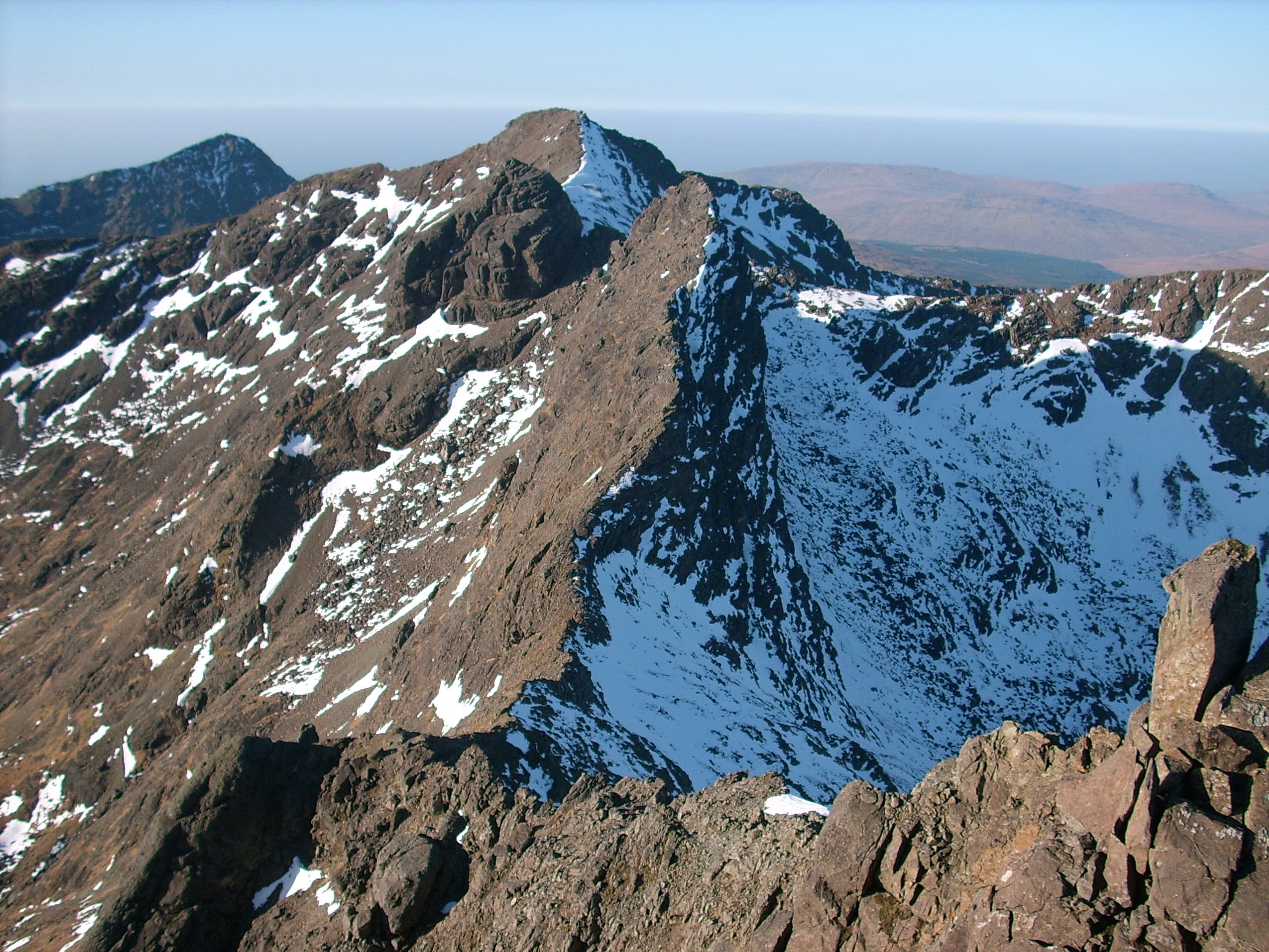
Sgùrr nan Gillean (966m) — "peak of the young men" — is the most iconic and instantly recognisable summit of the Cuillin Ridge, its pointed gabbro spire visible from miles around. The hill marks the northern terminus of the main Cuillin Ridge and is among the most photographed Scottish mountains. The standard "Tourist Route" via Coire Riabhach involves a serious Grade 3 scramble at the top — frequently underestimated by walkers expecting a routine ascent.
Quick facts
- Height
- 966.1m/ 3170ft
- Prominence
- 205 m
- Distance
- 17 km
- Ascent
- 850 m
- Time
- 6–9 hrs
- Grid ref
- NG471252
- Parking
- NG486298
- Nearest
- Fort William
- Dogs
- Dogs on lead required near livestockDog-friendly guide ↗
Height and prominence cross-checked against the Database of British and Irish Hills (CC BY).
No GPX track yet
Walked this route? Share your track to help other walkers.
Standard route
Sligachan path 30% · Rocky hillside 35% · Summit scramble 35%
Start from the Sligachan Hotel car park (paid parking). Take the path south-west across rough moorland into Coire Riabhach, then climb the steep boulder slopes to gain the south-east ridge. The final 100m to the summit is a sustained Grade 3 scramble on excellent gabbro — the technical crux of the day. Most parties return reverse-traverse. The Pinnacle Ridge to the north is one of the great Skye scrambles (Grade 4). Around 11km return with 950m of ascent.
Terrain
The Coire Riabhach approach path is rough boggy ground, then climbs steep boulder slopes onto the south-east ridge. The final scramble to the summit is sustained Grade 3 on bare gabbro — exposed and committing, with airy moves over rock steps. The Pinnacle Ridge to the north is a Grade 4 line for experienced scramblers only. Compass readings unreliable on Cuillin gabbro; carry GPS. The summit pinnacle is too small for a real cairn.
In winter
A major Cuillin winter mountaineering objective. The Tourist Route in winter conditions becomes a Grade III–IV mountaineering climb. Cuillin gabbro glazes readily with verglas. Daylight is short and committed retreat from the upper ridge is impossible without rope work. Very few parties tackle this in winter. The Sligachan Hotel makes a useful winter base.
Best time of year
Getting there
- Glasgow4h 45m
- Edinburgh4h 29m
OS maps: OS Landranger 32
Mobile signal: Dead above 600m in the Cuillin. Sligachan has good 4G. Save mapping before crossing the Sligachan car park — the Tourist Route has no coverage above the lower slopes.
Current conditions
Daylight Today
- Sunrise
- 05:04
- Sunset
- 21:58
- Civil dawn
- 04:08
- Civil dusk
- 22:54
NOAA Solar Calculator · 23 July 2026
Pair with
Curated multi-hill combinations from Sgurr nan Gillean.
Around Sgurr nan Gillean on the SCOT network
Getting there, basing yourself, and what to do off the hill.
Getting there: Kyle of Lochalsh station
Skye Bridge; Five Sisters of Kintail; Glen Shiel; Plockton
29km from the hill
tripscot.co.uk
On TripSCOTBase yourself in Portree
Main Skye base — Cuillin, Trotternish, Storr
18km from the hill
tripscot.co.uk
On TasteSCOTAfter the hill: Talisker
Carbost on Skye — Cuillin foothills distillery; peppery, maritime, big-bodied
12km from the hill
tastescot.co.uk
Sgurr nan Gillean — common questions
- What difficulty is Sgurr nan Gillean?
- On the OutdoorSCOT scale, Sgurr nan Gillean comes in at 5/5 — very challenging. Expect roughly 17km and 850m of ascent on the usual route — 6-9 hours for most parties. Terrain: The Coire Riabhach approach path is rough boggy ground, then climbs steep boulder slopes onto the south-east ridge.
- How prominent is Sgurr nan Gillean?
- Sgurr nan Gillean has 205m of topographic prominence — the height of its summit above the highest col connecting it to higher ground.
- Where should I park to climb Sgurr nan Gillean?
- Standard parking is at NG486298 near Fort William. Check the parking grid reference on an OS map before travel; informal laybys can fill on summer weekends.
- When should I climb Sgurr nan Gillean?
- The standard good-weather months for Sgurr nan Gillean are May, June, July, August, September. Outside those months, expect winter conditions on the high ground — full mountain kit, navigation skills, and a check of the SAIS avalanche forecast for the relevant region.
- Can I bring my dog up Sgurr nan Gillean?
- On a lead only — the route crosses ground with livestock or nesting-bird interest.
- What's mobile reception like on Sgurr nan Gillean?
- Dead above 600m in the Cuillin. Sligachan has good 4G. Save mapping before crossing the Sligachan car park — the Tourist Route has no coverage above the lower slopes.
- Is Sgurr nan Gillean safe in winter?
- A major Cuillin winter mountaineering objective. The Tourist Route in winter conditions becomes a Grade III–IV mountaineering climb. Cuillin gabbro glazes readily with verglas. Daylight is short and committed retreat from the upper ridge is impossible without rope work. Very few parties tackle this in winter. The Sligachan Hotel makes a useful winter base.
Get the OutdoorSCOT weekly
One email a week — new route, hill and bothy guides, seasonal conditions and the odd hard-won lesson. No spam, unsubscribe in one click.