Graham · Glen Coe & Lochaber
Glas Bheinn
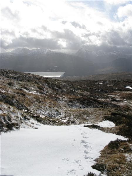
A subsidiary Graham on the broad Mamore-side ridge above Kinlochleven, often passed over in favour of the higher Munros to the north. Worth a visit on a low-cloud day when the bigger hills are socked in.
Gaelic: “grey-green” · Pronunciation: glass bheinn
Quick facts
- Height
- 731.5m/ 2400ft
- Prominence
- 292 m
- Distance
- 13 km
- Ascent
- 599 m
- Time
- 4–6 hrs
- Grid ref
- NN171918
- Nearest city
- Fort William· 19km
- Dogs
- Dogs on lead required near livestockDog-friendly guide ↗
Height and prominence cross-checked against the Database of British and Irish Hills (CC BY).
No GPX track yet
Walked this route? Share your track to help other walkers.
Standard route
glen access 15% · heather hillside 50% · grassy ridge 25% · summit area 10%
From Kinlochleven follow the West Highland Way north-west out of the village, then break right onto the old military road up to the Lairig Mor. Leave the track at the Allt a' Choire Mhusgain and climb the broad east ridge to the rounded top.
Terrain
WHW track and old military road give easy access. Above the path, heather, grass and a few peat hags. The summit is broad and unremarkable underfoot.
In winter
Snow is reliable from December onwards but the angle stays gentle. Lochaber SAIS forecast covers the area but avalanche risk on this hill itself is low. The WHW remains the safest approach.
This hill is in the Glen Coe SAIS forecast area. Check SAIS forecasts in winter (December–April).
Best time of year
Getting there
- Glasgow3h 50m
- Edinburgh3h 5m
OS maps: OS Landranger 41, OS Explorer 391
Mobile signal: Signal in Kinlochleven; intermittent on the Lairig Mor
Current conditions
Daylight Today
- Sunrise
- 04:45
- Sunset
- 22:07
- Civil dawn
- 03:44
- Civil dusk
- 23:08
NOAA Solar Calculator · 13 July 2026
Around Glas Bheinn on the SCOT network
Getting there, basing yourself, and what to do off the hill.
Getting there: Roy Bridge station
Glen Roy; Grey Corries (Stob Choire Claurigh, Sgurr Choinnich Mor)
15km from the hill
tripscot.co.uk
On TripSCOTBase yourself in Fort William
Ben Nevis base, West Highland Line, gateway to Lochaber
19km from the hill
tripscot.co.uk
On TasteSCOTAfter the hill: Ben Nevis Distillery
Fort William — Lochaber distillery at the foot of the Ben; long-aged Japanese-owned classics
17km from the hill
tastescot.co.uk
Glas Bheinn — common questions
- How difficult is Glas Bheinn?
- Glas Bheinn carries a 2/5 (moderate) grade on the OutdoorSCOT scale. Count on about 13km, 599m of ascent and a 4-6 hour day on the standard route. Ground conditions: WHW track and old military road give easy access.
- How much drop does Glas Bheinn have?
- The drop is 292m: measured from the summit of Glas Bheinn down to the saddle joining it to higher terrain.
- What's the best month to climb Glas Bheinn?
- Aim for April, May, June, July, August, September, October on Glas Bheinn. In the remaining months treat it as a winter hill — full kit, solid navigation, and a look at the relevant SAIS avalanche forecast before you go.
- Can dogs go up Glas Bheinn?
- Dogs are fine on a lead. The route passes livestock or ground-nesting bird habitat, so keep them close throughout.
- Will I get phone signal on Glas Bheinn?
- Signal in Kinlochleven; intermittent on the Lairig Mor
- Is Glas Bheinn safe in winter?
- Snow is reliable from December onwards but the angle stays gentle. Lochaber SAIS forecast covers the area but avalanche risk on this hill itself is low. The WHW remains the safest approach.
Get the OutdoorSCOT weekly
One email a week — new route, hill and bothy guides, seasonal conditions and the odd hard-won lesson. No spam, unsubscribe in one click.