Graham · North-West Highlands
Beinn a' Chlachain (Meall an Doireachain)
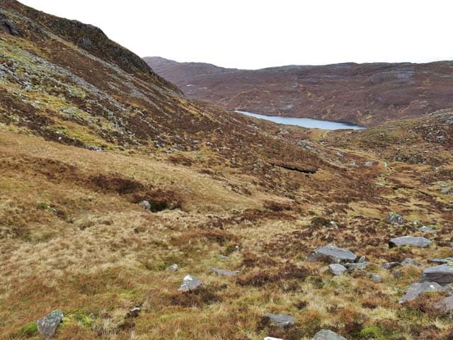
Beinn a' Chlachain, also called Meall an Doireachain (625m), sits on the Applecross peninsula in the NG74 square, looking west over the Inner Sound to Raasay and Skye. The Torridonian sandstone summit rock perches at the end of a long, broad ridge dotted with lochans, and the sea panorama is one of the finest of any Graham in the country. Access is from the single-track road over the Bealach na Bà.
Quick facts
- Height
- 625.8m/ 2053ft
- Prominence
- 373 m
- Distance
- 12 km
- Ascent
- 469 m
- Time
- 3–6 hrs
- Grid ref
- NG724490
- Parking
- NG750520
- Nearest
- Ullapool· Inverness 94km
- Dogs
- Dogs on lead required near livestockDog-friendly guide ↗
Height and prominence cross-checked against the Database of British and Irish Hills (CC BY).
No GPX track yet
Walked this route? Share your track to help other walkers.
Standard route
heather and bog 60% · grass slopes 25% · rocky outcrops 15%
Park near NG750520 on the high road above Applecross and traverse south-west across open ground, picking a line through the maze of lochans on the broad ridge. Boggy depressions slow progress between the firmer rock platforms. The summit rock is reached after a final easy pull, and the descent should reverse the outward route — straying east leads onto steep mixed ground above Loch Kishorn.
Terrain
Sandstone slabs, peat hollows and a host of small lochans dominate the plateau. The going is rarely fast — expect to weave between bog and outcrop. Compass work is essential because the landscape feels uniformly horizontal once the road is out of sight.
In winter
Applecross hills catch wet snow off the Inner Sound and the lochan-strewn plateau is treacherous when frozen, with hidden water under thin ice. The summit rock can glaze quickly. The road from Tornapress over the Bealach na Bà is regularly closed in winter, so check before setting out.
This hill is in the Torridon SAIS forecast area. Check SAIS forecasts in winter (December–April).
Best time of year
Getting there
- Glasgow4h 54m
- Edinburgh4h 28m
OS maps: OS Landranger 24
Mobile signal: Poor. Applecross peninsula; very most networks struggle here.
Current conditions
Daylight Today
- Sunrise
- 04:44
- Sunset
- 22:14
- Civil dawn
- 03:41
- Civil dusk
- 23:17
NOAA Solar Calculator · 13 July 2026
Got a photo of Beinn a' Chlachain (Meall an Doireachain)?
30 seconds, helps other walkers.
Submit a photoAround Beinn a' Chlachain (Meall an Doireachain) on the SCOT network
Getting there, basing yourself, and what to do off the hill.
Getting there: Plockton station
Coastal Wester Ross; Plockton village; Skye Bridge approach
18km from the hill
tripscot.co.uk
On TripSCOTBase yourself in Portree
Main Skye base — Cuillin, Trotternish, Storr
25km from the hill
tripscot.co.uk
On TasteSCOTAfter the hill: Isle of Raasay Distillery
Raasay — new island distillery with rooms; Dun Caan walks from the door
22km from the hill
tastescot.co.uk
Beinn a' Chlachain (Meall an Doireachain) — common questions
- What difficulty is Beinn a' Chlachain (Meall an Doireachain)?
- On the OutdoorSCOT scale, Beinn a' Chlachain (Meall an Doireachain) comes in at 4/5 — challenging. Expect roughly 12km and 469m of ascent on the usual route — 3-6 hours for most parties. Terrain: Sandstone slabs, peat hollows and a host of small lochans dominate the plateau.
- How prominent is Beinn a' Chlachain (Meall an Doireachain)?
- Beinn a' Chlachain (Meall an Doireachain) has 373m of topographic prominence — the height of its summit above the highest col connecting it to higher ground.
- Where should I park to climb Beinn a' Chlachain (Meall an Doireachain)?
- Standard parking is at NG750520 near Ullapool. Check the parking grid reference on an OS map before travel; informal laybys can fill on summer weekends.
- When should I climb Beinn a' Chlachain (Meall an Doireachain)?
- The standard good-weather months for Beinn a' Chlachain (Meall an Doireachain) are May, June, July, August, September. Outside those months, expect winter conditions on the high ground — full mountain kit, navigation skills, and a check of the SAIS avalanche forecast for the relevant region.
- Can I bring my dog up Beinn a' Chlachain (Meall an Doireachain)?
- On a lead only — the route crosses ground with livestock or nesting-bird interest.
- What's mobile reception like on Beinn a' Chlachain (Meall an Doireachain)?
- Poor. Applecross peninsula; very most networks struggle here.
- Is Beinn a' Chlachain (Meall an Doireachain) safe in winter?
- Applecross hills catch wet snow off the Inner Sound and the lochan-strewn plateau is treacherous when frozen, with hidden water under thin ice. The summit rock can glaze quickly. The road from Tornapress over the Bealach na Bà is regularly closed in winter, so check before setting out.
Get the OutdoorSCOT weekly
One email a week — new route, hill and bothy guides, seasonal conditions and the odd hard-won lesson. No spam, unsubscribe in one click.