Graham · North-West Highlands
Beinn na h-Eaglaise
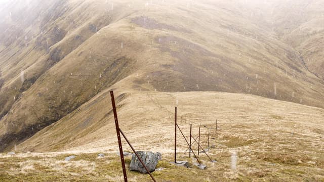
A craggy Torridonian Graham above Loch Damh, sitting between the giants of Liathach and Beinn Damh. The hill of the church takes its name from the chapel-shaped summit block — a striking little tower of red sandstone.
Quick facts
- Height
- 735.1m/ 2412ft
- Prominence
- 305 m
- Distance
- 14 km
- Ascent
- 603 m
- Time
- 4–7 hrs
- Grid ref
- NG908523
- Parking
- NG902509
- Nearest
- Ullapool· Inverness 76km
- Dogs
- Dogs on lead required near livestockDog-friendly guide ↗
Height and prominence cross-checked against the Database of British and Irish Hills (CC BY).
No GPX track yet
Walked this route? Share your track to help other walkers.
Standard route
moorland path 20% · heather hillside 50% · grassy upper slopes 20% · summit area 10%
From the Loch Damh viewpoint south of Annat take the stalkers' path up Coire Roill, then break west onto the south ridge of the hill. The final summit knoll involves a short, easy scramble onto the chapel block.
Terrain
Stalkers' path for the approach, then heather and Torridonian sandstone slabs. The summit block has positive holds but is genuinely exposed on its north side.
In winter
The summit tower is a different proposition under snow — the easy scramble becomes a proper winter problem. Loch Damh holds cloud for days and Torridon SAIS advice applies to the surrounding corries.
This hill is in the Torridon SAIS forecast area. Check SAIS forecasts in winter (December–April).
Best time of year
Getting there
- Glasgow4h 49m
- Edinburgh4h 18m
OS maps: OS Landranger 25
Mobile signal: No signal in Glen Torridon south of Annat
Current conditions
Daylight Today
- Sunrise
- 04:43
- Sunset
- 22:13
- Civil dawn
- 03:39
- Civil dusk
- 23:16
NOAA Solar Calculator · 13 July 2026
Around Beinn na h-Eaglaise on the SCOT network
Getting there, basing yourself, and what to do off the hill.
Beinn na h-Eaglaise — common questions
- How hard is Beinn na h-Eaglaise?
- We grade Beinn na h-Eaglaise at 4/5, which puts it in challenging territory. The usual route is around 14km with 603m of climbing; allow 4-7 hours. Terrain: Stalkers' path for the approach, then heather and Torridonian sandstone slabs.
- How prominent is Beinn na h-Eaglaise?
- Beinn na h-Eaglaise has 305m of topographic prominence — the height of its summit above the highest col connecting it to higher ground.
- Where should I park to climb Beinn na h-Eaglaise?
- Standard parking is at NG902509 near Ullapool. Check the parking grid reference on an OS map before travel; informal laybys can fill on summer weekends.
- When should I climb Beinn na h-Eaglaise?
- The standard good-weather months for Beinn na h-Eaglaise are May, June, July, August, September. Outside those months, expect winter conditions on the high ground — full mountain kit, navigation skills, and a check of the SAIS avalanche forecast for the relevant region.
- Can I bring my dog up Beinn na h-Eaglaise?
- On a lead only — the route crosses ground with livestock or nesting-bird interest.
- What's mobile reception like on Beinn na h-Eaglaise?
- No signal in Glen Torridon south of Annat
- Is Beinn na h-Eaglaise safe in winter?
- The summit tower is a different proposition under snow — the easy scramble becomes a proper winter problem. Loch Damh holds cloud for days and Torridon SAIS advice applies to the surrounding corries.
Get the OutdoorSCOT weekly
One email a week — new route, hill and bothy guides, seasonal conditions and the odd hard-won lesson. No spam, unsubscribe in one click.