Graham · North-West Highlands
Carn Breac
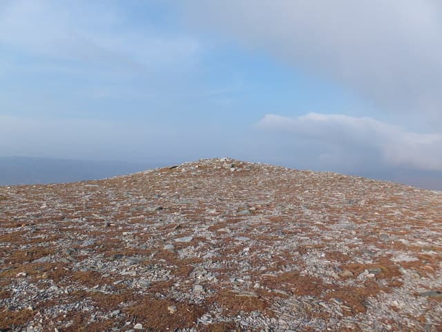
Carn Breac (677m) — the speckled cairn — stands above the south side of Loch Gowan in NH04, on the watershed between Achnasheen and Glen Carron. Its 392m of prominence gives it a fine independent character, and the rocky outcrop summit looks straight across to the Achnashellach Munros and west toward the saw-edge of Maol Chean-dearg.
Quick facts
- Height
- 677.8m/ 2224ft
- Prominence
- 392 m
- Distance
- 13 km
- Ascent
- 555 m
- Time
- 4–6 hrs
- Grid ref
- NH046531
- Parking
- NH022501
- Nearest
- Ullapool· Inverness 62km
- Dogs
- Dogs on lead required near livestockDog-friendly guide ↗
Height and prominence cross-checked against the Database of British and Irish Hills (CC BY).
No GPX track yet
Walked this route? Share your track to help other walkers.
Standard route
heather moorland 65% · grass slopes 25% · rocky summit 10%
Park beside the A890 at Loch Gowan and follow a faint quad rut south through bog onto the lower heather slopes. A direct line up the north spur on tussock and slab gains the broad ridge at around 500m, then a stony walk south leads to the summit outcrop. The view down Loch Carron justifies the steep middle section of the climb.
Terrain
Bog and tussock on the lochside approach, then heather and patches of slabby sandstone on the steeper north spur. The upper ridge is stony and pleasant on grippy rock. Pathless throughout but the line is obvious in clear weather.
In winter
Carn Breac catches the wet snow of the Achnasheen-Achnashellach gap and the north spur ices up in any cold snap. The summit outcrop becomes a serious step in full winter. SAIS Torridon forecasts apply for the wider area though Carn Breac itself is rarely on the avalanche radar.
This hill is in the Torridon SAIS forecast area. Check SAIS forecasts in winter (December–April).
Best time of year
Getting there
- Glasgow4h 45m
- Edinburgh4h 9m
OS maps: OS Landranger 25
Mobile signal: Poor. Remote Strathfarrar location; most networks struggle here.
Current conditions
Daylight Today
- Sunrise
- 04:42
- Sunset
- 22:12
- Civil dawn
- 03:38
- Civil dusk
- 23:15
NOAA Solar Calculator · 13 July 2026
Around Carn Breac on the SCOT network
Getting there, basing yourself, and what to do off the hill.
Carn Breac — common questions
- How difficult is Carn Breac?
- Carn Breac carries a 4/5 (challenging) grade on the OutdoorSCOT scale. Count on about 13km, 555m of ascent and a 4-6 hour day on the standard route. Underfoot: Bog and tussock on the lochside approach, then heather and patches of slabby sandstone on the steeper north spur.
- What is Carn Breac's prominence?
- 392m of prominence. That's the vertical drop from the summit to the col that links Carn Breac to the next higher ground.
- Where do I park for Carn Breac?
- Most walkers start from NH022501 near Ullapool. Verify the grid reference on an OS map before you set off — space is tight on busy summer weekends.
- When is the best time to climb Carn Breac?
- May, June, July, August, September give the most reliable conditions on Carn Breac. Beyond that window the high ground turns wintry: carry full mountain kit, be confident navigating, and check the SAIS avalanche forecast for the area.
- Is Carn Breac dog-friendly?
- Yes, but dogs must be kept on a lead — there is livestock or ground-nesting bird interest on the route.
- Is there mobile signal on Carn Breac?
- Poor. Remote Strathfarrar location; most networks struggle here.
- Is Carn Breac safe in winter?
- Carn Breac catches the wet snow of the Achnasheen-Achnashellach gap and the north spur ices up in any cold snap. The summit outcrop becomes a serious step in full winter. SAIS Torridon forecasts apply for the wider area though Carn Breac itself is rarely on the avalanche radar.
Get the OutdoorSCOT weekly
One email a week — new route, hill and bothy guides, seasonal conditions and the odd hard-won lesson. No spam, unsubscribe in one click.