Donald · Galloway
Meaul
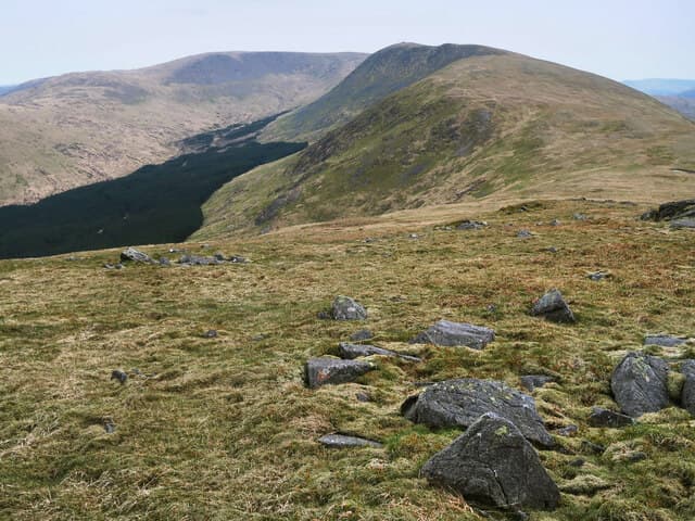
Meaul is the northernmost Donald of the Rhinns of Kells ridge, just above Loch Doon and the start of the Doon valley. A weathered trig pillar caps a wide grassy summit, with a perfect view down to the loch and across to the wind turbines of Windy Standard.
Quick facts
- Height
- 695m/ 2280ft
- Prominence
- 74 m
- Distance
- 13 km
- Ascent
- 570 m
- Time
- 3–6 hrs
- Grid ref
- NX500909
- Parking
- NX497903
- Nearest city
- Dumfries· 50km
- Dogs
- Dogs on lead required near livestockDog-friendly guide ↗
Height and prominence cross-checked against the Database of British and Irish Hills (CC BY).
No GPX track yet
Walked this route? Share your track to help other walkers.
Standard route
heather moorland 55% · grass moorland 35% · rocky summit 10%
Park at the Stroan Bridge below Loch Doon and follow forest roads east before climbing onto the north shoulder. Linking it with neighbouring Cairnsgarroch makes a satisfying loop back to the loch.
Terrain
Solid forest road for the first half — easy walking. Open hill is short heath on a flat tableland; the trig pillar is visible from a distance once you breach the plantation.
In winter
A relatively gentle winter outing for the Galloway hills, with the forest road usually passable on foot even after snowfall. The summit itself is wind-blown and seldom carries deep cover. Watch the loch shore — ice plates can break under foot.
Best time of year
Getting there
- Glasgow2h 47m
- Edinburgh2h 23m
OS maps: OS Landranger 77
Mobile signal: Mixed. EE in and out; patchy in the Galloway interior.
Current conditions
Daylight Today
- Sunrise
- 04:54
- Sunset
- 21:52
- Civil dawn
- 04:00
- Civil dusk
- 22:46
NOAA Solar Calculator · 13 July 2026
Around Meaul on the SCOT network
Getting there, basing yourself, and what to do off the hill.
Meaul — common questions
- How difficult is Meaul?
- Meaul carries a 3/5 (moderately challenging) grade on the OutdoorSCOT scale. Count on about 13km, 570m of ascent and a 3-6 hour day on the standard route. Terrain: Solid forest road for the first half — easy walking.
- How prominent is Meaul?
- Meaul has 74m of topographic prominence — the height of its summit above the highest col connecting it to higher ground.
- Where should I park to climb Meaul?
- Standard parking is at NX497903. Check the parking grid reference on an OS map before travel; informal laybys can fill on summer weekends.
- When should I climb Meaul?
- The standard good-weather months for Meaul are March, April, May, June, July, August, September, October, November. Outside those months, expect winter conditions on the high ground — full mountain kit, navigation skills, and a check of the SAIS avalanche forecast for the relevant region.
- Can I bring my dog up Meaul?
- On a lead only — the route crosses ground with livestock or nesting-bird interest.
- What's mobile reception like on Meaul?
- Mixed. EE in and out; patchy in the Galloway interior.
- Is Meaul safe in winter?
- A relatively gentle winter outing for the Galloway hills, with the forest road usually passable on foot even after snowfall. The summit itself is wind-blown and seldom carries deep cover. Watch the loch shore — ice plates can break under foot.
Get the OutdoorSCOT weekly
One email a week — new route, hill and bothy guides, seasonal conditions and the odd hard-won lesson. No spam, unsubscribe in one click.