Donald · Galloway
Cairnsgarroch
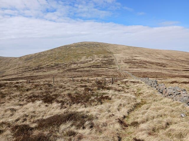
Cairnsgarroch — 'rough cairn' in Gaelic — is the high point of the moorland east of the Carsphairn group, between the Water of Ken and the Rhinns of Kells. An embedded boulder topped with a small cairn sits on a flat heather summit.
Quick facts
- Height
- 659m/ 2162ft
- Prominence
- 105 m
- Distance
- 13 km
- Ascent
- 540 m
- Time
- 3–6 hrs
- Grid ref
- NX515913
- Parking
- NX507912
- Nearest city
- Dumfries· 48km
- Dogs
- Dogs on lead required near livestockDog-friendly guide ↗
Height and prominence cross-checked against the Database of British and Irish Hills (CC BY).
No GPX track yet
Walked this route? Share your track to help other walkers.
Standard route
heather moorland 60% · grass moorland 30% · rocky summit 10%
From the Forrest Lodge road end in Glenkens, take a forest track north then break out onto open heather for the climb. About 11km return with 480m of climb.
Terrain
Deep heather and tussock above the forest line. No path of note on the upper hill; route-finding by compass between the forestry breaks.
In winter
Heather holds drift and the deep hollows fill in fast. Approach from Forrest Lodge can become a long slog on snow-covered forest tracks.
Best time of year
Getting there
- Glasgow2h 46m
- Edinburgh2h 22m
OS maps: OS Landranger 77
Mobile signal: Moderate. EE unreliable on top; coverage limited in south Galloway.
Current conditions
Daylight Today
- Sunrise
- 05:00
- Sunset
- 21:47
- Civil dawn
- 04:07
- Civil dusk
- 22:40
NOAA Solar Calculator · 17 July 2026
Around Cairnsgarroch on the SCOT network
Getting there, basing yourself, and what to do off the hill.
Cairnsgarroch — common questions
- What difficulty is Cairnsgarroch?
- On the OutdoorSCOT scale, Cairnsgarroch comes in at 3/5 — moderately challenging. Expect roughly 13km and 540m of ascent on the usual route — 3-6 hours for most parties. Ground conditions: Deep heather and tussock above the forest line.
- How much drop does Cairnsgarroch have?
- The drop is 105m: measured from the summit of Cairnsgarroch down to the saddle joining it to higher terrain.
- Where's the parking for Cairnsgarroch?
- Park at NX507912. Double-check the grid reference on an OS map first; informal laybys here fill early in high season.
- What's the best month to climb Cairnsgarroch?
- Aim for March, April, May, June, July, August, September, October, November on Cairnsgarroch. In the remaining months treat it as a winter hill — full kit, solid navigation, and a look at the relevant SAIS avalanche forecast before you go.
- Can dogs go up Cairnsgarroch?
- Dogs are fine on a lead. The route passes livestock or ground-nesting bird habitat, so keep them close throughout.
- Will I get phone signal on Cairnsgarroch?
- Moderate. EE unreliable on top; coverage limited in south Galloway.
- Is Cairnsgarroch safe in winter?
- Heather holds drift and the deep hollows fill in fast. Approach from Forrest Lodge can become a long slog on snow-covered forest tracks.
Get the OutdoorSCOT weekly
One email a week — new route, hill and bothy guides, seasonal conditions and the odd hard-won lesson. No spam, unsubscribe in one click.