Graham · Galloway
Mullwharchar
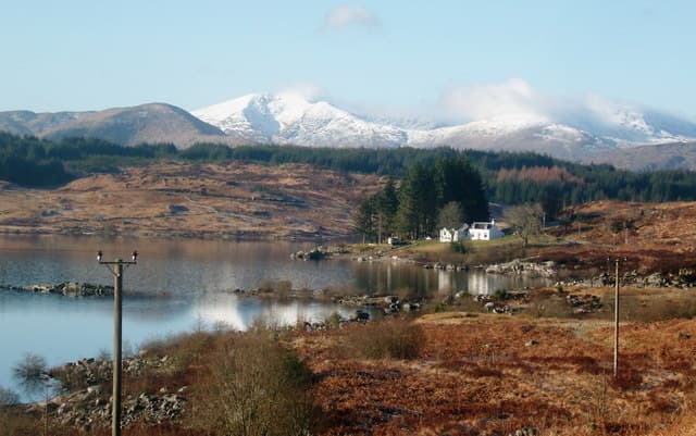
Mullwharchar (692m) is the remote granite dome at the heart of the Range of the Awful Hand, set in the NX48 square between Loch Enoch and Loch Doon. The name means the hill of the call, possibly from huntsmen's horns. Famous in the 1980s as a proposed nuclear waste site, it remains one of the loneliest summits south of the Highland line.
Quick facts
- Height
- 692m/ 2270ft
- Prominence
- 187 m
- Distance
- 13 km
- Ascent
- 567 m
- Time
- 3–6 hrs
- Grid ref
- NX454866
- Parking
- NX454856
- Nearest city
- Dumfries· 53km
- Dogs
- Dogs on lead required near livestockDog-friendly guide ↗
Height and prominence cross-checked against the Database of British and Irish Hills (CC BY).
No GPX track yet
Walked this route? Share your track to help other walkers.
Standard route
heather and bog 55% · grass moorland 30% · rocky summit 15%
From the parking at Bruce's Stone in Glen Trool follow the Merrick path to the col below Benyellary, then strike east across heather and granite slabs past Loch Enoch. The final 200m up the south-west flank weaves between bedrock and bog. Most parties traverse from Merrick or Kirriereoch as part of a Galloway round.
Terrain
Granite slabs are the dominant feature — clean dry rock interspersed with peat hag and pools of standing water. Pathless above Loch Enoch with route-finding through the slabs the main challenge. The summit itself is a low granite outcrop crowned with a small cairn.
In winter
Galloway granite holds verglas and the exposed slabs around Loch Enoch ice into wide skating rinks under cold rain. Snow rarely lies deep but the slabs become serious in any frost. The remoteness — over 8km to road in any direction — is the dominant risk factor here in winter.
Best time of year
Getting there
- Glasgow2h 54m
- Edinburgh3h 31m
OS maps: OS Landranger 77
Mobile signal: Moderate. EE intermittent up top; better on south-eastern approaches.
Current conditions
Daylight Today
- Sunrise
- 04:55
- Sunset
- 21:52
- Civil dawn
- 04:01
- Civil dusk
- 22:46
NOAA Solar Calculator · 13 July 2026
Pair with
Curated multi-hill combinations from Mullwharchar.
Around Mullwharchar on the SCOT network
Getting there, basing yourself, and what to do off the hill.
Mullwharchar — common questions
- How difficult is Mullwharchar?
- Mullwharchar carries a 3/5 (moderately challenging) grade on the OutdoorSCOT scale. Count on about 13km, 567m of ascent and a 3-6 hour day on the standard route. Terrain: Granite slabs are the dominant feature — clean dry rock interspersed with peat hag and pools of standing water.
- How prominent is Mullwharchar?
- Mullwharchar has 187m of topographic prominence — the height of its summit above the highest col connecting it to higher ground.
- Where should I park to climb Mullwharchar?
- Standard parking is at NX454856. Check the parking grid reference on an OS map before travel; informal laybys can fill on summer weekends.
- When should I climb Mullwharchar?
- The standard good-weather months for Mullwharchar are March, April, May, June, July, August, September, October, November. Outside those months, expect winter conditions on the high ground — full mountain kit, navigation skills, and a check of the SAIS avalanche forecast for the relevant region.
- Can I bring my dog up Mullwharchar?
- On a lead only — the route crosses ground with livestock or nesting-bird interest.
- What's mobile reception like on Mullwharchar?
- Moderate. EE intermittent up top; better on south-eastern approaches.
- Is Mullwharchar safe in winter?
- Galloway granite holds verglas and the exposed slabs around Loch Enoch ice into wide skating rinks under cold rain. Snow rarely lies deep but the slabs become serious in any frost. The remoteness — over 8km to road in any direction — is the dominant risk factor here in winter.
Get the OutdoorSCOT weekly
One email a week — new route, hill and bothy guides, seasonal conditions and the odd hard-won lesson. No spam, unsubscribe in one click.