Graham · Galloway
Cairnsmore of Fleet
Cairnsmore of Fleet (711m) is the granite dome at NX50 that dominates the lower Cree valley and gives the surrounding National Nature Reserve its name. The hill features in John Buchan's "The Thirty-Nine Steps" — Hannay's flight across "the moors of Galloway" took him over these very flanks. From the summit cairn the view stretches over the Wigtown peninsula to the Solway, the Isle of Man and on the clearest days as far as Snowdonia.
Quick facts
- Height
- 711.1m/ 2333ft
- Prominence
- 522 m
- Distance
- 13 km
- Ascent
- 583 m
- Time
- 3–6 hrs
- Grid ref
- NX501670
- Parking
- NX509670
- Nearest city
- Dumfries· 48km
- Dogs
- Dogs on lead required near livestockDog-friendly guide ↗
Height and prominence cross-checked against the Database of British and Irish Hills (CC BY).
No GPX track yet
Walked this route? Share your track to help other walkers.
Standard route
heather moorland 55% · grass and rushes 25% · rocky summit 20%
Park at Cairnsmore Estate (NX509670) where waymarked access begins. The path climbs gradually through plantation forestry, breaking out onto the open hillside near the Knee of Cairnsmore. From there a well-trodden line rises to the summit dome, often boggy after rain. About 13km return with 583m climbed; an unmistakable route in clear weather.
Terrain
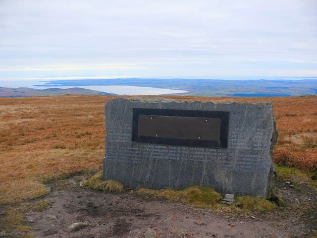
Granite blocks emerge through peat between 500m and the summit; the going on the upper dome is on bilberry and tussock with intermittent stone slabs. The famous memorial to wartime aircrew sits on the upper plateau, a useful waypoint. Be wary of feral goat sign on the lower slopes — they cross the path frequently.
In winter
Snow drifts deeply into the granite hollows on the broad plateau, and the Knee of Cairnsmore catches lee accumulation from southerlies. The SAIS Southern Uplands area is the formal reference. South-westerly Solway storms drive horizontal sleet for days; full storm shells are appropriate even at this modest altitude.
Best time of year
Getting there
- Glasgow2h 6m
- Edinburgh3h 47m
OS maps: OS Landranger 83
Mobile signal: Solid summit coverage; EE and Vodafone hold. Some gaps on approach from Clatteringshaws.
Current conditions
Daylight Today
- Sunrise
- 04:56
- Sunset
- 21:50
- Civil dawn
- 04:02
- Civil dusk
- 22:44
NOAA Solar Calculator · 13 July 2026
Pair with
Curated multi-hill combinations from Cairnsmore of Fleet.
Around Cairnsmore of Fleet on the SCOT network
Getting there, basing yourself, and what to do off the hill.
Getting there: Ayr station
Ayrshire coast; Galloway approach via bus/car
57km from the hill
tripscot.co.uk
On TripSCOTBase yourself in Kirkcudbright
Galloway base — Solway coast, Galloway Forest, Mull of Galloway Trail
24km from the hill
tripscot.co.uk
On TasteSCOTAfter the hill: Bladnoch
Wigtown — Galloway's only distillery; Scotland's most southerly
15km from the hill
tastescot.co.uk
Cairnsmore of Fleet — common questions
- How difficult is Cairnsmore of Fleet?
- Cairnsmore of Fleet carries a 3/5 (moderately challenging) grade on the OutdoorSCOT scale. Count on about 13km, 583m of ascent and a 3-6 hour day on the standard route. Ground conditions: Granite blocks emerge through peat between 500m and the summit; the going on the upper dome is on bilberry and tussock with intermittent stone slabs.
- How much drop does Cairnsmore of Fleet have?
- The drop is 522m: measured from the summit of Cairnsmore of Fleet down to the saddle joining it to higher terrain.
- Where's the parking for Cairnsmore of Fleet?
- Park at NX509670. Double-check the grid reference on an OS map first; informal laybys here fill early in high season.
- What's the best month to climb Cairnsmore of Fleet?
- Aim for April, May, June, July, August, September, October on Cairnsmore of Fleet. In the remaining months treat it as a winter hill — full kit, solid navigation, and a look at the relevant SAIS avalanche forecast before you go.
- Can dogs go up Cairnsmore of Fleet?
- Dogs are fine on a lead. The route passes livestock or ground-nesting bird habitat, so keep them close throughout.
- Will I get phone signal on Cairnsmore of Fleet?
- Solid summit coverage; EE and Vodafone hold. Some gaps on approach from Clatteringshaws.
- Is Cairnsmore of Fleet safe in winter?
- Snow drifts deeply into the granite hollows on the broad plateau, and the Knee of Cairnsmore catches lee accumulation from southerlies. The SAIS Southern Uplands area is the formal reference. South-westerly Solway storms drive horizontal sleet for days; full storm shells are appropriate even at this modest altitude.
Get the OutdoorSCOT weekly
One email a week — new route, hill and bothy guides, seasonal conditions and the odd hard-won lesson. No spam, unsubscribe in one click.