Corbett · Galloway
Shalloch on Minnoch
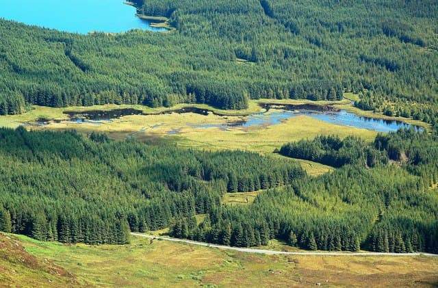
Shalloch on Minnoch is the most northerly hill of the Range of the Awful Hand, the great Galloway ridge that runs south to Merrick (the highest hill in southern Scotland). At 774m it gives a fine extension to a Merrick round, or makes a quiet stand-alone day from the Stinchar Bridge / Rowantree Toll side. The summit is a pointed granite rock beside a cairn on a broad heather plateau, with views across the Galloway Dark Sky Park to the Solway Firth and beyond to the Isle of Man on a clear day.
Quick facts
- Height
- 774.2m/ 2540ft
- Prominence
- 194 m
- Distance
- 14 km
- Ascent
- 635 m
- Time
- 4–7 hrs
- Grid ref
- NX407905
- Parking
- NX395958
- Nearest city
- Dumfries· 58km
- Dogs
- Dogs on lead required near livestockDog-friendly guide ↗
Height and prominence cross-checked against the Database of British and Irish Hills (CC BY).
No GPX track yet
Walked this route? Share your track to help other walkers.
Standard route
forest track 20% · moorland path 40% · grassy ridge 30% · summit area 10%
Start from the Stinchar Bridge car park at Tairlaw on the Straiton-to-Bargrennan road through the Galloway Forest. Follow the forestry track south up the Minnoch Burn, then climb open moorland east onto the broad north ridge of Shalloch on Minnoch. Around 14km return with 635m of ascent. The full Range of the Awful Hand round south to Merrick adds 15km and 1000m of ascent — a major day.
Terrain
The Galloway forestry tracks are firm gravel. Off the track the moor is wet heather and tussock with intermittent paths; the broad summit plateau is short heather and granite outcrops. The pointed rock at the high point is unmissable in clear weather; no exposure or technical ground anywhere.
In winter
A typical Galloway winter hill — gentle gradients, no avalanche concerns, but exposed to full south-westerly Atlantic weather. Snow cover is intermittent. The Galloway Forest road network is generally clear; some forestry tracks gritted, others not. The Galloway Dark Sky reserve means starry winter nights are exceptional if conditions allow a late finish.
Best time of year
Getting there
- Glasgow2h 50m
- Edinburgh3h 32m
OS maps: OS Landranger 77
Mobile signal: Reasonable signal in Galloway Forest; usable on the summit
Current conditions
Daylight Today
- Sunrise
- 05:01
- Sunset
- 21:48
- Civil dawn
- 04:08
- Civil dusk
- 22:40
NOAA Solar Calculator · 17 July 2026
Pair with
Curated multi-hill combinations from Shalloch on Minnoch.
Around Shalloch on Minnoch on the SCOT network
Getting there, basing yourself, and what to do off the hill.
Shalloch on Minnoch — common questions
- How hard is Shalloch on Minnoch?
- We grade Shalloch on Minnoch at 2/5, which puts it in moderate territory. The usual route is around 14km with 635m of climbing; allow 4-7 hours. Terrain: The Galloway forestry tracks are firm gravel.
- How prominent is Shalloch on Minnoch?
- Shalloch on Minnoch has 194m of topographic prominence — the height of its summit above the highest col connecting it to higher ground.
- Where should I park to climb Shalloch on Minnoch?
- Standard parking is at NX395958. Check the parking grid reference on an OS map before travel; informal laybys can fill on summer weekends.
- When should I climb Shalloch on Minnoch?
- The standard good-weather months for Shalloch on Minnoch are April, May, June, July, August, September, October. Outside those months, expect winter conditions on the high ground — full mountain kit, navigation skills, and a check of the SAIS avalanche forecast for the relevant region.
- Can I bring my dog up Shalloch on Minnoch?
- On a lead only — the route crosses ground with livestock or nesting-bird interest.
- What's mobile reception like on Shalloch on Minnoch?
- Reasonable signal in Galloway Forest; usable on the summit
- Is Shalloch on Minnoch safe in winter?
- A typical Galloway winter hill — gentle gradients, no avalanche concerns, but exposed to full south-westerly Atlantic weather. Snow cover is intermittent. The Galloway Forest road network is generally clear; some forestry tracks gritted, others not. The Galloway Dark Sky reserve means starry winter nights are exceptional if conditions allow a late finish.
Get the OutdoorSCOT weekly
One email a week — new route, hill and bothy guides, seasonal conditions and the odd hard-won lesson. No spam, unsubscribe in one click.