Donald · Galloway
Corserine
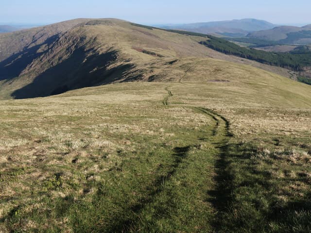
The high point of the Rhinns of Kells in Galloway, looking west across the Silver Flowe to Merrick. Less famous than its neighbour Merrick but a quieter and arguably finer hill day on a long, well-shaped ridge.
Quick facts
- Height
- 814m/ 2671ft
- Prominence
- 488 m
- Distance
- 16 km
- Ascent
- 700 m
- Time
- 4–7 hrs
- Grid ref
- NX498871
- Parking
- NX549865
- Nearest
- Newton Stewart· Dumfries 49km
- Dogs
- Dogs on lead required near livestockDog-friendly guide ↗
Height and prominence cross-checked against the Database of British and Irish Hills (CC BY).
No GPX track yet
Walked this route? Share your track to help other walkers.
Standard route
heather moorland 55% · granite boulders 25% · grass moorland 20%
Approach from Forrest Lodge near Loch Doon. Long but steady climb up the south ridge via Polmaddy Burn, gaining the broad Kells crest before a final pull onto the granite-strewn summit dome.
Terrain
Forestry tracks, then open hillside with intermittent paths.
In winter
Snow holds in the upper coires longer than the Galloway average.
Best time of year
Getting there
- Glasgow2h 10m
- Edinburgh3h 45m
OS maps: OS Explorer 318
Mobile signal: Strong summit reception; EE and Vodafone reliable. Central Galloway Range viewpoint.
Current conditions
Daylight Today
- Sunrise
- 04:55
- Sunset
- 21:52
- Civil dawn
- 04:01
- Civil dusk
- 22:46
NOAA Solar Calculator · 13 July 2026
Pair with
Curated multi-hill combinations from Corserine.
Around Corserine on the SCOT network
Getting there, basing yourself, and what to do off the hill.
Corserine — common questions
- What difficulty is Corserine?
- On the OutdoorSCOT scale, Corserine comes in at 3/5 — moderately challenging. Expect roughly 16km and 700m of ascent on the usual route — 4-7 hours for most parties. Ground conditions: Forestry tracks, then open hillside with intermittent paths.
- How much drop does Corserine have?
- The drop is 488m: measured from the summit of Corserine down to the saddle joining it to higher terrain.
- Where's the parking for Corserine?
- Park at NX549865 near Newton Stewart. Double-check the grid reference on an OS map first; informal laybys here fill early in high season.
- What's the best month to climb Corserine?
- Aim for April, May, June, July, August, September, October on Corserine. In the remaining months treat it as a winter hill — full kit, solid navigation, and a look at the relevant SAIS avalanche forecast before you go.
- Can dogs go up Corserine?
- Dogs are fine on a lead. The route passes livestock or ground-nesting bird habitat, so keep them close throughout.
- Will I get phone signal on Corserine?
- Strong summit reception; EE and Vodafone reliable. Central Galloway Range viewpoint.
- Is Corserine safe in winter?
- Snow holds in the upper coires longer than the Galloway average.
Get the OutdoorSCOT weekly
One email a week — new route, hill and bothy guides, seasonal conditions and the odd hard-won lesson. No spam, unsubscribe in one click.