Corbett · Knoydart
Ben Tee
Ben Tee is the perfect pyramid rising above the Caledonian Canal between Invergarry and Loch Lochy — visible for miles along the Great Glen and among the most distinctive small mountains in the Highlands. The classic conical shape gives away the geology: a steep cone of schist with little flat ground anywhere on the upper slopes. The summit is sharp, the view down the length of Loch Lochy and across to Knoydart ranks as a particularly good in Lochaber, and the hill has just enough commitment to feel like a proper day without being long.
Quick facts
- Height
- 901.6m/ 2958ft
- Prominence
- 354 m
- Distance
- 12 km
- Ascent
- 920 m
- Time
- 4–6 hrs
- Grid ref
- NN240971
- Parking
- NN286962
- Nearest city
- Fort William· 27km
- Dogs
- Dogs on lead required near livestockDog-friendly guide ↗
Height and prominence cross-checked against the Database of British and Irish Hills (CC BY).
No GPX track yet
Walked this route? Share your track to help other walkers.
Standard route
glen track 25% · rough hillside 35% · steep ridge 30% · rocky summit 10%
The standard route starts from the Laggan Locks car park on the Caledonian Canal. Walk north along the canal towpath briefly, then climb west on a forestry track and footpath onto open hillside. The route picks up the south-east ridge of the hill, which rises steadily then steepens into the final cone. The summit can be reached via a short scramble onto a small rocky top. The descent simply reverses the ascent. Allow 5–6 hours.
Terrain
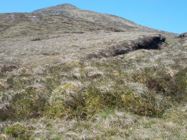
Canal towpath and forest track in. The open hillside is heather and tussocky grass — slow going on the lower slopes. The south-east ridge is mostly grass with rock outcrops; the summit cone is steep enough to feel like a final push. Wet conditions make the upper grassy slopes slippery on descent.
In winter
Ben Tee in firm winter conditions is a fine day — the cone holds snow well and the gradient is interesting without being technical. In thaw or wet snow the descent is the main hazard. Loaded slopes on the steep upper face produce slab avalanches in the wrong conditions; the daily SAIS bulletin for Lochaber is mandatory reading before driving up.
Best time of year
Getting there
- Glasgow3h 54m
- Edinburgh3h 4m
OS maps: OS Landranger 34
Mobile signal: Intermittent on the lower approach near Laggan Locks; brief 4G on top looking south to the Great Glen
Current conditions
Daylight Today
- Sunrise
- 04:44
- Sunset
- 22:07
- Civil dawn
- 03:43
- Civil dusk
- 23:08
NOAA Solar Calculator · 13 July 2026
Pair with
Curated multi-hill combinations from Ben Tee.
On a long-distance route
Ben Tee sits within 5km of these named long-distance walks — useful for trail-pack rest days or section extensions.
Around Ben Tee on the SCOT network
Getting there, basing yourself, and what to do off the hill.
Getting there: Roy Bridge station
Glen Roy; Grey Corries (Stob Choire Claurigh, Sgurr Choinnich Mor)
16km from the hill
tripscot.co.uk
On TripSCOTBase yourself in Fort William
Ben Nevis base, West Highland Line, gateway to Lochaber
27km from the hill
tripscot.co.uk
On TasteSCOTAfter the hill: Ben Nevis Distillery
Fort William — Lochaber distillery at the foot of the Ben; long-aged Japanese-owned classics
24km from the hill
tastescot.co.uk
Ben Tee — common questions
- What difficulty is Ben Tee?
- On the OutdoorSCOT scale, Ben Tee comes in at 3/5 — moderately challenging. Expect roughly 12km and 920m of ascent on the usual route — 4-6 hours for most parties. Ground conditions: Canal towpath and forest track in.
- How much drop does Ben Tee have?
- The drop is 354m: measured from the summit of Ben Tee down to the saddle joining it to higher terrain.
- Where's the parking for Ben Tee?
- Park at NN286962. Double-check the grid reference on an OS map first; informal laybys here fill early in high season.
- What's the best month to climb Ben Tee?
- Aim for May, June, July, August, September, October on Ben Tee. In the remaining months treat it as a winter hill — full kit, solid navigation, and a look at the relevant SAIS avalanche forecast before you go.
- Can dogs go up Ben Tee?
- Dogs are fine on a lead. The route passes livestock or ground-nesting bird habitat, so keep them close throughout.
- Will I get phone signal on Ben Tee?
- Intermittent on the lower approach near Laggan Locks; brief 4G on top looking south to the Great Glen
- Is Ben Tee safe in winter?
- Ben Tee in firm winter conditions is a fine day — the cone holds snow well and the gradient is interesting without being technical. In thaw or wet snow the descent is the main hazard. Loaded slopes on the steep upper face produce slab avalanches in the wrong conditions; the daily SAIS bulletin for Lochaber is mandatory reading before driving up.
Get the OutdoorSCOT weekly
One email a week — new route, hill and bothy guides, seasonal conditions and the odd hard-won lesson. No spam, unsubscribe in one click.