Corbett · Central Highlands
Beinn Iaruinn
Beinn Iaruinn — 'the iron hill' — is the broad-shouldered Corbett rising above the Parallel Roads of Glen Roy, the famous Quaternary shorelines that puzzled geologists for a century before being recognised as ice-dammed loch terraces. The 804m summit sits above the parallel roads themselves and gives a unique vantage on the geological feature visible right below. Beyond Glen Roy, the view sweeps west to Ben Nevis and the Aonachs across the Great Glen and east to the Monadhliath. A characterful Lochaber-edge Corbett accessible from Roy Bridge.
Quick facts
- Height
- 804.3m/ 2639ft
- Prominence
- 445 m
- Distance
- 10 km
- Ascent
- 700 m
- Time
- 2–5 hrs
- Grid ref
- NN296900
- Parking
- NN298857
- Nearest city
- Fort William· 25km
- Dogs
- Dogs on lead required near livestockDog-friendly guide ↗
Height and prominence cross-checked against the Database of British and Irish Hills (CC BY).
No GPX track yet
Walked this route? Share your track to help other walkers.
Standard route
glen path 20% · heather hillside 45% · grassy ridge 25% · summit area 10%
Park at the Glen Roy NNR viewpoint car park (NN298857), with its small layby and information board explaining the parallel roads. Continue up the glen road on foot for about 2km, then turn west off the tarmac and climb steeply onto the south-east shoulder of Beinn Iaruinn. A sustained heather-and-grass ascent leads to the summit cairn. Allow 4.5–5.5 hours.
Terrain
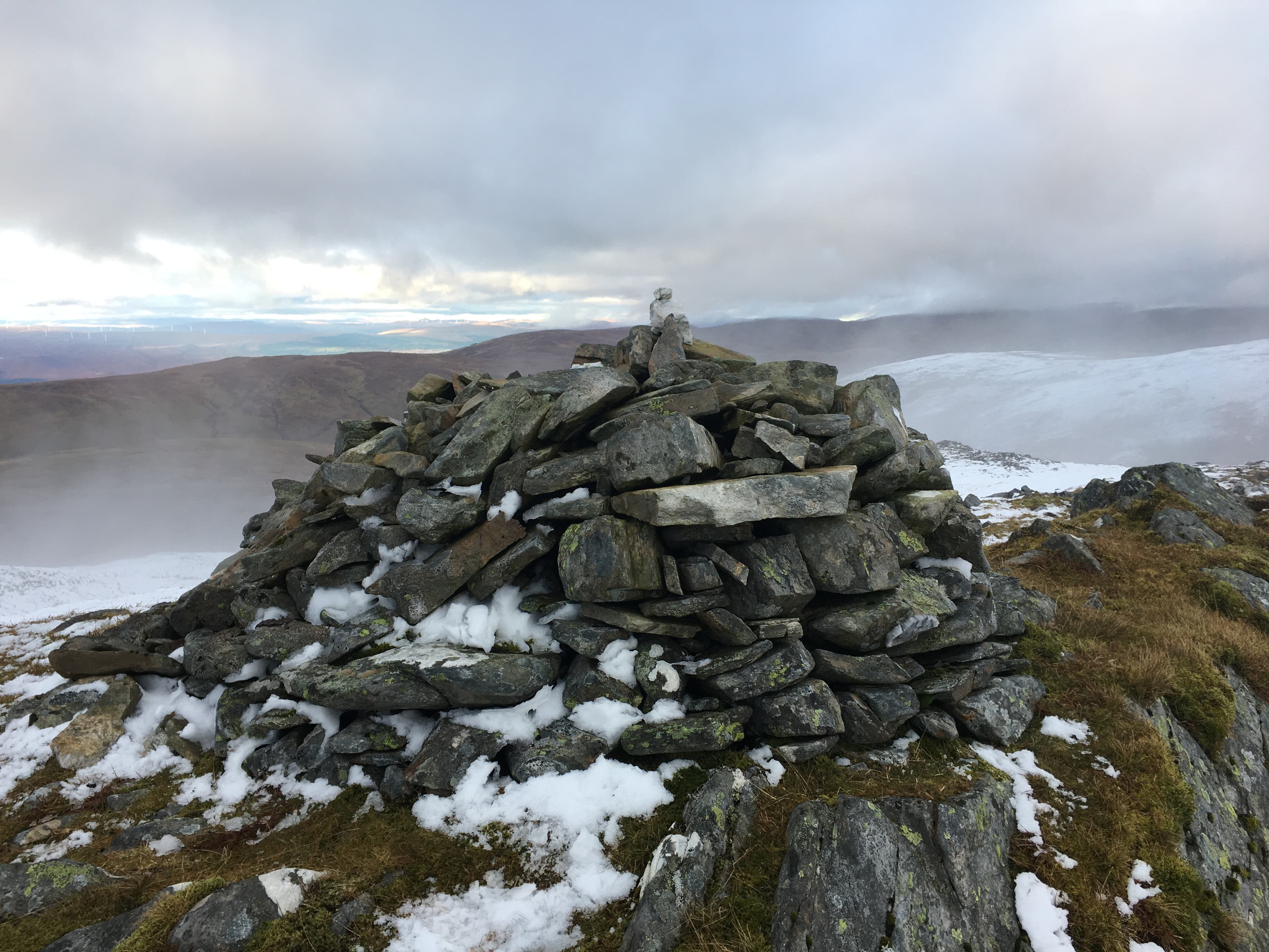
Tarmac glen road on the approach. The hillside above is heather and grass dotted with occasional rocky knobs on the upper crest. The top is a wide rounded dome capped by a substantial cairn. Drier underfoot than the western Lochaber Munros because Glen Roy sits in a partial rain shadow.
In winter
Snow lies well on Beinn Iaruinn's east-facing slopes through midwinter. The wide ridge gives easy walking under cover with no avalanche issues on the standard line. The Glen Roy road slows when iced but stays driveable. Modest cornicing develops on the north-eastern lip of the summit dome — give the edge a wide berth.
This hill is in the Creag Meagaidh SAIS forecast area. Check SAIS forecasts in winter (December–April).
Best time of year
Getting there
- Glasgow3h 43m
- Edinburgh3h 54m
OS maps: OS Landranger 34
Mobile signal: No coverage in this remote area between Loch Laggan and Roy Bridge
Current conditions
Daylight Today
- Sunrise
- 04:44
- Sunset
- 22:06
- Civil dawn
- 03:43
- Civil dusk
- 23:07
NOAA Solar Calculator · 13 July 2026
On a long-distance route
Beinn Iaruinn sits within 5km of these named long-distance walks — useful for trail-pack rest days or section extensions.
Around Beinn Iaruinn on the SCOT network
Getting there, basing yourself, and what to do off the hill.
Getting there: Roy Bridge station
Glen Roy; Grey Corries (Stob Choire Claurigh, Sgurr Choinnich Mor)
9km from the hill
tripscot.co.uk
On TripSCOTBase yourself in Fort William
Ben Nevis base, West Highland Line, gateway to Lochaber
25km from the hill
tripscot.co.uk
On TasteSCOTAfter the hill: Ben Nevis Distillery
Fort William — Lochaber distillery at the foot of the Ben; long-aged Japanese-owned classics
22km from the hill
tastescot.co.uk
Beinn Iaruinn — common questions
- Is Beinn Iaruinn a hard climb?
- Beinn Iaruinn is rated 2/5 (moderate) on the OutdoorSCOT scale. The standard route covers about 10km with 700m of ascent and takes most walkers 2-5 hours. Ground conditions: Tarmac glen road on the approach.
- How much drop does Beinn Iaruinn have?
- The drop is 445m: measured from the summit of Beinn Iaruinn down to the saddle joining it to higher terrain.
- Where's the parking for Beinn Iaruinn?
- Park at NN298857. Double-check the grid reference on an OS map first; informal laybys here fill early in high season.
- What's the best month to climb Beinn Iaruinn?
- Aim for April, May, June, July, August, September, October on Beinn Iaruinn. In the remaining months treat it as a winter hill — full kit, solid navigation, and a look at the relevant SAIS avalanche forecast before you go.
- Can dogs go up Beinn Iaruinn?
- Dogs are fine on a lead. The route passes livestock or ground-nesting bird habitat, so keep them close throughout.
- Will I get phone signal on Beinn Iaruinn?
- No coverage in this remote area between Loch Laggan and Roy Bridge
- Is Beinn Iaruinn safe in winter?
- Snow lies well on Beinn Iaruinn's east-facing slopes through midwinter. The wide ridge gives easy walking under cover with no avalanche issues on the standard line. The Glen Roy road slows when iced but stays driveable. Modest cornicing develops on the north-eastern lip of the summit dome — give the edge a wide berth.
Get the OutdoorSCOT weekly
One email a week — new route, hill and bothy guides, seasonal conditions and the odd hard-won lesson. No spam, unsubscribe in one click.