Graham · Central Highlands
Creag Dhubh
Creag Dhubh (659m) — the dark crag — rises sharply from the A86 above Loch Laggan in the NN32 square. The rocky south face is well known to climbers, but the cairned summit is reached more gently by walkers from the west and gives a striking view down on Loch Laggan and across to Ardverikie.
Gaelic: “crag, black” · Pronunciation: krayg goo
Quick facts
- Height
- 659.6m/ 2164ft
- Prominence
- 332 m
- Distance
- 13 km
- Ascent
- 540 m
- Time
- 3–6 hrs
- Grid ref
- NN322824
- Parking
- NN336834
- Nearest city
- Fort William· 23km
- Dogs
- Dogs on lead required near livestockDog-friendly guide ↗
Height and prominence cross-checked against the Database of British and Irish Hills (CC BY).
No GPX track yet
Walked this route? Share your track to help other walkers.
Standard route
heather moorland 55% · rocky hillside 30% · bog and wet grass 15%
Park in the lay-by near Drumgask west of Laggan village. Cross the river by the bridge and angle north-east up a faint shepherd's line through birch onto open hillside. Avoid the steep south crags by working round to the west shoulder and up to the cairn — a steady pull rather than a difficult one.
Terrain
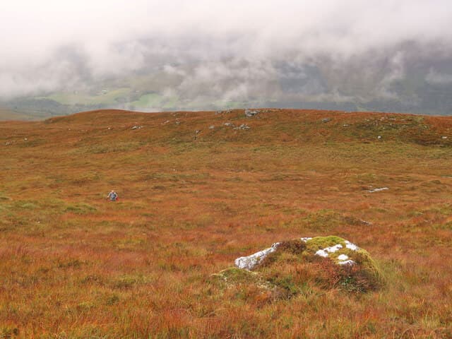
Birch woodland low down, then heather and lichen-covered rock on the west shoulder. The south face holds serious crags — keep west of the main line on ascent and descent. The cairn sits on a small grassy area between low rock walls.
In winter
The Creag Dhubh crags glaze quickly and become a regular winter climbing venue in cold spells. Walkers should keep well west of the crag top, which is loaded with cornices in north-east winds. The A86 corridor is well plowed so access remains reliable through winter.
This hill is in the Creag Meagaidh SAIS forecast area. Check SAIS forecasts in winter (December–April).
Best time of year
Getting there
- Glasgow3h 33m
- Edinburgh3h 3m
OS maps: OS Landranger 34, OS Landranger 41
Mobile signal: Moderate. EE near the A86 corridor by Laggan; weaker on the summit.
Current conditions
Daylight Today
- Sunrise
- 04:44
- Sunset
- 22:05
- Civil dawn
- 03:44
- Civil dusk
- 23:06
NOAA Solar Calculator · 13 July 2026
On a long-distance route
Creag Dhubh sits within 5km of these named long-distance walks — useful for trail-pack rest days or section extensions.
Around Creag Dhubh on the SCOT network
Getting there, basing yourself, and what to do off the hill.
Getting there: Tulloch station
Loch Treig; Beinn na Lap; Stob Coire Easain / Stob a Choire Mheadhoin approach
5km from the hill
tripscot.co.uk
On TripSCOTBase yourself in Fort William
Ben Nevis base, West Highland Line, gateway to Lochaber
23km from the hill
tripscot.co.uk
On TasteSCOTAfter the hill: Ben Nevis Distillery
Fort William — Lochaber distillery at the foot of the Ben; long-aged Japanese-owned classics
21km from the hill
tastescot.co.uk
Creag Dhubh — common questions
- What difficulty is Creag Dhubh?
- On the OutdoorSCOT scale, Creag Dhubh comes in at 3/5 — moderately challenging. Expect roughly 13km and 540m of ascent on the usual route — 3-6 hours for most parties. Underfoot: Birch woodland low down, then heather and lichen-covered rock on the west shoulder.
- What is Creag Dhubh's prominence?
- 332m of prominence. That's the vertical drop from the summit to the col that links Creag Dhubh to the next higher ground.
- Where do I park for Creag Dhubh?
- Most walkers start from NN336834. Verify the grid reference on an OS map before you set off — space is tight on busy summer weekends.
- When is the best time to climb Creag Dhubh?
- March, April, May, June, July, August, September, October, November give the most reliable conditions on Creag Dhubh. Beyond that window the high ground turns wintry: carry full mountain kit, be confident navigating, and check the SAIS avalanche forecast for the area.
- Is Creag Dhubh dog-friendly?
- Yes, but dogs must be kept on a lead — there is livestock or ground-nesting bird interest on the route.
- Is there mobile signal on Creag Dhubh?
- Moderate. EE near the A86 corridor by Laggan; weaker on the summit.
- Is Creag Dhubh safe in winter?
- The Creag Dhubh crags glaze quickly and become a regular winter climbing venue in cold spells. Walkers should keep well west of the crag top, which is loaded with cornices in north-east winds. The A86 corridor is well plowed so access remains reliable through winter.
Get the OutdoorSCOT weekly
One email a week — new route, hill and bothy guides, seasonal conditions and the odd hard-won lesson. No spam, unsubscribe in one click.