Corbett · Fife & Perthshire
Beinn nan Imirean
Beinn nan Imirean is the modest 849m Corbett rising directly above the Glen Lochay road north of Killin, sandwiched between the better-known Munros of the Tarmachan ridge to the east and Meall Glas to the west. The Gaelic name means 'hill of the ridges', apt for a summit reached over a series of gentle grassy steps. Most parties bag it as a quick add-on to a day in Glen Lochay or after the Tarmachan ridge — the walk is short, the navigation is easy, and the views across Loch Tay are a tidy reward.
Quick facts
- Height
- 848.3m/ 2783ft
- Prominence
- 189 m
- Distance
- 10 km
- Ascent
- 690 m
- Time
- 2–4 hrs
- Grid ref
- NN419309
- Parking
- NN461361
- Nearest
- Fort William· Stirling 53km
- Dogs
- Dogs on lead required near livestockDog-friendly guide ↗
Height and prominence cross-checked against the Database of British and Irish Hills (CC BY).
No GPX track yet
Walked this route? Share your track to help other walkers.
Standard route
estate track 25% · heather hillside 40% · grassy upper slopes 25% · summit area 10%
Park at the small layby near Kenknock Farm in Glen Lochay (NN461361). Walk south up a Land Rover track for around 2km, then climb west onto the broad east ridge of Beinn nan Imirean. The route gains height steadily across mixed grass and heather. The summit is a small cairn on a broad rounded top. For a fuller day, continue west across the bealach to Meall Glas (Munro). Allow 4–5 hours for Beinn nan Imirean alone.
Terrain
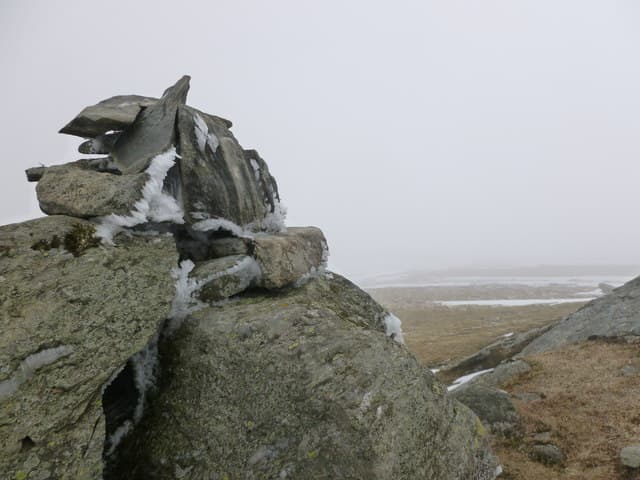
Land Rover track on the approach. Above the track, easy underfoot on grassy slopes flecked with heather — quick walking with no rocky difficulties. The summit cairn is small; the top can be confusing in cloud because the rounded plateau has subtle false summits.
In winter
A reasonable winter Corbett — broad slopes carry no avalanche concerns and the ridge holds snow well through January and February. The Glen Lochay road can hold snow but is generally cleared. Cold easterly winds blast across from the Tarmachan ridge; bring a windproof.
Best time of year
Getting there
- Glasgow2h 37m
- Edinburgh2h 9m
OS maps: OS Landranger 51
Mobile signal: EE/Vodafone reasonable along the lower Glen Lochay road; weakens as you climb; brief signal at the top looking south to Loch Tay
Current conditions
Daylight Today
- Sunrise
- 04:47
- Sunset
- 22:01
- Civil dawn
- 03:48
- Civil dusk
- 23:00
NOAA Solar Calculator · 13 July 2026
Around Beinn nan Imirean on the SCOT network
Getting there, basing yourself, and what to do off the hill.
Beinn nan Imirean — common questions
- How difficult is Beinn nan Imirean?
- Beinn nan Imirean carries a 2/5 (moderate) grade on the OutdoorSCOT scale. Count on about 10km, 690m of ascent and a 2-4 hour day on the standard route. Terrain: Land Rover track on the approach.
- How prominent is Beinn nan Imirean?
- Beinn nan Imirean has 189m of topographic prominence — the height of its summit above the highest col connecting it to higher ground.
- Where should I park to climb Beinn nan Imirean?
- Standard parking is at NN461361 near Fort William. Check the parking grid reference on an OS map before travel; informal laybys can fill on summer weekends.
- When should I climb Beinn nan Imirean?
- The standard good-weather months for Beinn nan Imirean are April, May, June, July, August, September, October. Outside those months, expect winter conditions on the high ground — full mountain kit, navigation skills, and a check of the SAIS avalanche forecast for the relevant region.
- Can I bring my dog up Beinn nan Imirean?
- On a lead only — the route crosses ground with livestock or nesting-bird interest.
- What's mobile reception like on Beinn nan Imirean?
- EE/Vodafone reasonable along the lower Glen Lochay road; weakens as you climb; brief signal at the top looking south to Loch Tay
- Is Beinn nan Imirean safe in winter?
- A reasonable winter Corbett — broad slopes carry no avalanche concerns and the ridge holds snow well through January and February. The Glen Lochay road can hold snow but is generally cleared. Cold easterly winds blast across from the Tarmachan ridge; bring a windproof.
Get the OutdoorSCOT weekly
One email a week — new route, hill and bothy guides, seasonal conditions and the odd hard-won lesson. No spam, unsubscribe in one click.