Munro · Cairngorms
Mullach Clach a' Bhlair
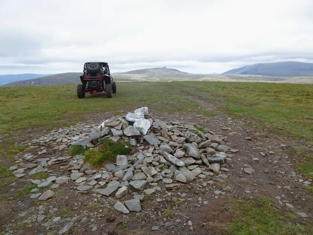
Mullach Clach a' Bhlair (1019m) — "summit of the stone of the battlefield" — is the southernmost Munro of the great Cairngorms plateau, sitting at the head of Glen Feshie. The hill itself is a broad mossy table, almost flat-topped, but the approach through Glen Feshie is one of the great Highland glens — ancient Caledonian pinewood, sweeping river plains, and the Aviemore-side estates ongoing rewilding work. Often paired with Sgòr Gaoith on the same long day.
Quick facts
- Height
- 1019m/ 3343ft
- Prominence
- 105 m
- Distance
- 17 km
- Ascent
- 897 m
- Time
- 5–8 hrs
- Grid ref
- NN882927
- Parking
- NN852978
- Nearest city
- Inverness· 57km
- Dogs
- Dogs on lead required near livestockDog-friendly guide ↗
Height and prominence cross-checked against the Database of British and Irish Hills (CC BY).
No GPX track yet
Walked this route? Share your track to help other walkers.
Standard route
Glen track 40% · Open hillside 35% · Summit plateau 25%
Start from the Achlean car park in upper Glen Feshie. Walk south down the rough track along the east bank of the River Feshie, then turn east up the Allt Garbhlach onto the south Cairngorm plateau. Climb the broad south ridge of Mullach Clach a' Bhlair via the old estate track. From the summit it is possible to continue north across the plateau to Sgòr Gaoith via Càrn Bàn Mòr — a long but rewarding combination. Mullach alone is 22km with 800m of ascent.
Terrain
The Glen Feshie estate landrover tracks give excellent fast going for the long approach — among the best valley tracks in Scotland. The climb onto Mullach Clach a' Bhlair via the old estate track is steady on gravel and short turf. The summit plateau is a vast mossy expanse — almost featureless and a true navigation challenge in poor visibility. The Garbhlach falls section in lower Glen Feshie crosses some impressive eroded river banks.
In winter
An extended winter outing, much of it spent traversing the broad flat southern Cairngorm tableland. Whiteout navigation is the primary risk; the plateau routinely catches sub-arctic continental conditions. Cornicing on the rim of Coire Garbhlach (south side) is consistent. The Glen Feshie estate roads can be drifted but are usually passable on foot. Phone signal absent above the treeline. SAIS Northern Cairngorms applies.
This hill is in the Northern Cairngorms SAIS forecast area. Check SAIS forecasts in winter (December–April).
Best time of year
Getting there
- Glasgow3h 47m
- Edinburgh3h 39m
OS maps: OS Landranger 35, OS Landranger 43
Mobile signal: No signal on the Feshie plateau. Achlean or Feshiebridge has occasional 4G. Save mapping before you leave Kingussie.
Current conditions
Daylight Today
- Sunrise
- 04:57
- Sunset
- 21:47
- Civil dawn
- 04:01
- Civil dusk
- 22:43
NOAA Solar Calculator · 23 July 2026
Pair with
Curated multi-hill combinations from Mullach Clach a' Bhlair.
Around Mullach Clach a' Bhlair on the SCOT network
Getting there, basing yourself, and what to do off the hill.
Getting there: Kingussie station
Cairngorms south side; Glen Feshie; Insh Marshes; Monadhliath access
15km from the hill
tripscot.co.uk
On TripSCOTBase yourself in Aviemore
Cairngorms base — Strathspey valley, ski centre, train
20km from the hill
tripscot.co.uk
On TasteSCOTAfter the hill: Dalwhinnie
Dalwhinnie — Scotland's highest distillery on the Drumochter pass
26km from the hill
tastescot.co.uk
Mullach Clach a' Bhlair — common questions
- Is Mullach Clach a' Bhlair a hard climb?
- Mullach Clach a' Bhlair is rated 4/5 (challenging) on the OutdoorSCOT scale. The standard route covers about 17km with 897m of ascent and takes most walkers 5-8 hours. Terrain: The Glen Feshie estate landrover tracks give excellent fast going for the long approach — among the best valley tracks in Scotland.
- How prominent is Mullach Clach a' Bhlair?
- Mullach Clach a' Bhlair has 105m of topographic prominence — the height of its summit above the highest col connecting it to higher ground.
- Where should I park to climb Mullach Clach a' Bhlair?
- Standard parking is at NN852978. Check the parking grid reference on an OS map before travel; informal laybys can fill on summer weekends.
- When should I climb Mullach Clach a' Bhlair?
- The standard good-weather months for Mullach Clach a' Bhlair are May, June, July, August, September, October. Outside those months, expect winter conditions on the high ground — full mountain kit, navigation skills, and a check of the SAIS avalanche forecast for the relevant region.
- Can I bring my dog up Mullach Clach a' Bhlair?
- On a lead only — the route crosses ground with livestock or nesting-bird interest.
- What's mobile reception like on Mullach Clach a' Bhlair?
- No signal on the Feshie plateau. Achlean or Feshiebridge has occasional 4G. Save mapping before you leave Kingussie.
- Is Mullach Clach a' Bhlair safe in winter?
- An extended winter outing, much of it spent traversing the broad flat southern Cairngorm tableland. Whiteout navigation is the primary risk; the plateau routinely catches sub-arctic continental conditions. Cornicing on the rim of Coire Garbhlach (south side) is consistent. The Glen Feshie estate roads can be drifted but are usually passable on foot. Phone signal absent above the treeline. SAIS Northern Cairngorms applies.
Get the OutdoorSCOT weekly
One email a week — new route, hill and bothy guides, seasonal conditions and the odd hard-won lesson. No spam, unsubscribe in one click.