Corbett · Cairngorms
Leathad an Taobhain
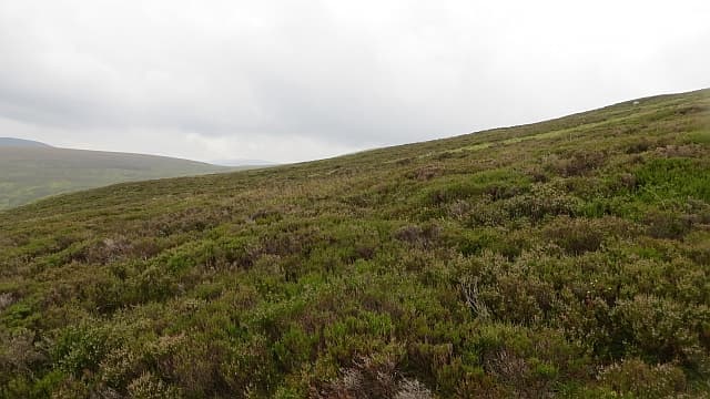
Leathad an Taobhain — 'the slope of the rafter' — is the 912m Corbett standing at the south-east corner of the Gaick, the great deer-forest of high featureless plateau between Speyside and Atholl. The summit is genuinely remote, a long way from any road, and gives a sense of empty space found in few other places on the Scottish mainland. The Gaick approach is most often a bike-in from Drumochter or Glen Tromie. Notorious in winter: an avalanche on the Loch an Dùin slopes in 1800 killed five drovers and entered the bagging folklore.
Quick facts
- Height
- 911.7m/ 2991ft
- Prominence
- 155 m
- Distance
- ~30 km
- Ascent
- ~700 m
- Time
- 7–11 hrs
- Grid ref
- NN821858
- Parking
- NN762828
- Nearest city
- Inverness· 61km
- Dogs
- Dogs on lead required near livestockDog-friendly guide ↗
Height and prominence cross-checked against the Database of British and Irish Hills (CC BY).
No GPX track yet
Walked this route? Share your track to help other walkers.
Standard route
grass path 30% · plateau grass 50% · peat hags 15% · stony top 5%
Park at the small layby near Allt Bhran on the A9 north of Drumochter (NN762828). Walk or cycle the long estate track south-east through Gaick Lodge for around 10km, then turn east into Coire na h-Eilrig. Climb north-east from the corrie onto Leathad an Taobhain's broad south ridge — gentle gradients across short grass and peat. The summit is a low rise on a vast plateau with no obvious cairn. Allow 10–12 hours on foot, considerably less with a bike.
Terrain
Long Land Rover estate track on the approach — fast on a bike, tedious on foot. Off the track the going is short grass and peat hag on a vast featureless plateau. The summit is unmarked on most older maps; GPS is essential in cloud. The whole upper Gaick plateau is one of the most navigationally demanding places in Scotland in poor visibility.
In winter
Leathad an Taobhain in winter is one of the most committed Corbetts in the eastern Highlands. The 1800 Gaick avalanche disaster shows what the area can do — the plateau collects deep wind slab on lee aspects after easterlies. Daylight in midwinter is too short for a single-day round on foot. A two-day with bivvy or bothy is more sensible; the Gaick has several stalker's bothies.
Kit for this: the winter Munro kit list · which boots take crampons
Best time of year
Getting there
- Glasgow3h 36m
- Edinburgh3h 33m
OS maps: OS Landranger 43
Mobile signal: No bars on the hill; brief coverage on the Drumochter pass road
Current conditions
Daylight Today
- Sunrise
- 07:46
- Sunset
- 18:18
- Civil dawn
- 07:07
- Civil dusk
- 18:56
NOAA Solar Calculator · 14 October 2026
Around Leathad an Taobhain on the SCOT network
Getting there, basing yourself, and what to do off the hill.
Getting there: Kingussie station
Cairngorms south side; Glen Feshie; Insh Marshes; Monadhliath access
16km from the hill
tripscot.co.uk
On TripSCOTBase yourself in Kingussie
Monadhliath and western Cairngorms base on the Highland Main Line
16km from the hill
tripscot.co.uk
On TasteSCOTAfter the hill: Dalwhinnie
Dalwhinnie — Scotland's highest distillery on the Drumochter pass
19km from the hill
tastescot.co.uk
Leathad an Taobhain — common questions
- How difficult is Leathad an Taobhain?
- Leathad an Taobhain carries a 3/5 (moderately challenging) grade on the OutdoorSCOT scale. Count on about 30km, 700m of ascent and a 7-11 hour day on the standard route. Ground conditions: Long Land Rover estate track on the approach — fast on a bike, tedious on foot.
- How much drop does Leathad an Taobhain have?
- The drop is 155m: measured from the summit of Leathad an Taobhain down to the saddle joining it to higher terrain.
- Where's the parking for Leathad an Taobhain?
- Park at NN762828. Double-check the grid reference on an OS map first; informal laybys here fill early in high season.
- What's the best month to climb Leathad an Taobhain?
- Aim for May, June, July, August, September, October on Leathad an Taobhain. In the remaining months treat it as a winter hill — full kit, solid navigation, and a look at the relevant SAIS avalanche forecast before you go.
- Can dogs go up Leathad an Taobhain?
- Dogs are fine on a lead. The route passes livestock or ground-nesting bird habitat, so keep them close throughout.
- Will I get phone signal on Leathad an Taobhain?
- No bars on the hill; brief coverage on the Drumochter pass road
- Is Leathad an Taobhain safe in winter?
- Leathad an Taobhain in winter is one of the most committed Corbetts in the eastern Highlands. The 1800 Gaick avalanche disaster shows what the area can do — the plateau collects deep wind slab on lee aspects after easterlies. Daylight in midwinter is too short for a single-day round on foot. A two-day with bivvy or bothy is more sensible; the Gaick has several stalker's bothies.
Get the OutdoorSCOT weekly
One email a week — new route, hill and bothy guides, seasonal conditions and the odd hard-won lesson. No spam, unsubscribe in one click.