Corbett · Cairngorms
A' Chaoirnich (Maol Creag an Loch)
A' Chaoirnich — also known as Maol Creag an Loch — is a remote, double-topped Corbett in the empty Gaick Forest country between Glen Tromie and Glen Bruar, south of Aviemore. At 875m the hill is broad and featureless, more a high moorland plateau than a peak, but it commands enormous views of the southern Cairngorms and the wide spread of Drumochter beyond. The Gaick is one of the quietest deer-forest landscapes in the eastern Highlands; many baggers find this is the most distant Corbett-day from any road they will undertake.
Quick facts
- Height
- 875.7m/ 2873ft
- Prominence
- 214 m
- Distance
- 16 km
- Ascent
- 770 m
- Time
- 5–8 hrs
- Grid ref
- NN735807
- Parking
- NN789998
- Nearest
- Fort William· Inverness 65km
- Dogs
- Dogs on lead required near livestockDog-friendly guide ↗
Height and prominence cross-checked against the Database of British and Irish Hills (CC BY).
No GPX track yet
Walked this route? Share your track to help other walkers.
Standard route
estate track 35% · rough heather 35% · grassy plateau 25% · summit areas 5%
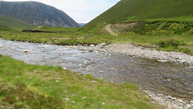
Most parties start from Tromie Bridge on the B970 south of Kingussie and use a mountain bike for the long estate track approach up Glen Tromie to Bhran Cottage. From there, cross the Allt Bhran and climb pathless grass and heather east onto the broad summit plateau. The two tops are about 1km apart; the cairn at Maol Creag an Loch is the highest. Around 16km plus the cycle approach (closer to 30km on foot), with 770m of ascent. Return retraces the line.
Terrain
The Glen Tromie estate track is firm and bike-friendly for the long approach. Off the track the ground is rough peat, heather and tussock grass — slow walking, with hidden burns and peat hags. The summit plateau itself is grass and crowberry with the highest cairn easy to miss between the broad tops. No exposure or technical ground anywhere, but real navigation skill needed in mist.
In winter
Gaick is famous for its 1800 avalanche disaster on a different hill in the area, a reminder that even gentle-looking moorland country here builds dangerous slab in easterly storms. The summit plateau is featureless in whiteout. Cycling the approach is rarely feasible in winter. Daylight is the main constraint; total distances mean most parties bivvy or split the trip across two days.
This hill is in the Northern Cairngorms SAIS forecast area. Check SAIS forecasts in winter (December–April).
Best time of year
Getting there
- Glasgow2h 28m
- Edinburgh3h 31m
OS maps: OS Landranger 42
Mobile signal: No signal across the Gaick Forest interior
Current conditions
Daylight Today
- Sunrise
- 04:48
- Sunset
- 21:57
- Civil dawn
- 03:50
- Civil dusk
- 22:55
NOAA Solar Calculator · 17 July 2026
Around A' Chaoirnich (Maol Creag an Loch) on the SCOT network
Getting there, basing yourself, and what to do off the hill.
Getting there: Dalwhinnie station
Highest mainline station; Drumochter Munros; Ben Alder approach
11km from the hill
tripscot.co.uk
On TripSCOTBase yourself in Pitlochry
Perthshire base — Schiehallion, Beinn a Ghlo, Ben Vrackie
30km from the hill
tripscot.co.uk
On TasteSCOTAfter the hill: Dalwhinnie
Dalwhinnie — Scotland's highest distillery on the Drumochter pass
11km from the hill
tastescot.co.uk
A' Chaoirnich (Maol Creag an Loch) — common questions
- How difficult is A' Chaoirnich (Maol Creag an Loch)?
- A' Chaoirnich (Maol Creag an Loch) carries a 3/5 (moderately challenging) grade on the OutdoorSCOT scale. Count on about 16km, 770m of ascent and a 5-8 hour day on the standard route. Ground conditions: The Glen Tromie estate track is firm and bike-friendly for the long approach.
- How much drop does A' Chaoirnich (Maol Creag an Loch) have?
- The drop is 214m: measured from the summit of A' Chaoirnich (Maol Creag an Loch) down to the saddle joining it to higher terrain.
- Where's the parking for A' Chaoirnich (Maol Creag an Loch)?
- Park at NN789998 near Fort William. Double-check the grid reference on an OS map first; informal laybys here fill early in high season.
- What's the best month to climb A' Chaoirnich (Maol Creag an Loch)?
- Aim for May, June, July, August, September, October on A' Chaoirnich (Maol Creag an Loch). In the remaining months treat it as a winter hill — full kit, solid navigation, and a look at the relevant SAIS avalanche forecast before you go.
- Can dogs go up A' Chaoirnich (Maol Creag an Loch)?
- Dogs are fine on a lead. The route passes livestock or ground-nesting bird habitat, so keep them close throughout.
- Will I get phone signal on A' Chaoirnich (Maol Creag an Loch)?
- No signal across the Gaick Forest interior
- Is A' Chaoirnich (Maol Creag an Loch) safe in winter?
- Gaick is famous for its 1800 avalanche disaster on a different hill in the area, a reminder that even gentle-looking moorland country here builds dangerous slab in easterly storms. The summit plateau is featureless in whiteout. Cycling the approach is rarely feasible in winter. Daylight is the main constraint; total distances mean most parties bivvy or split the trip across two days.
Get the OutdoorSCOT weekly
One email a week — new route, hill and bothy guides, seasonal conditions and the odd hard-won lesson. No spam, unsubscribe in one click.