Munro · North-West Highlands
An Teallach - Sgurr Fiona
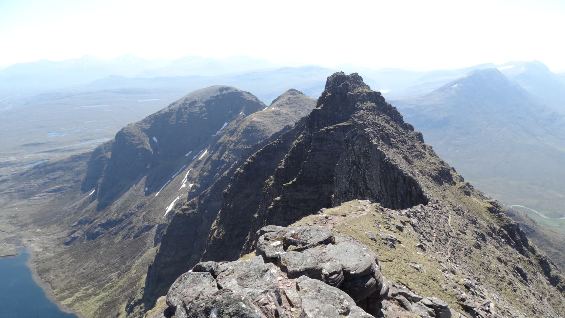
Sgurr Fiona (1058m) — "the fair peak" — is the second An Teallach Munro and the gateway to the celebrated Corrag Bhuidhe pinnacles. Where Bidein a' Ghlas Thuill is the high point, Sgurr Fiona is the architectural climax of the ridge: a needle-pointed sandstone summit immediately above the dizzy Lord Berkeley's Seat overhang. Almost universally climbed in tandem with Bidein on the same long traverse from Dundonnell, this is one of the great Munro pairings in Scotland.
Quick facts
- Height
- 1058.7m/ 3473ft
- Prominence
- 142 m
- Distance
- ~18 km
- Ascent
- ~932 m
- Time
- 7–10 hrs
- Grid ref
- NH064836
- Parking
- NH114859
- Nearest
- Ullapool· Inverness 71km
- Dogs
- Dogs on lead required near livestockDog-friendly guide ↗
Height and prominence cross-checked against the Database of British and Irish Hills (CC BY).
No GPX track yet
Walked this route? Share your track to help other walkers.
Standard route
Moorland path 20% · Rocky hillside 30% · Pinnacled ridge / scramble 50%
See Bidein a' Ghlas Thuill route. The standard traverse from Dundonnell climbs Bidein first then continues south along the ridge to Sgurr Fiona — about 30 minutes between the two summits via a narrow rocky crest. From Sgurr Fiona the choice is whether to commit to the Corrag Bhuidhe pinnacles (Grade 2/3 scramble) or take the western bypass path. Total round 18km with 1500m of ascent. The shorter Shenavall option from the south is rarely used as a day-trip.
Terrain
The narrow connecting crest from Bidein down to Sgurr Fiona is a sequence of bare sandstone ribs, with airy footing and big drops east and west. The Sgurr Fiona summit cone is a small pointed top with limited standing room. The Corrag Bhuidhe pinnacles immediately south are clean Torridonian sandstone scrambling at Grade 2/3; the alternative line on the west traverses thin, sloping scree ledges below the crest. The drop from Fiona's summit to Lord Berkeley's Seat is the visual highlight of the whole ridge.
In winter
The same considerations apply as for Bidein a' Ghlas Thuill. In winter the pinnacles become a serious technical Grade III–IV mountaineering route; the bypass is still steep ice-prone scree. The exposed sandstone glazes readily and offers little hold once iced. Approach decisions should be made early — retreat from the ridge is committing once past Bidein.
Kit for this: the winter Munro kit list · which boots take crampons
Best time of year
Getting there
- Glasgow4h 19m
- Edinburgh5h 38m
OS maps: OS Landranger 19
Mobile signal: Dead above 400m. Moderate signal at Dundonnell village. An Teallach requires full emergency communication planning.
Current conditions
Daylight Today
- Sunrise
- 08:11
- Sunset
- 18:00
- Civil dawn
- 07:30
- Civil dusk
- 18:41
NOAA Solar Calculator · 22 October 2026
Pair with
Curated multi-hill combinations from An Teallach - Sgurr Fiona.
Around An Teallach - Sgurr Fiona on the SCOT network
Getting there, basing yourself, and what to do off the hill.
An Teallach - Sgurr Fiona — common questions
- How difficult is An Teallach - Sgurr Fiona?
- An Teallach - Sgurr Fiona carries a 5/5 (very challenging) grade on the OutdoorSCOT scale. Count on about 18km, 932m of ascent and a 7-10 hour day on the standard route. Underfoot: The narrow connecting crest from Bidein down to Sgurr Fiona is a sequence of bare sandstone ribs, with airy footing and big drops east and west.
- What is An Teallach - Sgurr Fiona's prominence?
- 142m of prominence. That's the vertical drop from the summit to the col that links An Teallach - Sgurr Fiona to the next higher ground.
- Where do I park for An Teallach - Sgurr Fiona?
- Most walkers start from NH114859 near Ullapool. Verify the grid reference on an OS map before you set off — space is tight on busy summer weekends.
- When is the best time to climb An Teallach - Sgurr Fiona?
- May, June, July, August, September give the most reliable conditions on An Teallach - Sgurr Fiona. Beyond that window the high ground turns wintry: carry full mountain kit, be confident navigating, and check the SAIS avalanche forecast for the area.
- Is An Teallach - Sgurr Fiona dog-friendly?
- Yes, but dogs must be kept on a lead — there is livestock or ground-nesting bird interest on the route.
- Is there mobile signal on An Teallach - Sgurr Fiona?
- Dead above 400m. Moderate signal at Dundonnell village. An Teallach requires full emergency communication planning.
- Is An Teallach - Sgurr Fiona safe in winter?
- The same considerations apply as for Bidein a' Ghlas Thuill. In winter the pinnacles become a serious technical Grade III–IV mountaineering route; the bypass is still steep ice-prone scree. The exposed sandstone glazes readily and offers little hold once iced. Approach decisions should be made early — retreat from the ridge is committing once past Bidein.
Get the OutdoorSCOT weekly
One email a week — new route, hill and bothy guides, seasonal conditions and the odd hard-won lesson. No spam, unsubscribe in one click.