Corbett · North-West Highlands
Beinn Dearg Mor
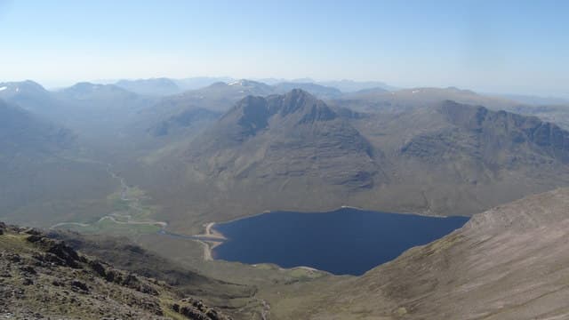
Beinn Dearg Mòr is the sandstone pyramid rising above Shenavall deep within the Fisherfield Forest — among the most remote big hills in Scotland and amongst the most visually striking. Not to be confused with the Munro Beinn Dearg near Ullapool: this one is wilder, harder to reach and never visited by accident. The cone of red Torridonian sandstone holds three corries and a sharp summit ridge; the views to An Teallach across Loch na Sealga and to the Fisherfield Munros to the east are among the finest in Britain. A hill that defines its own trip.
Gaelic: “mountain, red, big” · Pronunciation: bine jerr-ak more
Quick facts
- Height
- 906.28m/ 2973ft
- Prominence
- 564 m
- Distance
- 30 km
- Ascent
- 1300 m
- Time
- 9–14 hrs
- Grid ref
- NH032799
- Parking
- NH114851
- Nearest
- Ullapool· Inverness 72km
- Dogs
- Dogs on lead required near livestockDog-friendly guide ↗
Height and prominence cross-checked against the Database of British and Irish Hills (CC BY).
No GPX track yet
Walked this route? Share your track to help other walkers.
Standard route
stalkers path 15% · deep heather 35% · rocky slopes 35% · summit ridge 15%
The classic approach is from Corrie Hallie on the A832 south of Dundonnell. A good stalkers' path drops south-west to Shenavall bothy (8km), the standard base camp. From Shenavall, ford the Abhainn Gleann na Muice — a serious river crossing in spate, and one of the cruxes of the day — then climb west into Coire Nan Clach. The route picks up the north ridge to the summit. Allow 11–13 hours from Corrie Hallie for the round trip, or split as a Shenavall-based two-dayer.
Terrain
Good stalkers' path in for the first 8km, then committing wild ground all the way to the summit. The Abhainn Gleann na Muice is unbridged and rises rapidly in rain — many parties have been turned back by the crossing alone. Upper slopes are sandstone slab and block, firm underfoot but exposed near the summit.
In winter
In winter Beinn Dearg Mòr becomes serious. The Shenavall river crossing is sometimes frozen and sometimes fatal. Cornices form on the north and east ridges, and the descent in fading light from a midwinter ascent is a long commitment. The hill is best done as a settled-condition multi-day winter expedition with bivouac kit at Shenavall.
This hill is in the Torridon SAIS forecast area. Check SAIS forecasts in winter (December–April).
Best time of year
Getting there
- Glasgow4h 15m
- Edinburgh5h 36m
OS maps: OS Landranger 19
Mobile signal: No signal anywhere in the Fisherfield Forest — among the most committed signal blackspots in Britain. Brief EE/Vodafone on the A832 at Corrie Hallie
Current conditions
Daylight Today
- Sunrise
- 04:40
- Sunset
- 22:14
- Civil dawn
- 03:35
- Civil dusk
- 23:19
NOAA Solar Calculator · 13 July 2026
Pair with
Curated multi-hill combinations from Beinn Dearg Mor.
Around Beinn Dearg Mor on the SCOT network
Getting there, basing yourself, and what to do off the hill.
Beinn Dearg Mor — common questions
- Is Beinn Dearg Mor a hard climb?
- Beinn Dearg Mor is rated 4/5 (challenging) on the OutdoorSCOT scale. The standard route covers about 30km with 1300m of ascent and takes most walkers 9-14 hours. Terrain: Good stalkers' path in for the first 8km, then committing wild ground all the way to the summit.
- How prominent is Beinn Dearg Mor?
- Beinn Dearg Mor has 564m of topographic prominence — the height of its summit above the highest col connecting it to higher ground.
- Where should I park to climb Beinn Dearg Mor?
- Standard parking is at NH114851 near Ullapool. Check the parking grid reference on an OS map before travel; informal laybys can fill on summer weekends.
- When should I climb Beinn Dearg Mor?
- The standard good-weather months for Beinn Dearg Mor are May, June, July, August, September. Outside those months, expect winter conditions on the high ground — full mountain kit, navigation skills, and a check of the SAIS avalanche forecast for the relevant region.
- Can I bring my dog up Beinn Dearg Mor?
- On a lead only — the route crosses ground with livestock or nesting-bird interest.
- What's mobile reception like on Beinn Dearg Mor?
- No signal anywhere in the Fisherfield Forest — among the most committed signal blackspots in Britain. Brief EE/Vodafone on the A832 at Corrie Hallie
- Is Beinn Dearg Mor safe in winter?
- In winter Beinn Dearg Mòr becomes serious. The Shenavall river crossing is sometimes frozen and sometimes fatal. Cornices form on the north and east ridges, and the descent in fading light from a midwinter ascent is a long commitment. The hill is best done as a settled-condition multi-day winter expedition with bivouac kit at Shenavall.
Get the OutdoorSCOT weekly
One email a week — new route, hill and bothy guides, seasonal conditions and the odd hard-won lesson. No spam, unsubscribe in one click.