Corbett · North-West Highlands
Beinn a' Chaisgein Mor
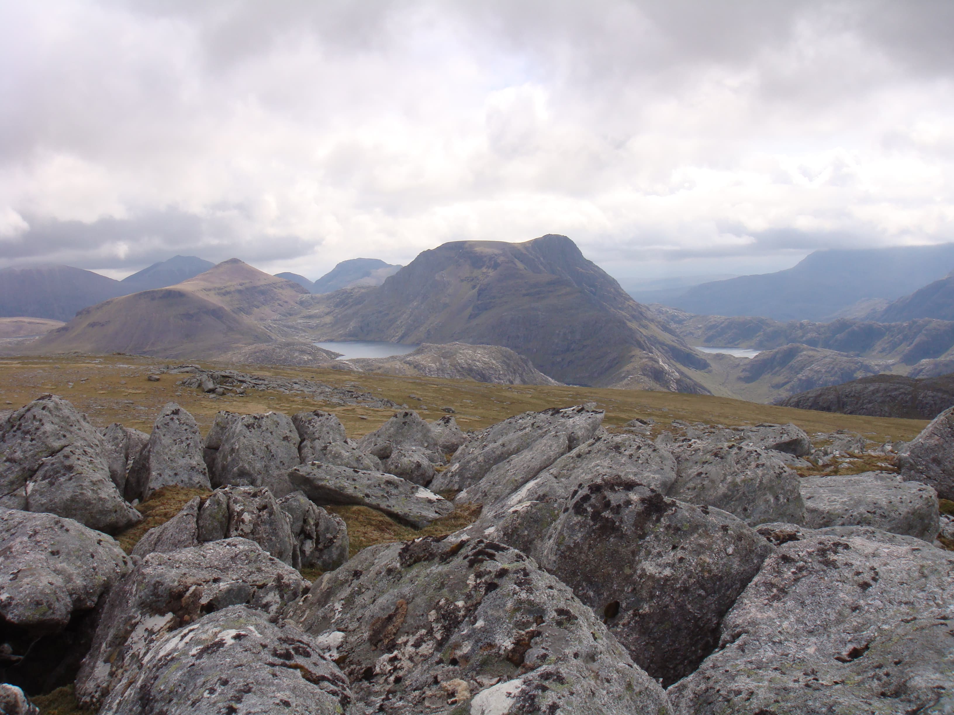
Beinn a' Chaisgein Mor is the prominent quartzite-and-gneiss Corbett rising directly above Carnmore at the heart of the Letterewe Forest, the wildest country in mainland Scotland. At 856m the summit dome is rough rocky ground above a complex of small lochans, with the unmistakable cliffs of Carnmore Crag and the Fionn Loch shore providing one of the most striking foreground views in the Highlands. The hill is almost always combined with Beinn Lair or A' Mhaighdean as part of a multi-day Letterewe round.
Gaelic: “mountain, of the, big” · Pronunciation: bine uh chaisgein more
Quick facts
- Height
- 856m/ 2808ft
- Prominence
- 345 m
- Distance
- 15 km
- Ascent
- 753 m
- Time
- 5–8 hrs
- Grid ref
- NG982785
- Parking
- NG858808
- Nearest
- Ullapool· Inverness 76km
- Dogs
- Dogs on lead required near livestockDog-friendly guide ↗
Height and prominence cross-checked against the Database of British and Irish Hills (CC BY).
No GPX track yet
Walked this route? Share your track to help other walkers.
Standard route
stalkers path 50% · gneiss slabs 20% · rocky shoulder 20% · summit dome 10%
There is no short approach. Most parties walk in from Poolewe along the stalkers path past Kernsary, around the head of the Fionn Loch and up to Carnmore — around 17km from the road. From Carnmore lodge, climb the south-east shoulder onto the broad rocky summit dome. Single-day attempts cover 30km plus and 1200m of total ascent; the 15km/753m figures relate to the hill alone from a Carnmore base. Expect to camp or bivvy.
Terrain
The Kernsary stalkers path is firm for 6km then degrades to rough peat and bog around the head of the Fionn Loch. Off-path ground around Carnmore is broken Lewisian gneiss — solid but irregular. The climb onto the hill is steep grass with rocky steps, easing onto the broad summit dome. The dome itself has multiple sub-tops and small lochans that confuse in mist.
In winter
An expedition under any conditions, but in winter the river crossings on the approach can freeze unpredictably and the Fionn Loch shore path becomes a verglas hazard. The summit dome is exposed to full Atlantic weather. Most winter parties use Carnmore as a base for a multi-day round. Phone signal is absent throughout; full self-rescue capability is essential.
This hill is in the Torridon SAIS forecast area. Check SAIS forecasts in winter (December–April).
Best time of year
Getting there
- Glasgow4h 15m
- Edinburgh5h 38m
OS maps: OS Landranger 19
Mobile signal: No signal in Letterewe; Poolewe village has reliable coverage
Current conditions
Daylight Today
- Sunrise
- 04:41
- Sunset
- 22:14
- Civil dawn
- 03:36
- Civil dusk
- 23:19
NOAA Solar Calculator · 13 July 2026
Pair with
Curated multi-hill combinations from Beinn a' Chaisgein Mor.
Around Beinn a' Chaisgein Mor on the SCOT network
Getting there, basing yourself, and what to do off the hill.
Beinn a' Chaisgein Mor — common questions
- Is Beinn a' Chaisgein Mor a hard climb?
- Beinn a' Chaisgein Mor is rated 5/5 (very challenging) on the OutdoorSCOT scale. The standard route covers about 15km with 753m of ascent and takes most walkers 5-8 hours. Terrain: The Kernsary stalkers path is firm for 6km then degrades to rough peat and bog around the head of the Fionn Loch.
- How prominent is Beinn a' Chaisgein Mor?
- Beinn a' Chaisgein Mor has 345m of topographic prominence — the height of its summit above the highest col connecting it to higher ground.
- Where should I park to climb Beinn a' Chaisgein Mor?
- Standard parking is at NG858808 near Ullapool. Check the parking grid reference on an OS map before travel; informal laybys can fill on summer weekends.
- When should I climb Beinn a' Chaisgein Mor?
- The standard good-weather months for Beinn a' Chaisgein Mor are May, June, July, August, September. Outside those months, expect winter conditions on the high ground — full mountain kit, navigation skills, and a check of the SAIS avalanche forecast for the relevant region.
- Can I bring my dog up Beinn a' Chaisgein Mor?
- On a lead only — the route crosses ground with livestock or nesting-bird interest.
- What's mobile reception like on Beinn a' Chaisgein Mor?
- No signal in Letterewe; Poolewe village has reliable coverage
- Is Beinn a' Chaisgein Mor safe in winter?
- An expedition under any conditions, but in winter the river crossings on the approach can freeze unpredictably and the Fionn Loch shore path becomes a verglas hazard. The summit dome is exposed to full Atlantic weather. Most winter parties use Carnmore as a base for a multi-day round. Phone signal is absent throughout; full self-rescue capability is essential.
Get the OutdoorSCOT weekly
One email a week — new route, hill and bothy guides, seasonal conditions and the odd hard-won lesson. No spam, unsubscribe in one click.