Graham · North-West Highlands
Meall Mheinnidh
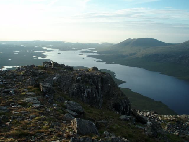
A wild Letterewe Graham deep in the wilderness north of Loch Maree, sandwiched between the Munros of Slioch and Beinn Lair. One of the most remote Grahams on the mainland — no road within 10km.
Quick facts
- Height
- 721.8m/ 2368ft
- Prominence
- 233 m
- Distance
- 13 km
- Ascent
- 591 m
- Time
- 4–6 hrs
- Grid ref
- NG954748
- Parking
- NG963739
- Nearest
- Ullapool· Inverness 77km
- Dogs
- Dogs on lead required near livestockDog-friendly guide ↗
Height and prominence cross-checked against the Database of British and Irish Hills (CC BY).
No GPX track yet
Walked this route? Share your track to help other walkers.
Standard route
forest track 20% · rough heather 45% · rocky slopes 25% · summit area 10%
Start at the Kinlochewe end of Loch Maree. Either boat across to the north shore, or take the long path round via Furnace and Letterewe estate. From the loch shore climb the south spur onto the rough summit ridge.
Terrain
Rough Lewisian and Torridonian terrain — slabs, bog and tussock. No path beyond the lochside track. Several false summits on the upper ridge.
In winter
Truly remote in winter — no quick escape and the boat option vanishes in storms. The Letterewe estate keeps the area as a wilderness reserve; help is many hours away.
This hill is in the Torridon SAIS forecast area. Check SAIS forecasts in winter (December–April).
Best time of year
Getting there
- Glasgow4h 12m
- Edinburgh5h 36m
OS maps: OS Landranger 19
Mobile signal: No signal anywhere in Letterewe; satellite messenger essential
Current conditions
Daylight Today
- Sunrise
- 04:41
- Sunset
- 22:14
- Civil dawn
- 03:37
- Civil dusk
- 23:18
NOAA Solar Calculator · 13 July 2026
Pair with
Curated multi-hill combinations from Meall Mheinnidh.
Around Meall Mheinnidh on the SCOT network
Getting there, basing yourself, and what to do off the hill.
Meall Mheinnidh — common questions
- What difficulty is Meall Mheinnidh?
- On the OutdoorSCOT scale, Meall Mheinnidh comes in at 4/5 — challenging. Expect roughly 13km and 591m of ascent on the usual route — 4-6 hours for most parties. Terrain: Rough Lewisian and Torridonian terrain — slabs, bog and tussock.
- How prominent is Meall Mheinnidh?
- Meall Mheinnidh has 233m of topographic prominence — the height of its summit above the highest col connecting it to higher ground.
- Where should I park to climb Meall Mheinnidh?
- Standard parking is at NG963739 near Ullapool. Check the parking grid reference on an OS map before travel; informal laybys can fill on summer weekends.
- When should I climb Meall Mheinnidh?
- The standard good-weather months for Meall Mheinnidh are May, June, July, August, September. Outside those months, expect winter conditions on the high ground — full mountain kit, navigation skills, and a check of the SAIS avalanche forecast for the relevant region.
- Can I bring my dog up Meall Mheinnidh?
- On a lead only — the route crosses ground with livestock or nesting-bird interest.
- What's mobile reception like on Meall Mheinnidh?
- No signal anywhere in Letterewe; satellite messenger essential
- Is Meall Mheinnidh safe in winter?
- Truly remote in winter — no quick escape and the boat option vanishes in storms. The Letterewe estate keeps the area as a wilderness reserve; help is many hours away.
Get the OutdoorSCOT weekly
One email a week — new route, hill and bothy guides, seasonal conditions and the odd hard-won lesson. No spam, unsubscribe in one click.