Corbett · North-West Highlands
Beinn Airigh Charr
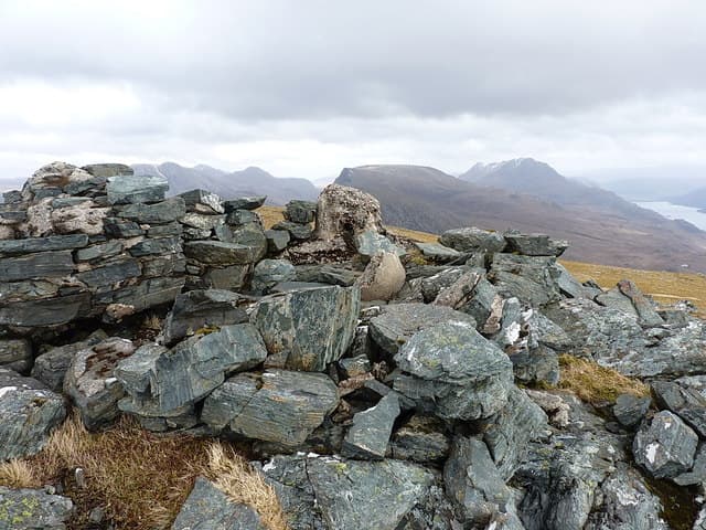
Beinn Airigh Charr is the great rocky bluff rising above the north shore of Loch Maree in the Letterewe wilderness — a 791m sandstone tower that dominates the view across the loch from Slattadale and the A832. The mountain has three sub-tops and a small but committing summit reached by a short scramble. Legend has it that Mary McKenzie of Letterewe was lured to her death from one of the cliffs by the fairies; the local Gaelic name commemorates her. The walk has the wild quality of the entire Letterewe estate — no public roads, big distances, and serious terrain.
Gaelic: “mountain, shieling” · Pronunciation: bine airigh charr
Quick facts
- Height
- 791.7m/ 2597ft
- Prominence
- 474 m
- Distance
- 22 km
- Ascent
- 950 m
- Time
- 7–10 hrs
- Grid ref
- NG930761
- Parking
- NG858808
- Nearest
- Ullapool· Inverness 80km
- Dogs
- Dogs on lead required near livestockDog-friendly guide ↗
Height and prominence cross-checked against the Database of British and Irish Hills (CC BY).
No GPX track yet
Walked this route? Share your track to help other walkers.
Standard route
forest track 20% · rough heather 35% · rocky ridge 30% · summit rocks 15%
The standard approach is from the Poolewe end of Loch Maree, via Kernsary and the long estate track running south-east along the north shore of the loch. A faint stalkers' path branches north onto the broad south flank of the hill, climbing onto a shoulder and then to the summit area. The final summit is gained by an easy but exposed scramble. Allow 8–10 hours from Poolewe — there is no short approach.
Terrain
Estate track on the long approach — easy walking but long. Above the track the ground is classic Letterewe: bare rock outcrop, deep heather, occasional bog, and not much in the way of a path. The summit scramble is short but airy with serious east-facing drops into Loch Maree.
In winter
In winter Beinn Airigh Charr is a major expedition — the Letterewe estate has no winter road access, the approach is committing, and the summit scramble in iced conditions is no longer a hillwalk. The combination of length and terrain means winter ascents are rare and usually multi-day, basing at the estate bothies. Stunning when conditions cooperate.
This hill is in the Torridon SAIS forecast area. Check SAIS forecasts in winter (December–April).
Best time of year
Getting there
- Glasgow4h 15m
- Edinburgh5h 39m
OS maps: OS Landranger 19
Mobile signal: EE/Vodafone usable in Poolewe village; no signal once past Kernsary into the Letterewe wilderness
Current conditions
Daylight Today
- Sunrise
- 04:48
- Sunset
- 22:09
- Civil dawn
- 03:46
- Civil dusk
- 23:10
NOAA Solar Calculator · 17 July 2026
Pair with
Curated multi-hill combinations from Beinn Airigh Charr.
Around Beinn Airigh Charr on the SCOT network
Getting there, basing yourself, and what to do off the hill.
Beinn Airigh Charr — common questions
- What difficulty is Beinn Airigh Charr?
- On the OutdoorSCOT scale, Beinn Airigh Charr comes in at 4/5 — challenging. Expect roughly 22km and 950m of ascent on the usual route — 7-10 hours for most parties. Terrain: Estate track on the long approach — easy walking but long.
- How prominent is Beinn Airigh Charr?
- Beinn Airigh Charr has 474m of topographic prominence — the height of its summit above the highest col connecting it to higher ground.
- Where should I park to climb Beinn Airigh Charr?
- Standard parking is at NG858808 near Ullapool. Check the parking grid reference on an OS map before travel; informal laybys can fill on summer weekends.
- When should I climb Beinn Airigh Charr?
- The standard good-weather months for Beinn Airigh Charr are May, June, July, August, September. Outside those months, expect winter conditions on the high ground — full mountain kit, navigation skills, and a check of the SAIS avalanche forecast for the relevant region.
- Can I bring my dog up Beinn Airigh Charr?
- On a lead only — the route crosses ground with livestock or nesting-bird interest.
- What's mobile reception like on Beinn Airigh Charr?
- EE/Vodafone usable in Poolewe village; no signal once past Kernsary into the Letterewe wilderness
- Is Beinn Airigh Charr safe in winter?
- In winter Beinn Airigh Charr is a major expedition — the Letterewe estate has no winter road access, the approach is committing, and the summit scramble in iced conditions is no longer a hillwalk. The combination of length and terrain means winter ascents are rare and usually multi-day, basing at the estate bothies. Stunning when conditions cooperate.
Get the OutdoorSCOT weekly
One email a week — new route, hill and bothy guides, seasonal conditions and the odd hard-won lesson. No spam, unsubscribe in one click.