Munro · North-West Highlands
Mullach Coire Mhic Fhearchair
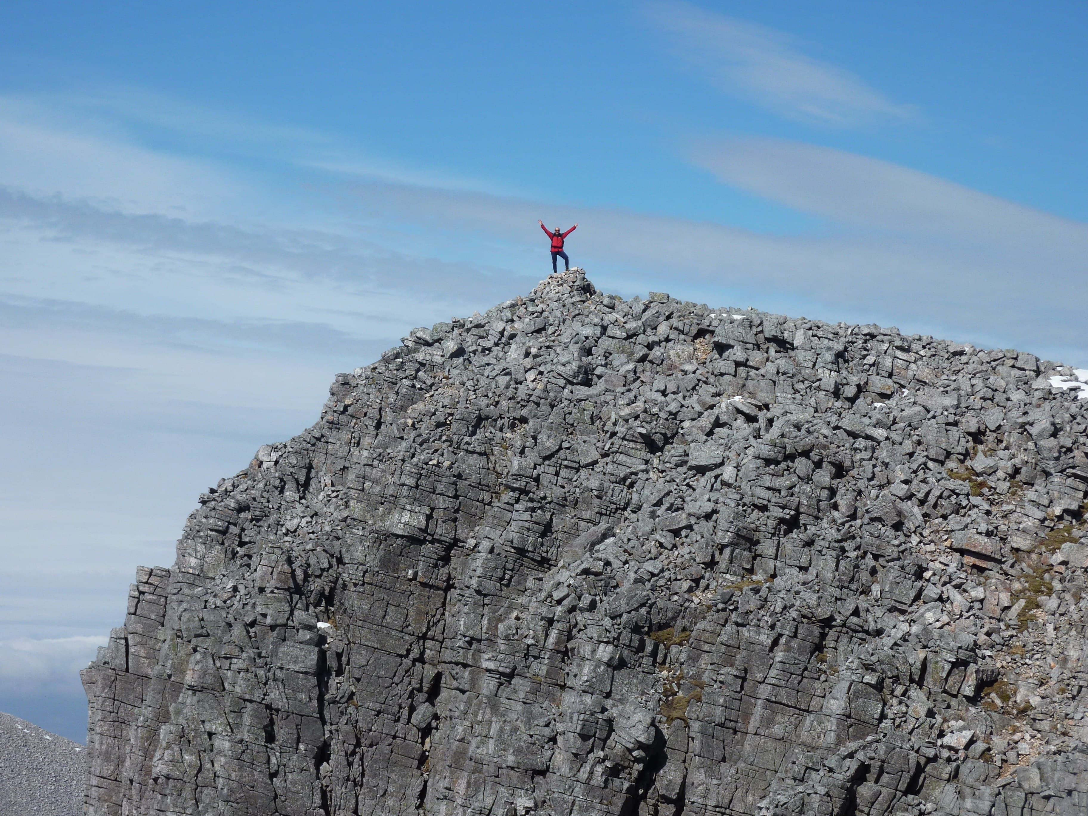
Mullach Coire Mhic Fhearchair (1015m) is the highest peak of the celebrated Fisherfield Six — the great cluster of remote Munros (now five since A' Mhaighdean's neighbour Beinn a' Chlàidheimh was demoted) deep in the Fisherfield Forest north of Loch Maree. The Fisherfield wilderness is the largest roadless area in Britain and a multi-day expedition is the normal way to tackle these peaks. Mullach Coire Mhic Fhearchair sits at the centre of the round, with views across some of the most uncompromising wild country in Scotland.
Gaelic: “summit, corrie, son of” · Pronunciation: mull-ach kor-a mhic fhearchair
Quick facts
- Height
- 1015.2m/ 3331ft
- Prominence
- 591 m
- Distance
- 17 km
- Ascent
- 893 m
- Time
- 6–9 hrs
- Grid ref
- NH052735
- Parking
- NH114859
- Nearest
- Ullapool· Inverness 67km
- Dogs
- Dogs on lead required near livestockDog-friendly guide ↗
Height and prominence cross-checked against the Database of British and Irish Hills (CC BY).
No GPX track yet
Walked this route? Share your track to help other walkers.
Standard route
Remote track / path 40% · Open hillside 35% · Rocky summit 25%
The classic round is the Fisherfield Six — a single very long day (50km+) or, more typically, an overnight at Shenavall bothy. Approach via the Dundonnell estate path from Corrie Hallie, descending into Strath na Sealga to Shenavall. From there ford the rivers and tackle the round in either direction. Mullach Coire Mhic Fhearchair sits near the middle, climbed via its broad south ridge from Bealach Odhar. Full round 50km with 2500m of ascent — usually two days.
Terrain
The Corrie Hallie estate path is firm pitching for the first 5km. The descent to Shenavall is steep and rooty; the Abhainn Loch an Nid and Abhainn Srath na Sealga river crossings can be impassable after rain — check water levels before committing. The Fisherfield hills are mostly broad whaleback Torridonian sandstone ridges, easy underfoot but with significant up-and-down between summits. The Mullach summit is a small broad plateau with a tiny cairn.
In winter
A genuinely committing winter expedition. The river crossings can be impassable for days after snowmelt. Shenavall bothy gives basic shelter but offers no rescue infrastructure within many kilometres. The whole round in winter is one of the most committing single-day routes in Scotland and most parties do it over two or three days. Phone signal absent throughout. SAIS Northern Highlands applies. Full self-sufficient winter mountaineering kit essential.
This hill is in the Torridon SAIS forecast area. Check SAIS forecasts in winter (December–April).
Best time of year
Getting there
- Glasgow4h 8m
- Edinburgh4h 29m
OS maps: OS Landranger 19
Mobile signal: No signal. One of the very remotest Munro groups in Scotland. Get mapping saved before you leave Kinlochewe or Dundonnell — no coverage for the entire approach.
Current conditions
Daylight Today
- Sunrise
- 04:58
- Sunset
- 21:57
- Civil dawn
- 04:00
- Civil dusk
- 22:55
NOAA Solar Calculator · 23 July 2026
Pair with
Curated multi-hill combinations from Mullach Coire Mhic Fhearchair.
Around Mullach Coire Mhic Fhearchair on the SCOT network
Getting there, basing yourself, and what to do off the hill.
Mullach Coire Mhic Fhearchair — common questions
- How hard is Mullach Coire Mhic Fhearchair?
- We grade Mullach Coire Mhic Fhearchair at 5/5, which puts it in very challenging territory. The usual route is around 17km with 893m of climbing; allow 6-9 hours. Terrain: The Corrie Hallie estate path is firm pitching for the first 5km.
- How prominent is Mullach Coire Mhic Fhearchair?
- Mullach Coire Mhic Fhearchair has 591m of topographic prominence — the height of its summit above the highest col connecting it to higher ground.
- Where should I park to climb Mullach Coire Mhic Fhearchair?
- Standard parking is at NH114859 near Ullapool. Check the parking grid reference on an OS map before travel; informal laybys can fill on summer weekends.
- When should I climb Mullach Coire Mhic Fhearchair?
- The standard good-weather months for Mullach Coire Mhic Fhearchair are May, June, July, August, September. Outside those months, expect winter conditions on the high ground — full mountain kit, navigation skills, and a check of the SAIS avalanche forecast for the relevant region.
- Can I bring my dog up Mullach Coire Mhic Fhearchair?
- On a lead only — the route crosses ground with livestock or nesting-bird interest.
- What's mobile reception like on Mullach Coire Mhic Fhearchair?
- No signal. One of the very remotest Munro groups in Scotland. Get mapping saved before you leave Kinlochewe or Dundonnell — no coverage for the entire approach.
- Is Mullach Coire Mhic Fhearchair safe in winter?
- A genuinely committing winter expedition. The river crossings can be impassable for days after snowmelt. Shenavall bothy gives basic shelter but offers no rescue infrastructure within many kilometres. The whole round in winter is one of the most committing single-day routes in Scotland and most parties do it over two or three days. Phone signal absent throughout. SAIS Northern Highlands applies. Full self-sufficient winter mountaineering kit essential.
Get the OutdoorSCOT weekly
One email a week — new route, hill and bothy guides, seasonal conditions and the odd hard-won lesson. No spam, unsubscribe in one click.