Marilyn · Cairngorms
Ord Ban
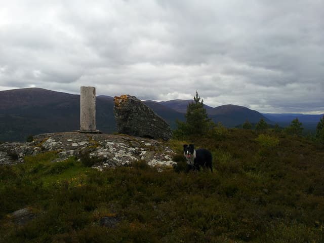
Ord Ban — the white knoll — is a sharp little 429m hill rising directly out of the Rothiemurchus pinewoods above Loch an Eilein near Aviemore. Despite minimal height, it gives one of the most spectacular short-walk views in Scotland: the entire Cairngorm northern corries laid out beyond a foreground of native pines.
Gaelic: “fair” · Pronunciation: ord bahn
Quick facts
- Height
- 429m/ 1407ft
- Prominence
- 167 m
- Grid ref
- NH 89171 08520
- Nearest city
- Inverness· 43km
- Dogs
- Dogs on lead required near livestockDog-friendly guide ↗
Height and prominence cross-checked against the Database of British and Irish Hills (CC BY).
No GPX track yet
Walked this route? Share your track to help other walkers.
Standard route
pinewood 35% · heather moorland 45% · rocky summit 20%
From the Loch an Eilein car park, take the lochside circuit a short way then turn uphill on a steep zigzagging path through pine and birch to the rocky summit. A 3km circuit takes about 1.5 to 2 hours.
Terrain
Sandy pine-needle footpath lower down giving way to exposed quartzite outcrops at the top. The summit is small and rocky with little room for groups to gather.
In winter
Often holds light snow on the pine-shaded ascent path, where ice can persist long after surrounding ground has cleared. Micro spikes useful from December onwards. Sunrise from the summit on a clear winter morning is special.
This hill is in the Northern Cairngorms SAIS forecast area. Check SAIS forecasts in winter (December–April).
Best time of year
Getting there
- Glasgow4h 31m
- Edinburgh4h 32m
OS maps: OS Landranger 35, OS Landranger 36, OS Explorer 057N, OS Explorer 403N
Mobile signal: Coverage is solid; EE seldom drops. Fine Strathspey views near Aviemore.
Current conditions
Daylight Today
- Sunrise
- 05:09
- Sunset
- 21:35
- Civil dawn
- 04:17
- Civil dusk
- 22:27
NOAA Solar Calculator · 30 July 2026
Around Ord Ban on the SCOT network
Getting there, basing yourself, and what to do off the hill.
Ord Ban — common questions
- Is Ord Ban a hard climb?
- Ord Ban is rated 1/5 (easy) on the OutdoorSCOT scale. Ground conditions: Sandy pine-needle footpath lower down giving way to exposed quartzite outcrops at the top.
- How much drop does Ord Ban have?
- The drop is 167m: measured from the summit of Ord Ban down to the saddle joining it to higher terrain. Passing the 150m-drop threshold on all sides is exactly what makes it a Marilyn.
- What's the best month to climb Ord Ban?
- Aim for March, April, May, June, July, August, September, October on Ord Ban. In the remaining months treat it as a winter hill — full kit, solid navigation, and a look at the relevant SAIS avalanche forecast before you go.
- Can dogs go up Ord Ban?
- Dogs are fine on a lead. The route passes livestock or ground-nesting bird habitat, so keep them close throughout.
- Will I get phone signal on Ord Ban?
- Coverage is solid; EE seldom drops. Fine Strathspey views near Aviemore.
- Is Ord Ban safe in winter?
- Often holds light snow on the pine-shaded ascent path, where ice can persist long after surrounding ground has cleared. Micro spikes useful from December onwards. Sunrise from the summit on a clear winter morning is special.
Get the OutdoorSCOT weekly
One email a week — new route, hill and bothy guides, seasonal conditions and the odd hard-won lesson. No spam, unsubscribe in one click.