Marilyn · Central Highlands
Creag Bheag
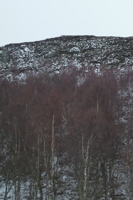
Creag Bheag, the little crag, is the rocky knoll that overlooks Kingussie from the north-west. At 487m it is the easternmost Marilyn of the Monadhliath and a justifiably popular half-day from the town, with a long view across Strathspey to the Cairngorms.
Gaelic: “crag, small” · Pronunciation: krayg vek
Quick facts
- Height
- 487.1m/ 1598ft
- Prominence
- 159 m
- Grid ref
- NH 74541 01643
- Nearest city
- Inverness· 44km
- Dogs
- Dogs on lead required near livestockDog-friendly guide ↗
Height and prominence cross-checked against the Database of British and Irish Hills (CC BY).
No GPX track yet
Walked this route? Share your track to help other walkers.
Standard route
heather moorland 55% · rocky summit 25% · grass slopes 20%
Waymarked from the centre of Kingussie via the golf course and Loch Gynack: a clear path climbs the heather-and-birch flank to twin rocky tops, the higher being the western. Two to three hours circular, with the option of returning over both summits.
Terrain
Birch and Scots pine scrub on the lower slopes give way to short heather and clean rock platforms near the tops. The path is dry and well-trodden by Kingussie standards — one of the most maintained routes among the Monadhliath outliers.
In winter
East of the watershed and only 487m, so snow seldom blocks the route. Frost and verglas on the rock platforms near the summit are the main hazard; spikes are a sensible precaution from December through to March.
This hill is in the Creag Meagaidh SAIS forecast area. Check SAIS forecasts in winter (December–April).
Best time of year
Getting there
- Glasgow3h 12m
- Edinburgh4h 43m
OS maps: OS Landranger 35, OS Explorer 056, OS Explorer 402
Mobile signal: Reliable up top; EE seldom drops. Fine Strathspey views near Kingussie.
Current conditions
Daylight Today
- Sunrise
- 05:10
- Sunset
- 21:35
- Civil dawn
- 04:18
- Civil dusk
- 22:27
NOAA Solar Calculator · 30 July 2026
Around Creag Bheag on the SCOT network
Getting there, basing yourself, and what to do off the hill.
Creag Bheag — common questions
- How difficult is Creag Bheag?
- Creag Bheag carries a 1/5 (easy) grade on the OutdoorSCOT scale. Terrain: Birch and Scots pine scrub on the lower slopes give way to short heather and clean rock platforms near the tops.
- How prominent is Creag Bheag?
- Creag Bheag has 159m of topographic prominence — the height of its summit above the highest col connecting it to higher ground. Marilyns are defined by that measure: at least 150m of drop on all sides.
- When should I climb Creag Bheag?
- The standard good-weather months for Creag Bheag are March, April, May, June, July, August, September, October. Outside those months, expect winter conditions on the high ground — full mountain kit, navigation skills, and a check of the SAIS avalanche forecast for the relevant region.
- Can I bring my dog up Creag Bheag?
- On a lead only — the route crosses ground with livestock or nesting-bird interest.
- What's mobile reception like on Creag Bheag?
- Reliable up top; EE seldom drops. Fine Strathspey views near Kingussie.
- Is Creag Bheag safe in winter?
- East of the watershed and only 487m, so snow seldom blocks the route. Frost and verglas on the rock platforms near the summit are the main hazard; spikes are a sensible precaution from December through to March.
Get the OutdoorSCOT weekly
One email a week — new route, hill and bothy guides, seasonal conditions and the odd hard-won lesson. No spam, unsubscribe in one click.