Marilyn · Central Highlands
Beinn Mhor
One of many Beinn Mhors in Scotland — big hill — this 471m Strathspey example sits between Carrbridge and Grantown above the Dulnain. Heather-covered and forested below, its broad summit looks out over the patchwork of birchwood and pasture in the lower Spey.
Gaelic: “mountain, big” · Pronunciation: bine vore
Quick facts
- Height
- 471m/ 1545ft
- Prominence
- 192 m
- Grid ref
- NH 99373 28092
- Nearest city
- Inverness· 37km
- Dogs
- Dogs on lead required near livestockDog-friendly guide ↗
Height and prominence cross-checked against the Database of British and Irish Hills (CC BY).
No GPX track yet
Walked this route? Share your track to help other walkers.
Standard route
heather moorland 65% · grass slopes 25% · rocky summit 10%
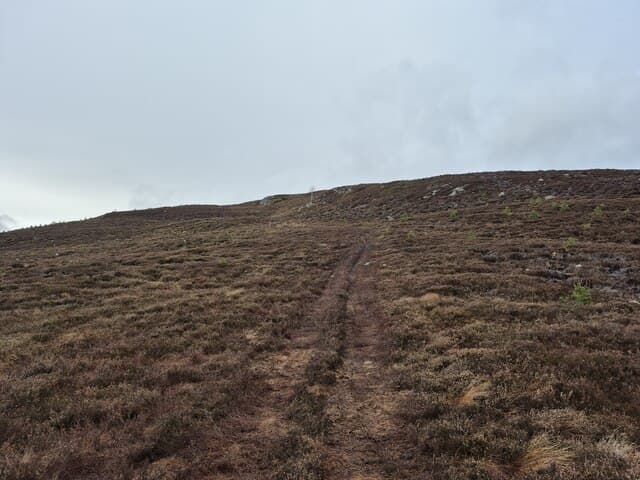
Start from the small parking area on the Bridge of Sluggan minor road and follow a forest road climbing south. The track turns to quad trail before a final stretch of pathless heather to the cairn. 7km return in 2.5 hours.
Terrain
Sheltered forest road for most of the walk, with the open hilltop covered in tussocky heather and patches of bilberry. Underfoot mostly firm except after prolonged wet spells.
In winter
A useful low-level option when the higher Cairngorm tops are out of condition. Sheltered forest sections stay walkable in snow, and the gentle summit poses limited risk in poor visibility.
This hill is in the Creag Meagaidh SAIS forecast area. Check SAIS forecasts in winter (December–April).
Best time of year
Getting there
- Glasgow4h 5m
- Edinburgh4h 47m
OS maps: OS Landranger 36, OS Explorer 060, OS Explorer 061S, OS Explorer 418, OS Explorer 419S
Mobile signal: Variable. EE flickers up top; better in Highland glens.
Current conditions
Daylight Today
- Sunrise
- 05:07
- Sunset
- 21:35
- Civil dawn
- 04:14
- Civil dusk
- 22:28
NOAA Solar Calculator · 30 July 2026
Around Beinn Mhor on the SCOT network
Getting there, basing yourself, and what to do off the hill.
Getting there: Aviemore station
Cairngorm plateau; Lairig Ghru; Speyside Way; Glenmore
18km from the hill
tripscot.co.uk
On TripSCOTBase yourself in Aviemore
Cairngorms base — Strathspey valley, ski centre, train
18km from the hill
tripscot.co.uk
On TasteSCOTAfter the hill: Cragganmore
Ballindalloch — quietly excellent Speysider; Classic Malts visitor experience
18km from the hill
tastescot.co.uk
Beinn Mhor — common questions
- Is Beinn Mhor a hard climb?
- Beinn Mhor is rated 1/5 (easy) on the OutdoorSCOT scale. Underfoot: Sheltered forest road for most of the walk, with the open hilltop covered in tussocky heather and patches of bilberry.
- What is Beinn Mhor's prominence?
- 192m of prominence. That's the vertical drop from the summit to the col that links Beinn Mhor to the next higher ground. That drop is what qualifies it as a Marilyn — a hill with at least 150m of descent on every side.
- When is the best time to climb Beinn Mhor?
- March, April, May, June, July, August, September, October give the most reliable conditions on Beinn Mhor. Beyond that window the high ground turns wintry: carry full mountain kit, be confident navigating, and check the SAIS avalanche forecast for the area.
- Is Beinn Mhor dog-friendly?
- Yes, but dogs must be kept on a lead — there is livestock or ground-nesting bird interest on the route.
- Is there mobile signal on Beinn Mhor?
- Variable. EE flickers up top; better in Highland glens.
- Is Beinn Mhor safe in winter?
- A useful low-level option when the higher Cairngorm tops are out of condition. Sheltered forest sections stay walkable in snow, and the gentle summit poses limited risk in poor visibility.
Get the OutdoorSCOT weekly
One email a week — new route, hill and bothy guides, seasonal conditions and the odd hard-won lesson. No spam, unsubscribe in one click.