Marilyn · Cairngorms
Carn Daimh
Stag's Cairn, the high point of the Glenlivet Estate moors south of Tomintoul. The summit sits at the heart of the Smugglers' Trail — the old illicit whisky route between Speyside and Strathdon — and gives one of the great views of Ben Avon and the eastern Cairngorms.
Quick facts
- Height
- 570m/ 1870ft
- Prominence
- 194 m
- Grid ref
- NJ 18153 24963
- Nearest city
- Inverness· 55km
- Dogs
- Dogs on lead required near livestockDog-friendly guide ↗
Height and prominence cross-checked against the Database of British and Irish Hills (CC BY).
No GPX track yet
Walked this route? Share your track to help other walkers.
Standard route
heather moorland 65% · grass slopes 25% · rocky summit 10%
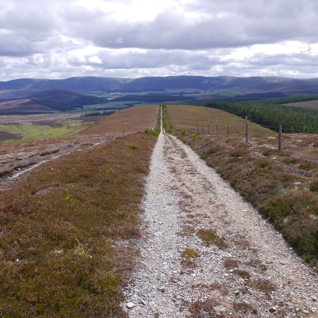
The Smugglers' Trail from Tomintoul to Ballindalloch passes directly over the summit, providing a clear waymarked route from either end. A there-and-back from Tomintoul is around 10km return; allow 3-4 hours.
Terrain
Land Rover tracks and well-trodden footpaths the whole way, on managed grouse moor with heather and short grass. The waymarked signs make navigation easy in summer.
In winter
Drifting snow can bury the waymark posts and obscure the trail. The plateau gives little shelter to a north-westerly — pack the windproofs even on bright winter days.
This hill is in the Northern Cairngorms SAIS forecast area. Check SAIS forecasts in winter (December–April).
Best time of year
Getting there
- Glasgow4h 24m
- Edinburgh4h 32m
OS maps: OS Landranger 36, OS Explorer 061S, OS Explorer 419S
Mobile signal: Moderate. EE flickers up top; better toward Grantown.
Current conditions
Daylight Today
- Sunrise
- 05:06
- Sunset
- 21:34
- Civil dawn
- 04:13
- Civil dusk
- 22:26
NOAA Solar Calculator · 30 July 2026
Around Carn Daimh on the SCOT network
Getting there, basing yourself, and what to do off the hill.
Getting there: Aviemore station
Cairngorm plateau; Lairig Ghru; Speyside Way; Glenmore
31km from the hill
tripscot.co.uk
On TripSCOTBase yourself in Dufftown
Speyside whisky town in the eastern Cairngorms
20km from the hill
tripscot.co.uk
On TasteSCOTAfter the hill: Tomintoul
Tomintoul village — the gentle Speysider in the eastern Cairngorms
7km from the hill
tastescot.co.uk
Carn Daimh — common questions
- How difficult is Carn Daimh?
- Carn Daimh carries a 2/5 (moderate) grade on the OutdoorSCOT scale. Underfoot: Land Rover tracks and well-trodden footpaths the whole way, on managed grouse moor with heather and short grass.
- What is Carn Daimh's prominence?
- 194m of prominence. That's the vertical drop from the summit to the col that links Carn Daimh to the next higher ground. That drop is what qualifies it as a Marilyn — a hill with at least 150m of descent on every side.
- When is the best time to climb Carn Daimh?
- March, April, May, June, July, August, September, October give the most reliable conditions on Carn Daimh. Beyond that window the high ground turns wintry: carry full mountain kit, be confident navigating, and check the SAIS avalanche forecast for the area.
- Is Carn Daimh dog-friendly?
- Yes, but dogs must be kept on a lead — there is livestock or ground-nesting bird interest on the route.
- Is there mobile signal on Carn Daimh?
- Moderate. EE flickers up top; better toward Grantown.
- Is Carn Daimh safe in winter?
- Drifting snow can bury the waymark posts and obscure the trail. The plateau gives little shelter to a north-westerly — pack the windproofs even on bright winter days.
Get the OutdoorSCOT weekly
One email a week — new route, hill and bothy guides, seasonal conditions and the odd hard-won lesson. No spam, unsubscribe in one click.