Marilyn · Central Highlands
Carn na Loine
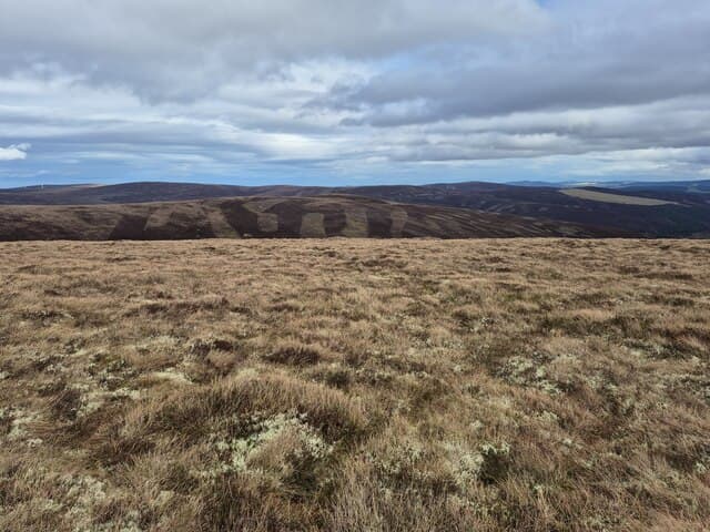
A 548m Strathspey moorland summit between Tomintoul and Grantown, in the rolling country between the Cairngorms and Moray Firth. Carn na Loines name probably derives from the loine grass that dominates parts of its summit plateau. The hill is criss-crossed by old peat-cutting tracks.
Quick facts
- Height
- 548.7m/ 1800ft
- Prominence
- 232 m
- Grid ref
- NJ 07002 36088
- Nearest city
- Inverness· 41km
- Dogs
- Dogs on lead required near livestockDog-friendly guide ↗
Height and prominence cross-checked against the Database of British and Irish Hills (CC BY).
No GPX track yet
Walked this route? Share your track to help other walkers.
Standard route
heather moorland 65% · grass slopes 25% · rocky summit 10%
From the Bridge of Brown picnic area, take the public road north for a few hundred metres then strike up the eastern shoulder on faint quad trails. Reach the cairn in around 90 minutes; allow 3 hours for the 8km return.
Terrain
Strathspey muirburn pattern alternates strips of new growth with longer rank heather. Underfoot is generally firm and well drained, with isolated boggy patches around the springs.
In winter
Cold continental snow lies in fine powder here when the west coast is suffering thaw and rain. The plateau is featureless in cloud — bearing-and-pacing becomes essential above the half-height mark.
This hill is in the Creag Meagaidh SAIS forecast area. Check SAIS forecasts in winter (December–April).
Best time of year
Getting there
- Glasgow4h 23m
- Edinburgh4h 53m
OS maps: OS Landranger 27, OS Explorer 061N, OS Explorer 061S, OS Explorer 419N, OS Explorer 419S
Mobile signal: Moderate. EE sporadic up top; better toward Grantown.
Current conditions
Daylight Today
- Sunrise
- 05:06
- Sunset
- 21:35
- Civil dawn
- 04:13
- Civil dusk
- 22:28
NOAA Solar Calculator · 30 July 2026
Around Carn na Loine on the SCOT network
Getting there, basing yourself, and what to do off the hill.
Getting there: Aviemore station
Cairngorm plateau; Lairig Ghru; Speyside Way; Glenmore
29km from the hill
tripscot.co.uk
On TripSCOTBase yourself in Dufftown
Speyside whisky town in the eastern Cairngorms
25km from the hill
tripscot.co.uk
On TasteSCOTAfter the hill: Cragganmore
Ballindalloch — quietly excellent Speysider; Classic Malts visitor experience
9km from the hill
tastescot.co.uk
Carn na Loine — common questions
- What difficulty is Carn na Loine?
- On the OutdoorSCOT scale, Carn na Loine comes in at 2/5 — moderate. Underfoot: Strathspey muirburn pattern alternates strips of new growth with longer rank heather.
- What is Carn na Loine's prominence?
- 232m of prominence. That's the vertical drop from the summit to the col that links Carn na Loine to the next higher ground. That drop is what qualifies it as a Marilyn — a hill with at least 150m of descent on every side.
- When is the best time to climb Carn na Loine?
- March, April, May, June, July, August, September, October give the most reliable conditions on Carn na Loine. Beyond that window the high ground turns wintry: carry full mountain kit, be confident navigating, and check the SAIS avalanche forecast for the area.
- Is Carn na Loine dog-friendly?
- Yes, but dogs must be kept on a lead — there is livestock or ground-nesting bird interest on the route.
- Is there mobile signal on Carn na Loine?
- Moderate. EE sporadic up top; better toward Grantown.
- Is Carn na Loine safe in winter?
- Cold continental snow lies in fine powder here when the west coast is suffering thaw and rain. The plateau is featureless in cloud — bearing-and-pacing becomes essential above the half-height mark.
Get the OutdoorSCOT weekly
One email a week — new route, hill and bothy guides, seasonal conditions and the odd hard-won lesson. No spam, unsubscribe in one click.