Marilyn · Central Highlands
Knock of Braemoray
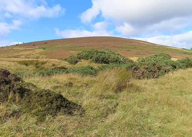
The Knock of Braemoray is a 456m wedge of heather rising sharply from the upper Findhorn valley on the A939 Dava road. From its trig pillar the view ranges from the high Cairngorm plateaus south to a bright slice of the Moray Firth, with the Knock of Braemoray itself a Pictish-era beacon site.
Quick facts
- Height
- 456m/ 1496ft
- Prominence
- 169 m
- Grid ref
- NJ 01186 41724
- Nearest city
- Inverness· 35km
- Dogs
- Dogs on lead required near livestockDog-friendly guide ↗
Height and prominence cross-checked against the Database of British and Irish Hills (CC BY).
No GPX track yet
Walked this route? Share your track to help other walkers.
Standard route
heather moorland 65% · grass slopes 25% · rocky summit 10%
Park at the cattle grid south of Lochindorb and follow the estate track climbing west. Above the bealach, leave the track and head directly up the heather shoulder for the summit. About 6km return in 2 hours.
Terrain
Compact estate vehicle track on the lower flank, opening to mature long-stem heather above. The summit area carries a few weather-worn boulders but no exposed bedrock.
In winter
High enough to hold snow for weeks at a time but with no avalanche-prone slopes. A bright cold afternoon delivers an extraordinary panorama northward to the Black Isle and beyond to Easter Ross.
Best time of year
Getting there
- Glasgow4h 24m
- Edinburgh4h 4m
OS maps: OS Landranger 27, OS Explorer 060, OS Explorer 061N, OS Explorer 418, OS Explorer 419N
Mobile signal: Signal is good; EE works well. Fine Moray and Strathspey views.
Current conditions
Daylight Today
- Sunrise
- 06:42
- Sunset
- 19:39
- Civil dawn
- 06:03
- Civil dusk
- 20:18
NOAA Solar Calculator · 14 September 2026
Around Knock of Braemoray on the SCOT network
Getting there, basing yourself, and what to do off the hill.
Getting there: Aviemore station
Cairngorm plateau; Lairig Ghru; Speyside Way; Glenmore
31km from the hill
tripscot.co.uk
On TripSCOTBase yourself in Aviemore
Cairngorms base — Strathspey valley, ski centre, train
31km from the hill
tripscot.co.uk
On TasteSCOTAfter the hill: Cragganmore
Ballindalloch — quietly excellent Speysider; Classic Malts visitor experience
15km from the hill
tastescot.co.uk
Knock of Braemoray — common questions
- How hard is Knock of Braemoray?
- We grade Knock of Braemoray at 1/5, which puts it in easy territory. Terrain: Compact estate vehicle track on the lower flank, opening to mature long-stem heather above.
- How prominent is Knock of Braemoray?
- Knock of Braemoray has 169m of topographic prominence — the height of its summit above the highest col connecting it to higher ground. Marilyns are defined by that measure: at least 150m of drop on all sides.
- When should I climb Knock of Braemoray?
- The standard good-weather months for Knock of Braemoray are March, April, May, June, July, August, September, October. Outside those months, expect winter conditions on the high ground — full mountain kit, navigation skills, and a check of the SAIS avalanche forecast for the relevant region.
- Can I bring my dog up Knock of Braemoray?
- On a lead only — the route crosses ground with livestock or nesting-bird interest.
- What's mobile reception like on Knock of Braemoray?
- Signal is good; EE works well. Fine Moray and Strathspey views.
- Is Knock of Braemoray safe in winter?
- High enough to hold snow for weeks at a time but with no avalanche-prone slopes. A bright cold afternoon delivers an extraordinary panorama northward to the Black Isle and beyond to Easter Ross.
Get the OutdoorSCOT weekly
One email a week — new route, hill and bothy guides, seasonal conditions and the odd hard-won lesson. No spam, unsubscribe in one click.