Marilyn · Moray
Burgiehill
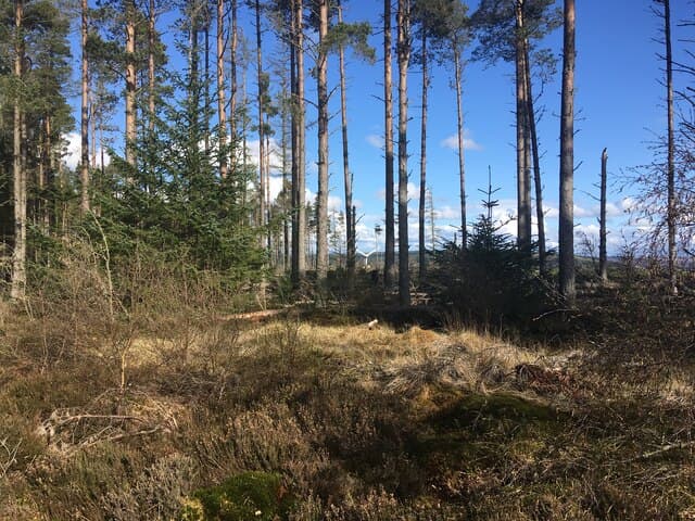
A short forested rise behind the Moray village of Burgie reaching a mere 254m, yet ticking the prominence box thanks to surrounding farmland. The hill carries the ruins of Burgie Castle on its lower flank, and a wartime concrete observation post sits crumbling near the top.
Quick facts
- Height
- 254m/ 833ft
- Prominence
- 167 m
- Grid ref
- NJ 09727 55901
- Nearest city
- Inverness· 44km
- Dogs
- Dogs on lead required near livestockDog-friendly guide ↗
Height and prominence cross-checked against the Database of British and Irish Hills (CC BY).
No GPX track yet
Walked this route? Share your track to help other walkers.
Standard route
heather moorland 60% · grass slopes 30% · summit area 10%
From a small parking area on the B9089, a forest road leads through Sitka spruce to a quad track that climbs the final 60m to the trig pillar. About 3km return in 45 minutes.
Terrain
Mostly hard-packed forest road through dense conifer, with the small open summit area covered in grass and self-seeded birch. The summit area can be midgy on summer evenings.
In winter
Snow is uncommon at this elevation on the Moray coastal plain. The biggest weather hazard is wind — gales coming off the Firth funnel through the forest with surprising force.
Best time of year
Getting there
- Glasgow5h 51m
- Edinburgh4h 18m
OS maps: OS Landranger 27, OS Explorer 423
Mobile signal: Reliable up top; EE is dependable. Fine Moray Firth views.
Current conditions
Daylight Today
- Sunrise
- 05:05
- Sunset
- 21:36
- Civil dawn
- 04:12
- Civil dusk
- 22:29
NOAA Solar Calculator · 30 July 2026
Around Burgiehill on the SCOT network
Getting there, basing yourself, and what to do off the hill.
Burgiehill — common questions
- How hard is Burgiehill?
- We grade Burgiehill at 1/5, which puts it in easy territory. Underfoot: Mostly hard-packed forest road through dense conifer, with the small open summit area covered in grass and self-seeded birch.
- What is Burgiehill's prominence?
- 167m of prominence. That's the vertical drop from the summit to the col that links Burgiehill to the next higher ground. That drop is what qualifies it as a Marilyn — a hill with at least 150m of descent on every side.
- When is the best time to climb Burgiehill?
- March, April, May, June, July, August, September, October give the most reliable conditions on Burgiehill. Beyond that window the high ground turns wintry: carry full mountain kit, be confident navigating, and check the SAIS avalanche forecast for the area.
- Is Burgiehill dog-friendly?
- Yes, but dogs must be kept on a lead — there is livestock or ground-nesting bird interest on the route.
- Is there mobile signal on Burgiehill?
- Reliable up top; EE is dependable. Fine Moray Firth views.
- Is Burgiehill safe in winter?
- Snow is uncommon at this elevation on the Moray coastal plain. The biggest weather hazard is wind — gales coming off the Firth funnel through the forest with surprising force.
Get the OutdoorSCOT weekly
One email a week — new route, hill and bothy guides, seasonal conditions and the odd hard-won lesson. No spam, unsubscribe in one click.