Marilyn · Moray
Hill of the Wangie
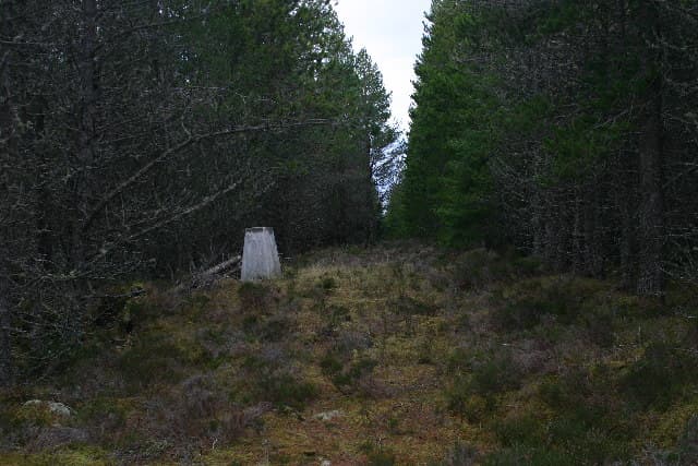
A curiously named 319m hill in the rolling country west of Forres, with the Wangie itself a small wooded scarp at the summits eastern end. Local folklore tells of fairy gatherings on its top at midsummer — improbable, but the place has a quiet otherworldly feel on a still evening.
Quick facts
- Height
- 319m/ 1047ft
- Prominence
- 157 m
- Grid ref
- NJ 13668 53733
- Nearest city
- Inverness· 48km
- Dogs
- Dogs on lead required near livestockDog-friendly guide ↗
Height and prominence cross-checked against the Database of British and Irish Hills (CC BY).
No GPX track yet
Walked this route? Share your track to help other walkers.
Standard route
heather moorland 70% · grass slopes 20% · summit area 10%
From the Califer viewpoint car park, a permissive path threads through plantation before opening onto sandy heath leading to the trig. A 3km circuit takes barely an hour.
Terrain
Free-draining sandy soil under birch and Scots pine, with the summit knoll capped by an exposed rocky bluff. Excellent footing in all but the wettest conditions.
In winter
A reliable low-level walk in any weather, with the woods offering shelter from the brisk Moray Firth winds. Snow rarely persists below 300m on this part of the coast. The Wangie itself can be slick if frosted.
Best time of year
Getting there
- Glasgow5h 53m
- Edinburgh4h 14m
OS maps: OS Landranger 28, OS Explorer 423
Mobile signal: Moderate. EE only occasional here; picks up toward Moray coast.
Current conditions
Daylight Today
- Sunrise
- 05:05
- Sunset
- 21:36
- Civil dawn
- 04:11
- Civil dusk
- 22:29
NOAA Solar Calculator · 30 July 2026
Around Hill of the Wangie on the SCOT network
Getting there, basing yourself, and what to do off the hill.
Getting there: Tain station
Easter Ross — Ben Wyvis approach, Glenmorangie distillery
46km from the hill
tripscot.co.uk
On TripSCOTBase yourself in Dufftown
Speyside whisky town in the eastern Cairngorms
23km from the hill
tripscot.co.uk
On TasteSCOTAfter the hill: Cardhu
Knockando — sweet Speysider and core of Johnnie Walker blends
11km from the hill
tastescot.co.uk
Hill of the Wangie — common questions
- Is Hill of the Wangie a hard climb?
- Hill of the Wangie is rated 1/5 (easy) on the OutdoorSCOT scale. Underfoot: Free-draining sandy soil under birch and Scots pine, with the summit knoll capped by an exposed rocky bluff.
- What is Hill of the Wangie's prominence?
- 157m of prominence. That's the vertical drop from the summit to the col that links Hill of the Wangie to the next higher ground. That drop is what qualifies it as a Marilyn — a hill with at least 150m of descent on every side.
- When is the best time to climb Hill of the Wangie?
- March, April, May, June, July, August, September, October give the most reliable conditions on Hill of the Wangie. Beyond that window the high ground turns wintry: carry full mountain kit, be confident navigating, and check the SAIS avalanche forecast for the area.
- Is Hill of the Wangie dog-friendly?
- Yes, but dogs must be kept on a lead — there is livestock or ground-nesting bird interest on the route.
- Is there mobile signal on Hill of the Wangie?
- Moderate. EE only occasional here; picks up toward Moray coast.
- Is Hill of the Wangie safe in winter?
- A reliable low-level walk in any weather, with the woods offering shelter from the brisk Moray Firth winds. Snow rarely persists below 300m on this part of the coast. The Wangie itself can be slick if frosted.
Get the OutdoorSCOT weekly
One email a week — new route, hill and bothy guides, seasonal conditions and the odd hard-won lesson. No spam, unsubscribe in one click.